Weekend snowstorm leaves Philly facing an icy Monday commute
Wind and very low temperatures could lead to ice on area roads, meteorologists said.
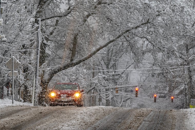
Philadelphia’s first significant snowstorm passed through the region on Sunday, but there will be a new weather challenge to deal with Monday, as temperatures plummet overnight and create icy roads for the morning commute.
While temperatures were in the upper 20s on Sunday afternoon, they’ll be very different when commuters set out on Monday.
“We are expecting a pretty strong blast of Arctic air moving in,” leaving temperatures in the mid-teens, said Alex Staarmann, a meteorologist with the National Weather Service in Mount Holly.
Philadelphia schools and Archdiocesan high schools and parish and regional Catholic elementary schools in the city will operate on a two-hour delay Monday.
While some plowed streets and shoveled sidewalks may have been cleared by Sunday afternoon, cold winds on Sunday night into Monday morning may blow a thin layer of snow back on to roads, Staarmann said.
Winds are forecast to pick up, from 10 to 20 miles per hour, with gusts up to 35, he said. That could make for dangerous conditions.
“If there’s any slush or snow melt on the roads or pavement from today, it certainly could refreeze if it’s not treated,” he said.
The region saw varied snowfall amounts as the storm moved through, with totals ranging from the official tally of 4.2 inches at Philadelphia International Airport to reports of 7 or even 8 inches in some suburbs, Staarmann said.
Monday afternoon is forecast to be warmer but still below freezing, with temperatures in the mid to high 20s.
Without much snow melt by Tuesday morning, dropping overnight temperatures could mean more trouble for some commuters for a second day.
“That could still produce some spotty black ice or refreezing of snow melt,” Staarmann said.
Higher temperatures on Wednesday should help remaining ice and snow to melt. But AccuWeather senior meteorologist Chad Merrill said changing weather conditions later in the week could pose a problem for some regional commuters: A new front may bring rain Thursday night into Friday morning.
“Sometimes when you have this Arctic air mass that lingers, even though the temperatures are going to warm up this week, the ground is still very cold,” Merrill said.
That’s a recipe for a different challenge.
“So, there is some potential that when this front comes through Thursday night and Friday morning, that there could be some limited visibility due to fog,” Merrill said.
