Balky weather? Blame it on the jet stream's erratic year
One in an occasional series. In the lore of warfare, the legendary Russian winter doomed the armies of Napoleon and Hitler. But in 2010, it was the Russian summer that made history.
One in an occasional series.
In the lore of warfare, the legendary Russian winter doomed the armies of Napoleon and Hitler. But in 2010, it was the Russian summer that made history.
An unprecedented heat wave killed as many as 15,000 Russians, a tragic exclamation point on a wild year of weather worldwide.
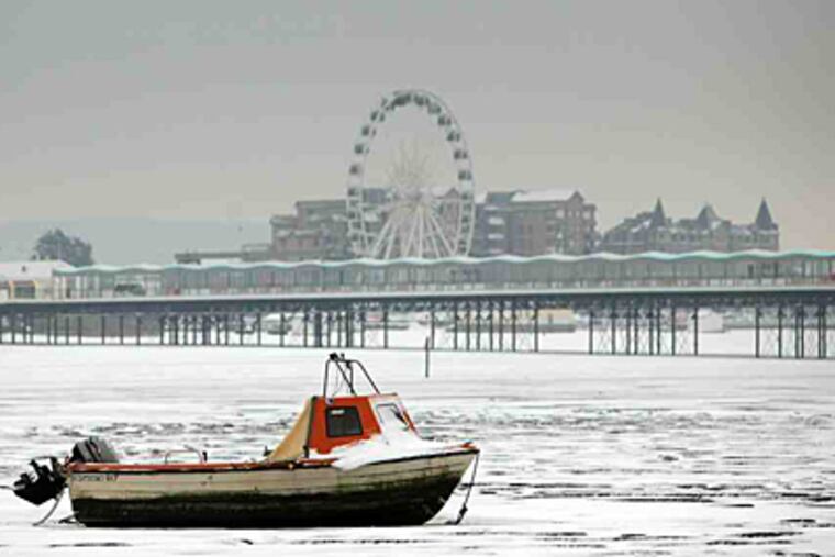
It was the year in which record heat baked the eastern United States; floods devastated Pakistan; snows more typical of northern Vermont paralyzed Philadelphia; and a Yukon-like December evocative of Dickens' A Christmas Carol iced Western Europe as recently as Monday.
It was a year in which the impresario of all this weather mayhem - the high-speed, high-altitude chaotic winds known commonly as the "jet stream" - misbehaved dangerously.
Climate specialists hesitate to draw conclusions from one year's weather. And on this, the first day of winter, the consensus holds a bit of good news, at least for Philadelphia and the rest of the Mid-Atlantic: December's chill is expected to yield to a balmier January, with the jet stream taking a more benign turn.
But some recent evidence has raised disturbing questions about the future of the jet stream and its impacts on droughts, floods, blizzards, and even the locations of deserts around the world.
Jet-stream winds are critical to weather and climate. They form at the battlegrounds of warm and cold air. They circle the globe, detonating storms, moving weather systems, and locking in prolonged periods of cold and heat, wetness, and dryness.
Discovered by a gentle and unassuming Japanese scientist named Wasaburo Ooishi in the 1920s, the winds are now viewed by some experts in the 21st century as bellwethers of a changing climate.
Until the mid-20th century, the jet stream was a mysterious force, but advances in satellite and computer technology are helping researchers penetrate some of its secrets.
At least two studies using satellite data have shown the high-altitude winds moving toward the poles in the northern and southern hemispheres, perhaps in response to worldwide warming.
If that were to continue, such shifts could mean the expansion of the tropics, the movement of deserts, and major changes in storm tracks.
John M. Wallace, a University of Washington researcher and coauthor of a 2006 study, said last week that he did a double-take when he first looked at the results, which showed a poleward movement of about 65 miles over 25 years.
"It was kind of surprising," said Wallace, a legend in the climate community. The trends were similar in both hemispheres. "That symmetry was instrumental in persuading us that these changes were not mere sampling fluctuations," he said.
Similar findings showed up in a 2008 study by Ken Caldeira of the Carnegie Institution in Stanford, Calif., and Cristina L. Archer of California State University, Chico.
Both studies portray a simplified view of the jet stream, but despite its appearance on TV weather programs, the jet is by no means tidy. It isn't even one entity. It flows in branches and pieces. It dives and buckles. If one were to look at its tracks over a one-year period, they would resemble Medusa on a bad hair day.
It is incited by ocean-temperature contrasts. For example, the El Niño warming of more than 10 million square miles of the equatorial Pacific juiced jet-stream winds last winter and contributed to Philadelphia's record snows.
But that was last winter. Now the pattern has flipped, and though December has been wintry, in the coming weeks the jet stream is expected to respond by diverting mega-storms and bitter cold away from Philadelphia.
Jet stream winds form three to nine miles above the surface at the collisions of air masses of different density and temperature. The spin of the Earth hurls them primarily west to east, as fast as 200 m.p.h. or more, and sometimes they spin in the opposite direction. The German scientist who named them (Ooishi merely discovered them) wasn't thinking of aircraft, but jets of air - as in water pulsing through a hose.
The high-speed winds lift the lid off developing storms the way cold breezes yank smoke from a chimney. The most-powerful winds are embedded in storm-exploding "jet streaks," as long as 1,500 miles and as wide as 300 miles, said Louis Uccellini, head of the National Centers for Environmental Prediction and a winter-storm expert.
The jet interacts with underlying surfaces in complex ways. While the air may flow smoothly over the oceans, it will undergo wild changes as it passes over mountains and the irregular topography of land masses.
Above all this chaos, however, researchers say they have seen a trend that makes sense in a warmer world. Overall warming would tend to move air-mass battlegrounds closer to the poles, thus displacing the jets.
Now scientists are trying to answer critical questions. Are the jets responding to human activity? Are these movements part of natural cycles?
Human-caused climate change is the prime suspect, said Pennsylvania State University climatologist Michael Mann. Mann is known for his work in using such evidence as tree rings and ice cores to reconstruct climates over the last 1,000 years. He gained unwanted notoriety in the last year when he was implicated in the so-called "climategate" scandal in which leaked e-mails suggested data-tampering. The university cleared him of wrongdoing, and his research is highly regarded among his peers.
In a warming planet, said David Easterling, a climate specialist with the National Oceanic and Atmospheric Administration, climate models show that an expansion of the atmospheric circulation over the tropics and subtropics would push the jet stream farther north.
Dry summer conditions of the Mediterranean and the Caribbean could invade northward toward Northern Europe and the U.S. Southeast, Mann said. "There is some evidence that we are seeing that pattern more frequently," he said. "Ultimately, if climate change is unmitigated, we will see such conditions encroach on Pennsylvania."
Mann sees the Russian summer as a warning sign. "What happened this summer is almost certainly a glimpse of precisely the sorts of events that climate models project to become increasingly more common," he said.
Mann's Penn State colleague Paul Knight, Pennsylvania's state climatologist, said that the Russian summer did not speak to long-term changes in the jet streams, citing a lack of extreme conditions elsewhere in the world.
Knight added that he did not see the hand of man behind the jet movements: "This is all natural variability."
"The possibility that they might be manifestations of natural variability cannot be ruled out," said the University of Washington's Wallace.
He said that while satellites can accurately detect the contrasting air masses that define jet streams, they are a relatively modern invention, making the available data limited. His study was confined to 25 years of information.
He added that using pre-satellite data to extend the record is "worth doing" but would be "risky" because of large gaps in measuring stations over the oceans and the Southern Hemisphere.
Wallace said that in the last few years, the jet has been chary with clues regarding its future course.
"I don't think the picture is much clearer now," Wallace said. "It's going to take another decade or so before we can lengthen the record to know."
At 70, Wallace has witnessed profound changes in perceptions and is wary of embracing a conclusion prematurely.
He recalled that when he was in graduate school, "we thought that the climate was cooling, if anything. But we didn't think of the climate as changing."