Record cold as temps plunge below zero in some areas
Temperatures in the area plunged unofficially to a record-breaking 4 degrees this morning with wind-chills nearing -30 closer to the Poconos in what has already been a trouble-fraught date in Philadelphia weather lore.
The previous record low for the date in Philadelphia was 7 degrees, set in 1988.
"We did hit a record," confirmed Dean Iovino, a meteorologist with the National Weather Service's Mount Holly, Burlington County, N.J. office. Iovino said temperatures were only likely to rise to 10 or 12 for the high today. Wind chills were at -18 in Philly this morning, with gusts of up to 35 mph.
So when will it start to feel warmer?
The weather service said wind gust speeds early this afternoon have been lower than expected, and will continue to diminish throughout the day and overnight.
Temperatures may not reach the teens today, and will dip back into single digits early Wednesday morning, forecasters say. But high temperatures Wednesday will reach the 20s for most of the area -- and without the accompanying frigid wind chills felt today.
"Winds across the region are expected to be significantly lower than those experienced on Tuesday," with most of the area seeing 5 to 10 mph winds, a weather service forecast discussion says.
Further north and west of Philadelphia, the cold today was beyond brutal, and more record-low temperatures were set. State College recorded -9 degrees and a wind chill of -36; Mount Pocono also recorded a record low of -8 and a windchill of -32.
Other places setting new record-low temperatures this morning included Wilmington, at 4 degrees; Trenton, at 2 degrees and Reading, at 1 degree.
Iovino said the arctic air mass that's descended to produce the temperature drop occurs every few years. It is a bit unusual, he said, that we would have two arctic blasts within the space of less than a week.
"It doesn't happen every year, just every once in a while," Iovino said.
Although power outages were not widespread, PECO reported more than 1,000 Philadelphia customers did not have power as of about 8:30 a.m., and fewer than 500 lacked power by early afternoon.
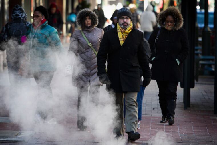
Those who ventured out in the frigid temperatures this morning came prepared: Layers were the style of the day at SEPTA's Market East station, with many donning bulky sweaters under thick coats, wearing jacket or sweatshirt hoods over their hats, and wrapping colorful scarves around their necks. People remained bundled up as they ate breakfast or sipped coffee at the Gallery food court.
"This bitter cold is very dangerous," said Philadelphia resident Eric Richardson, who was sporting a puffy coat, hooded sweatshirt and hat as he sat in the train station. "I'm staying nice and warm with several layers of clothes."
That was also Kathleen Madalion's strategy for battling the cold.
"You have to dress in layers. A lot of sweaters or sweatshirts," she said. The Philadelphia woman said she was surprised by the plunge in temperatures, after Monday's high reached 60 degrees.
"It was so warm yesterday," she said.
In anticipation of the bitter cold, Philadelphia declared a "cold blue" yesterday and homeless were being urged into shelters.
The arctic blast is bringing frigid air to much of the country, with single-digit temperatures expected from Alabama to New York City, according to AccuWeather. Many places are seeing the lowest temperatures in two decades.
Nationwide, as many as 117 million people are under wind chill warnings, advisories and watches, according to the Red Cross.
Coincidentally, Jan. 7 has proved trouble for Philadelphia in the past:
-In 1994, one of the worst ice storms to hit the area occurred on that day. A freezing rain started in the morning of Jan. 7, 1994, glazing roadways and encasing trees and power lines in ice up to an inch thick in some parts of the suburbs causing hundreds of thousands to lose power for days.
-Then, on the same day in 1996, the beginning of the biggest single snow on record began. By the time the snowfall was over the following day, Philadelphia recorded 30.7 inches of snow. Of that, 27.6 inches fell on Jan. 7. It beat out the previous record of 26 inches on Feb. 13, 1899.
As for the rest of the week's forecast:
The high Wednesday in Philadelphia is likely to be near 24.
Thursday will be mostly cloudy with a high of 36.
Friday is forecast for a high of 42.
Then, Saturday could see some rain and high of 53.
Sunday could be sunny with a high of 51.