A massive Sandy makes landfall in Atlantic City, heads inland
Having virtually shut down the Philadelphia region Monday with its ferocious arrival, the monstrous hybrid known as Sandy promised yet another day at least of damaging winds and punishing rains.
Having virtually shut down the Philadelphia region Monday with its ferocious arrival, the monstrous hybrid known as Sandy promised yet another day at least of damaging winds and punishing rains.
"It's going to be a long-duration event," Rick Knabb, National Hurricane Center director, warned at an afternoon briefing.
Sandy's impact looks certain to linger through Election Day next Tuesday and beyond. President Obama canceled a campaign event to return to Washington to oversee what is sure to be a multibillion-dollar recovery effort to undo the damage of a storm that has affected as many as 60 million people from the Carolinas to Maine.
At a news conference Monday night, Mayor Nutter said that 41,000 Philadelphians were without power and that from "90 to 100 trees" had been knocked down by Sandy's winds. He warned people not to go near downed wires and to report them to 911.
Nutter and Samantha Phillips, Philadelphia's deputy director of emergency management, said additional rain overnight could cause coastal flooding on the Delaware River. They said city officials are paying special attention to infrastructure on the river, including bridges, prisons, and the SugarHouse Casino.
The storm damaged the facade of a home in North Philadelphia, prompting the city to help the family there find a new place to stay, Nutter said.
And there is more drama to come. The National Weather Service warned of "historic and life-threatening coastal flooding" along the New York and Connecticut coasts through 3 p.m. Tuesday.
Amtrak service in the Northeast Corridor will remain suspended Tuesday, as will US Airways flights. SEPTA rail service will continue to experience disruptions, and the PATCO High-Speed Line won't be running during the morning.
Philadelphia public and parochial schools will remain closed, as will most suburban schools and all major colleges and universities. City and county court and government offices will also be closed.
Sandy technically made landfall at 8 p.m. Monday at Atlantic City with Category 1 hurricane winds having sustained peaks of 80 m.p.h.
The storm, which has haunted the Northeast for days as it crept northward from the Caribbean, is likely to be one of the costliest to ever hit the East Coast. It could rank with the devastating unnamed hurricane of 1944; Hazel, in 1954; and Floyd, in 1999.
Meteorologists on Monday spoke in awe of what some saw as an "unprecedented" weather system - part hurricane, part wintry storm, all menacing. It came up the coast and made a hard left toward South Jersey's fragile barrier islands.
"This is a once-in-a-lifetime event," said Tom Kines, a meteorologist at Accu-Weather Inc.
Its lashing winds and relentless rain did more than raise flood waters. Falling trees and boughs brought down power lines, leaving great swaths of region in the dark.
A million power outages were reported as of last night in Pennsylvania, New Jersey, and Delaware, where states of emergency were in effect. Gov. Corbett said he was ready to deploy 1,600 National Guard troops if necessary. The Delaware River Port Authority closed all its bridges indefinitely, and Corbett ordered the closing of the Schuylkill Expressway, the Blue Route, Route 1, and I-95 until 2 a.m. Tuesday.
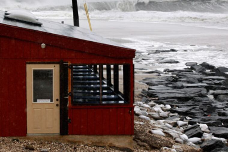
How impressive was this storm? Well, by 1 p.m. Monday, with Sandy still hours from landfall, Atlantic City and Ocean City had become lagoons. Flood waters lapped into Ocean City High School.
By that time, Sandy-incited waves had already smashed an 80-foot section of the Atlantic City Boardwalk into rubble. It was reminiscent of the 1944 storm that sent chunks of the famed promenade floating on floodwaters as high as the tops of parking meters.
Floodwaters attacked Absecon Island on Monday. They were so deep around Atlantic City's Convention Hall that stranded residents were appealing to firefighters for help. Margate's beach blocks were swamped at high tide, and at Longport, the bay met the ocean.
An 89-m.p.h. gust, well past hurricane force, was measured at Surf City, a 69-m.p.h. gust at Harvey Cedars, on Long Beach Island. There was a 76-m.p.h. gust in Bensalem, Bucks County.
In advance of the storm, the region was pelted with rain. Both Atlantic City and Rehoboth Beach, Del., recorded eight inches. Final totals could reach double figures in some places before the rains stop, meteorologists said.
Late in the morning, as many as 1,000 Bensalem residents were ordered to evacuate homes along the Neshaminy and Poquessing Creeks and the Delaware River.
Elsewhere in the county, residents of 23 streets near the Neshaminy Creek and several others along the Delaware were evacuated.
Mandatory evacuations were ordered along the flood-prone Darby Creek, which has been choked with tree debris from erosion on its banks.
Police Chief Robert Smythe said officers urged residents on 13th and 14th Streets and the 700 block of Pine Street to leave. Peco crews accompanied police and shut off gas and electricity in the targeted areas, Smythe said.
Flooding may be widespread Tuesday, but the bigger issue may be the lingering effects of tropical-storm-force gales that are all but certain to result in massive power outages that utility officials said could last for days.
Even before those winds got seriously cranking Monday, trees were coming down. One fell on a car on southbound I-295 in Cherry Hill, and in Delaware County, a falling tree whacked a house in the 400 block of School Lane in Drexel Hill, damaging a room where an infant was sleeping. The baby was taken to Children's Hospital of Philadelphia, said county Emergency Director Ed Truitt.
Three hundred people were at Red Cross shelters in the Philadelphia area as of midday Monday, while Darby had at least 150 staying at a community center.
East Coast tropical-storm threats are not without precedent in October, but no one could recall one quite like Sandy.
In its ponderous, almost slow-motion trip from the Caribbean, it paralleled the coast and then made a hard left at New Jersey. Typically in October, tropical storms scoot rapidly from southwest to northeast.
"We're in new territory here," said Dennis Feltgen, a meteorologist who is the National Hurricane Center spokesman.
Monday morning, Sandy crossed the Gulf Stream and got a fresh injection of tropical energy. "It did pick up a little juice," said Gary Szatkowski, meteorologist in charge of the National Weather Service office in Mount Holly.
It also picked up some speed after it entered the cooler ocean waters to the west, and that accelerated the landfall timetable, allowing Sandy to reach the South Jersey coast just before high tide. Tides generally have been swollen a foot or so by the full moon, said Knabb.
What explains the peculiar path?
Sandy slammed into a wall of high pressure, or heavier air, over the North Atlantic, Kines said. The high directed it toward a deep area of colder lower pressure over the Eastern United States, and as coconspirators that have generated mayhem that included profoundly heavy snows in the Virginia mountains.
Louis Uccellini, director of the National Centers for Environmental Prediction, said such behavior by a tropical system was unprecedented.
"Sandy is unique in a number of ways," said Hurricane Center director Knapp. "The rainfall could be measured in feet."
Szatkowski said it was possible that the hybrid Sandy could end up setting records before it winds down sometime Wednesday.
The bars for rain and wind records, however, are formidable in Philadelphia. The all-time highest wind gust recorded officially in Philadelphia, 94 m.p.h., occurred during Hazel in 1954.
Floyd remains the reigning rain king with close to seven inches officially and more than a foot elsewhere.
No hurricane had made landfall in New Jersey since a Category 1 in September 1903.
Irene at first was believed to have been a Category 1 when it grazed the Jersey coast last year. However, National Oceanic and Atmospheric Administration investigators determined that it hadn't quite made the grade.
Sandy didn't quite qualify because it had lost its tropical characteristics at landfall. But that distinction, meteorologists said, was a mere technicality.
They all agreed that Sandy is about to join the hurricane hall of fame.
at 610-313-8210.
Contributing to this article were Inquirer staff writers Miriam Hill, Carolyn Davis, Angela Couloumbis, Rita Giordano, Bill Reed, Amy S. Rosenberg, Mari A. Schaefer, Jacqueline L. Urgo, Dan Hardy, Peter Mucha, and Darran Simon.