Hurricane Earl likely to spare Jersey Shore
The Atlantic Ocean is in an uproar and North Carolina remains in a state of anxiety, but it appears Hurricane Earl will spare New Jersey's beachfront real estate and the plans of hundreds of thousands of Labor Day weekend revelers in the region.

The Atlantic Ocean is in an uproar and North Carolina remains in a state of anxiety, but it appears Hurricane Earl will spare New Jersey's beachfront real estate and the plans of hundreds of thousands of Labor Day weekend revelers in the region.
After causing up to $150 million in damage in the Caribbean and generating waves as high as 49 feet, Earl was headed northwest toward the Carolinas late Wednesday, forcing evacuations along the Outer Banks barrier islands.
It was a frightening-looking storm, with peak winds of 135 m.p.h. But computer models suggested the season's first bona fide East Coast hurricane scare would not end in catastrophe.
Although the National Hurricane Center posted a hurricane watch for the Delaware beaches and tropical-storm warnings from Virginia Beach to Sandy Hook, N.J., they were more a function of Earl's unusually large coverage area than fears that it would jog westward.
"This is a fairly good-size storm," said meteorologist Bob Wanton of the National Weather Service in Mount Holly. Hurricane-force winds, 74 m.p.h. or better, radiated 90 miles from the storm's eye. Tropical-storm-force winds extended about 180 miles northwest of the center, Wanton said.
"The hurricane center always errs on the side of safety," he said.
Computer guidance continued to insist that Earl would turn northeast once it reached Hatteras, N.C., late Thursday. It was expected to pass within 200 miles of the South Jersey coast Friday afternoon before speeding toward New England.
As for Philadelphia and the mainland, it could be quite a windy weekend - but that would likely be from breezes in the wake of a cold front that will help nudge Earl offshore.
Hurricanes are notoriously volatile, and two of the state's most-damaging in terms of flooding - in 1938 and 1944 - followed offshore tracks.
Harry J. Lombardi, 87, who lived in Ventnor, recalled watching the waves from a second-floor oceanfront window on Sept. 14, 1944.
"The water came right through the front door and halfway up the stairs," said Lombardi, who now lives in wave-free Bala Cynwyd. "When the water receded, I ran as fast as I could to a neighbor's house."
With Earl's track subject to change, New Jersey's emergency management officials watched the storm closely on Wednesday.
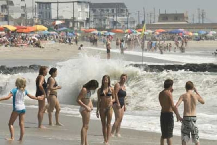
It already was kicking up the surf, and some beach patrols in Cape May, Atlantic, and Ocean Counties limited swimmers to knee-deep and waist-deep bathing.
At Island Beach State Park in Ocean County, the state Department of Environmental Protection has banned swimming until Saturday, though visitors are welcome.
So far, prospective holiday tourists appear to be unfazed, Shore tourism officials say.
"We haven't heard of any hotel cancellations or issues like that at all for this weekend," said Diane F. Wieland, director of tourism for Cape May County.
'Too good to wait'
Surfer Jules Castellini, 18, of Vineland, did alter his plans, at least slightly.
"I wasn't supposed to get down here until Friday," Castellini said as he gazed at the Atlantic churning along Ocean City's Ninth Street beach Wednesday. "But I got a call that the waves are really getting good, and that I should get down here. It's too good to wait."
For others, it may be too rough even to wade. After the storm passes, rip currents could be a problem into Saturday, Wanton cautioned. But the sea is expected to become progressively calmer, and the weather, nicer.
Fiona, the next storm in line, is a shadow of Earl. It looks to stay even farther to the east, and forecasters say it probably won't reach hurricane status.
Weekend outlook
Meanwhile, as Earl dissolves in the cold waters of the far North Atlantic, conditions around here will become markedly cooler.
In fact, as unbelievable as it may seem after three months in the broiler, a sweater situation is possible Saturday night as temperatures fall toward 60. The days are forecast to be be relentlessly sunny Saturday through Monday, with afternoon highs around 80.
Said Wanton: "The weekend looks beautiful."