Feared nor'easters peters out
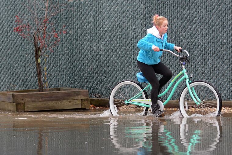
OCEAN CITY, N.J. - The boardwalk looked like a ghost town Tuesday, but except for some high surf, minor street flooding, scattered power outages, and wind gusts that topped out at 55 m.p.h., it appeared like any other chilly, gray December day in this Jersey Shore resort.
OCEAN CITY, N.J. - The boardwalk looked like a ghost town Tuesday, but except for some high surf, minor street flooding, scattered power outages, and wind gusts that topped out at 55 m.p.h., it appeared like any other chilly, gray December day in this Jersey Shore resort.
But barricades had been placed along some low-lying streets, emergency management personnel kept a close watch on the beachfront, and local schools here and in other Shore towns were closed for the day because of "heavy rains, high winds, and tidal flooding."
"This was nothing. I've lived around here my whole life, and I've certainly seen it a lot worse than this," said Joseph Libertore, 62, of Egg Harbor Township, who takes a walk most mornings - rain or shine - along the Ocean City boardwalk.
"In fact, yesterday's weather" - Monday featured coastal flooding and light snow, well in advance of the storm - "seemed worse than today."
Elsewhere in the region, to the west, the nor'easter meteorologists had begun talking about three days earlier unfolded as a rather ordinary rainstorm, and it appeared the Poconos would be spared a major snowfall.
But emergency management coordinators up and down the coast from Ocean County to Cape May County had been briefed and prepared for this pre-season nor'easter, said Jim Eberwine, a retired National Weather Service meteorologist and Absecon's emergency management coordinator.
Eberwine said he networks, from a meteorological standpoint, with other local and county emergency managers to help them understand "what they may be in for" during storms.
"I know the kind of information they are looking for," Eberwine said. "I can help them better understand what may be coming, and that helps them prepare. And I've learned a lot from them over the years, about how they do their job."
While the Shore received about 21/2 inches of rain, mostly overnight - as predicted - the European and U.S. models were off on the amounts of precipitation west of the Delaware River and just how far west the precipitation would extend, said Tom Kines, a meteorologist with AccuWeather Inc.
Less than an inch had been measured at Philadelphia International Airport by day's end, although winds were delaying inbound flights by an average of an hour and 19 minutes during the afternoon, according to Flightaware.com.
The storm moved more quickly than anticipated, with onshore winds becoming more northerly well before high tide at the coast, and by mid-morning the heaviest rains had moved to the north "a couple of hours faster than the general thinking" Monday, said Gary Szatkowski, meteorologist in charge of the National Weather Service office in Mount Holly.
And meteorologists said that as the storm moved past the area on Tuesday, it took most of the punch with it, so they are predicting only moderate wind and a little more rain over the next couple of days.
Eberwine said computer weather models had predicted that when high tide hit the Shore by mid-morning Tuesday, a coastal low would have been sitting off North Carolina that would have driven stronger winds and heavier surf onto New Jersey beaches, creating deeper flooding and rougher surf - and ultimately more damage.
Despite dodging the bullet this time around, Eberwine predicted that when officials check beaches in a few days to determine whether the storm created erosion, they will find some. How severe it will be is the question.
"This storm was definitely a nor'easter, but far from the classic nor'easter, far from the perfect storm," said Eberwine, noting that this storm hit just a few days shy of the 22d anniversary of the Dec. 11, 1992, nor'easter.
That nor'easter - which Eberwine calls a "beautiful storm" - hit at the height of the holiday season, and was a ferocious overnight event that shook beds, blew out windows, sent 10-foot waves breaking on downtown barrier island streets, and knocked out power for days in coastal towns.
"What makes nor'easters so interesting is that they are hard to predict. They are remarkable in that you don't really know what they are going to do," Eberwine said. "This one was good from a preparation standpoint because it's not even officially the winter season yet when you get the most nor'easters. It's a good reminder of what they can be all about."
As for the snow threat from Tuesday's nor'easter, Kines said temperatures in the upper atmosphere were warmer than expected, and that all but eliminated any chance that up to a foot would slam the Poconos.
While precipitation was forecast to linger into Thursday, in terms of snow, Philadelphia will probably have to settle for a few flake sightings, Kines said.