Philadelphia’s first coronavirus map offers incomplete but troubling picture ‘all over the city’
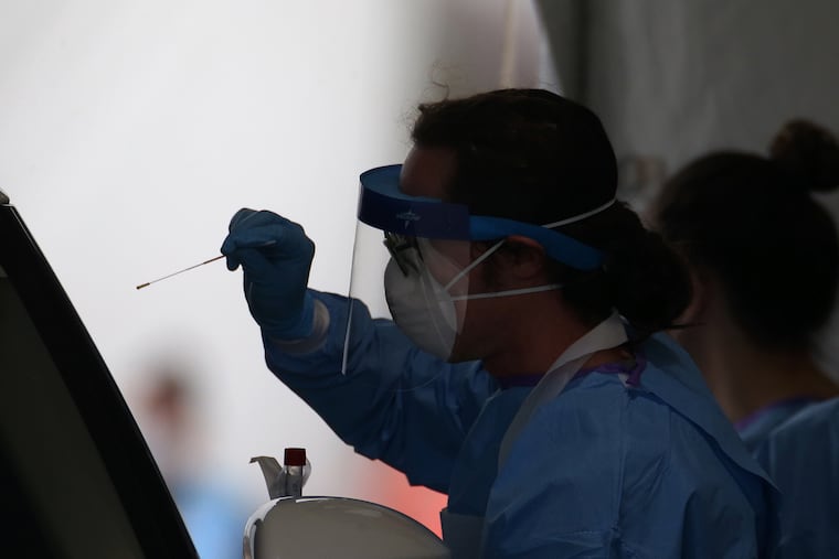
New data shows less than 1% of the city has been testied for the fast-spreading coronavirus.
Coronavirus cases have been confirmed in zip codes throughout the city, according to newly released data showing the most detailed picture yet of the virus’ spread.
Some Philadelphia zip codes have fewer than five cases and one has more than 40. These numbers are expected to grow significantly in the days and weeks ahead as officials, hospital workers, and the community brace for a surge in cases.
The data, the most current information as of Saturday morning, provide a window into which parts of the city have residents who most availed themselves of testing, and also highlight how thinly Philadelphia has been tested, as well as how a lack of information has hindered health officials’ efforts to track the spread of the illness.
People have received 5,601 test results through Saturday. The data do not indicate cases where the same person was tested more than once, but based on the test numbers it appears less than .5% of the population has been tested for the virus.
About 800 people, or 14% of those who have been tested, were found to be infected with the coronavirus. The number of confirmed cases is almost certainly much lower than the actual number of infected people in Philadelphia. The relatively low proportion of positive test results could be a result of several factors, city health officials said, including fewer actual cases than other cities have experienced or a difference in the testing criteria in Philadelphia that allows people to be tested.
While the map shows some neighborhoods more affected than others, it is more likely the virus has spread widely throughout the city, said Jennifer Nuzzo, an epidemiologist and senior scholar at Johns Hopkins Center for Health Security. The map does, though, hint at the omnipresence of the coronavirus and emphasizes the need to practice social distancing.
”It’s here," she said. "It’s all over. This is why we all need to stay home.”
A difference of a few dozen cases between zip codes is not large enough to say one area is worse off than others, Nuzzo observed. Accurately identifying where clusters of infection are in the city, Garrow said, would require widespread testing in a particular area, and the city lacks the test kits and lab capacity to do that.
“These numbers are undercounts of what we feel the real number of cases in those zip codes are,” said James Garrow, a spokesperson for the city’s health department.
The map and the data behind it, though, provide an indication of where people have been more likely to be tested. Population density and access to health care play roles in shading neighborhoods’ infection numbers, but so does wealth. The data provided by the city showed that testing rates were higher in the city’s wealthier zip codes.
Center City, with 20 cases per 10,000 residents, and Center City West, with 14 cases per 10,000, had the highest rates of infected residents. Both also had among the highest rates of people who sought testing. Chinatown, which was hurt economically when the virus first spread from Wuhan, China, had the highest rate of testing in Philadelphia. Zip codes with higher rates of tested residents, Garrow said, could indicate people more in the habit of seeking medical care when they feel sick, in part due to living near large health providers.
“I could say that anecdotally these are places where people tend to have better access to those large health-care systems,” Garrow said. “The one in West Philly, that’s right near Penn and CHOP.”
Conversely, he said, people who live in zip codes where there were few confirmed cases should not take that as a sign that the coronavirus has passed them by. It might simply mean fewer people were tested.
“Just because you live in a particular area doesn’t make you more at risk or less at risk,” Garrow said.
As cases rise, Nuzzo said, people should pay attention to how the map changes. Health-care facilities could also use this kind of visualization to prepare, the best they can, for cases in the coming weeks. Hospitals know where patients typically come from.
“If I were at a health facility, I would be looking at this map thinking, ‘How hard are we going to be hit?’” she said. “If they see where the cases are, they might be able to use it to anticipate.”
If nothing else, the map should motivate people to adhere to the city’s stay-at-home order, Nuzzo said, something some Philadelphians continue to take lightly. An official announcing the city’s case count, she said, might not be as persuasive as seeing a map of the virus’ spread.
“If you see where your house is on this map and you think, ‘Gosh there’s a whole lot of COVID-19 around me,’" she said. “That sounds a lot more personal and real.”
Cases are doubling every two to three days and city officials have expressed dismay at those not isolating themselves.
“This is all over the city,” Garrow said. “Everyone is affected by it.”
Graphics editor John Duchneskie contributed to this article.

