From smoke to storms to the threat of tornadoes, the Philly area continues to deal with weather drama
The region spent Saturday under ominous skies and a daunting forecast, but the area was spared a rerun of last weekend.
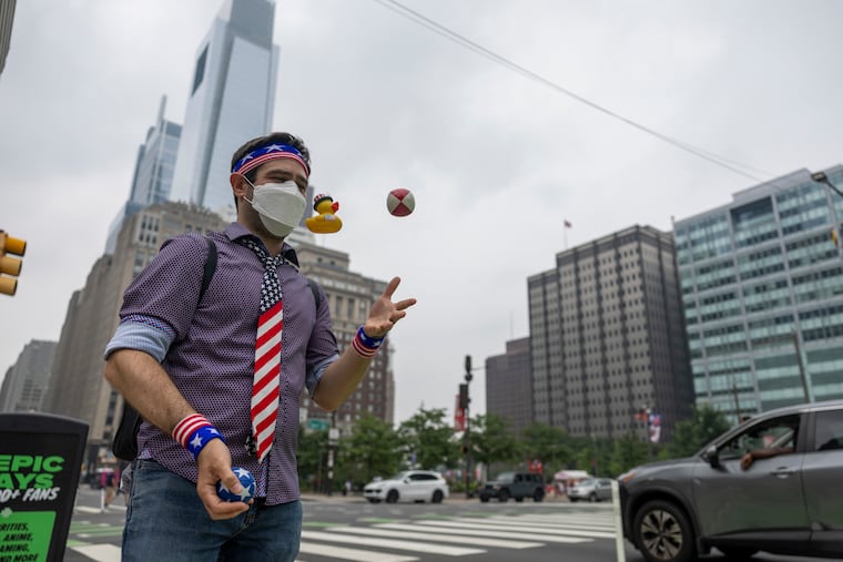
A weather-weary Philadelphia moved from one extreme to another Saturday as the smoke-filled skies began to clear, only to be replaced by the threat of high winds, heavy rain, flooding, and the threat of tornadoes.
The severe weather forecast came one week after storms uprooted trees, flooded basements, and caused widespread power outages in the region — leading Philadelphia to declare a disaster emergency. That was followed by a wave of smoke from ongoing wildfires in Canada that settled over the city Thursday, driving air quality indexes into the “very unhealthy” range.
While elevated smoke levels were expected to continue Sunday, some relief from the high temperatures were forecast.
Saturday afternoon, the first round of thunderstorms missed Philly and caused flash floods in the New York City region, according to news reports.
“With the early threat, we lucked out,” National Weather Service meteorologist Mike Lee said. “That said, the second round of storms are forming as we speak. ”
» READ MORE: The wildfire smoke in Philly is forecast to last into the weekend — and be followed by storms
Between two and three inches per hour of rainfall was expected, NWS said. That would be enough to cause flash floods in urban areas. River flooding was not forecast but was a possibility. NWS issued a flash-flood watch in eastern Pennsylvania, New Jersey, and northern Delaware, along I-95 and to its northwest. Half-inch thick hail capable of denting a car was also a threat.
But as Saturday progressed, the Philly area was generally spared widespread damage. There were reports of downed trees in North Wales, Montgomery County, and reports of damage in Ocean County, N.J., and Delaware, but it was not a rerun of last weekend.
“Microburst” storms like the ones the city experienced last Saturday were a possibility, Lee said, and there was a high chance that wind gusts would exceed 60 miles per hour.
“In terms of the greatest threat, it’s going to be the damaging wind gusts. There certainly could be a few tornadoes possible as well. These sorts of thunderstorms pack a punch,” Lee said.
The tornado risk is between 5% and 9% for the affected region, comprising a large swath of eastern Pennsylvania, Delaware, and New Jersey. “In addition, the risk of a strong (EF2) tornado is notably high,” the forecasting service stated online, using the Enhanced Fujita Scale, which ranks tornado intensity from 0 to 5 based on estimated wind speed and likely damage.
Wind from an EF2 tornado ranges from 113 to 157 miles per hour, NWS said. Such wind can tear roofs from houses and snap or uproot trees, NWS said. Last Saturday, both of those things happened as a result of microburst storms.
» READ MORE: Philly picks up the pieces from ferocious ‘microbursts’ that sent trees crashing into houses and cars, and cut power
Effects felt
Early Saturday afternoon, the Philadelphia Office of Emergency Management announced a tornado watch in effect until 9 p.m.
“This watch means that conditions are favorable for the development of severe thunderstorms with possible tornadoes,” the city office said in an emailed alert. “Hail and strong winds are also possible. Persons in the watch area should be on the lookout for threatening weather conditions and listen for later statements and possible warnings.”
Philadelphia remains under a disaster emergency declaration as a result of last Saturday’s storms. The city has been addressing the recent spate of severe weather through its emergency operations center, said Dominick Mireles, deputy managing director of the city’s office of emergency management.
With the help of six contractors, the city has cleared nearly 500 trees damaged in last week’s storm, “and we are prepared if today’s storm creates more damage,” Mireles said in an emailed statement.
The Phillies moved up their home game Saturday with the New York Mets to 3 p.m., hoping that starting an hour earlier would prevent a rain delay or cancellation. It was the second such change of this series — on Thursday, the Phillies moved their home game forward an hour to avoid worsening air quality expected after sunset.
The effects of the wildfire smoke and looming storms could be seen across the city Saturday.
In Rittenhouse Square, plenty of people were outside, determined to enjoy the slightly less polluted air and lower temperatures before more storms ripped through the city.
Sally Linnett wore an N95 mask as she carried a bouquet of fresh-cut flowers across the square. The retired nurse said she watched the “pyrotechnics” of last Saturday’s storms from her 13th-floor Center City apartment. She’d been avoiding the outdoors since Thursday but decided to get in a walk before the next round of severe weather begins.
“I’m 78. I need to walk. I need to keep moving,” Linnett said.
Jennifer Ferd and Kyle Gavin walked through the park wearing silver-colored finisher medals from the Diplo 5K, a “run and rave” that took place in South Philly and at Lincoln Financial Field Saturday morning.
“It was more of a power-walk for me,” said Gavin, a 35-year-old finance professional based in Hoboken, N.J.
Gavin and Ferd, who lives in Washington Square West, said they signed up for the run a month ago, shortly after they started dating, and they didn’t want the weather to slow down their interstate relationship.
Gavin said climate change is forcing Americans to get used to more severe weather events.
“Obviously it wasn’t great,” Gavin said of the smoke-tinged air, “but at least it was kind of early in the morning.”
It was a bit surreal to see people running in N95 masks, said Ferd, a 29-year-old who just earned a doctorate in biological engineering from the University of Pennsylvania. The couple was mulling whether to cancel their plan to visit the suburbs Saturday evening due to the flood risk.
“I don’t let it discourage me, but maybe that’s a little dumb,” Ferd said.
When will it end?
Once those thunderstorms end, the smoke is likely to return.
“Interestingly, the storms probably won’t have much effect. We need a whole new change of an air mass before they clear out,” Lee said. “So, essentially we need to wait until a cold front comes through.” He referred people to the federal Airnow.gov website for updates on air quality.
Sunday should bring some relief, Lee said. If not from the smoke, at least from the storms: Sunny skies, a high of 85 degrees, no chance of rain.
“It’s not as active, that’s for sure,” Lee said.