Snow, ice threat ebbing for Philly; flash freeze still a lock
The snow and ice threat for the Philadelphia region is waning, but expect a flash freeze as the weekend storm pulls away, along with a harvest of black ice.
Amazingly, for more than a week the computer guidance has been on to the coming storm. So much for the easy part.
Late Friday, the precise path of the storm’s center still was somewhat in doubt, thus so were the impacts. It appeared almost certain that much of Pennsylvania and parts of New Jersey would be locked in ice, buried in snow, or both during the weekend, prompting Govs. Tom Wolf and Phil Murphy to declare states of emergency.
But for all that, in the Philadelphia region the weekend snow totals might be in a league with the inch that was on the ground Friday morning. The region is expected to see snow at the outset Saturday evening, followed by a transition to possibly heavy rain later Saturday with temperatures rising above freezing.
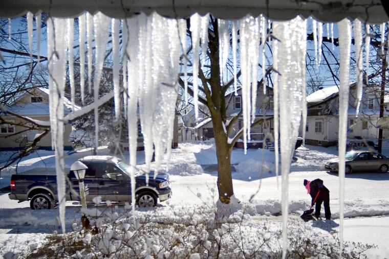
The precipitation could change back to snow at least briefly Sunday as temperatures crash, flash-freezing all remnants and likely creating a harvest of black ice that could persist for days. By Monday morning, temperatures could fall into single digits with winds gusting past 30 mph and below-zero wind-chills.
“The cold air is going to move in very quickly,” said Alex Staarmann, a meteorologist at the National Weather Service office in Mount Holly.
“The more interesting part of the event is going to be at the end,” said Stephen Strader, an atmospheric scientist at Villanova University. “These kind of events scare me a bit because of the black ice."
The approaching storm and its multiple uncertainties have been sources of anxiety for forecasters, including the government meteorologists who are working without pay at the National Weather Service and for whom this will not be a holiday weekend.
As so often happens with winter-storm threats in the East, small differences in the storm track can make all the difference in terms of impacts on tens of millions of people.
The storm center should track near Philadelphia, said Weather Service meteorologist Valerie Meola, and that should draw in enough warm air from the Atlantic to turn the snow near the city into rain before more than an inch has accumulated.
Should it take a slightly more southerly path, that would mean more snow and ice for the immediate Philadelphia area.
The transition to rain is going to take longer to the north and west; plus, in upper Bucks and Montgomery Counties, which are under a winter-storm watch, snow could accumulate a few inches and cold air could lead to freezing rain after any changeover.
The precipitation won’t start until well after the two scheduled women’s marches in the city Saturday morning: the Women’s March on Philadelphia and the Women’s March Pennsylvania. Both start at 10. The Women’s March on Philadelphia is set to start at Logan Square and end at Eakins Oval, where there will be speakers. The Women’s March Pennsylvania will be at LOVE Park, and is more of a rally.
Organizers of the Women’s March on New Jersey in Trenton canceled the event scheduled Saturday in response to the state of emergency, though Atlantic City’s march will still go on as planned. Similarly, an annual Dr. Martin Luther King, Jr. breakfast event Monday at Rowan University has been canceled.
Air travel is expected to be affected on the East Coast, including Philadelphia International Airport, and Amtrak announced it was preemptively canceling a number of trains on Sunday, including Keystone Service (New York-Philadelphia-Harrisburg) and Pennsylvanian Service (New York-Philadelphia-Harrisburg-Pittsburgh). Trains between New York and Boston, and New York and St. Albans, Vt., also are canceled Sunday. The details are on Amtrak’s website.
It should all come to an end later Sunday, when the storm yanks Arctic air into the region as it pulls away. It will be the region’s first serious visit this winter from the dreaded “polar vortex.”
“Sounds like a horror movie," Strader said.
Staff writer Joseph A. Gambardello contributed to this article.
