Slipup: Why Sunday's snow forecast was botched
When Tony Gigi left his house in Mount Laurel on Sunday morning and saw the snowflakes, he knew the weather forecast was in more trouble than a motorist fishtailing on the Schuylkill Expressway.
When Tony Gigi left his house in Mount Laurel on Sunday morning and saw the snowflakes, he knew the weather forecast was in more trouble than a motorist fishtailing on the Schuylkill Expressway.
What the National Weather Service meteorologist relearned in the next few hours, along with millions of other people in the region, is that nature can still trump science.
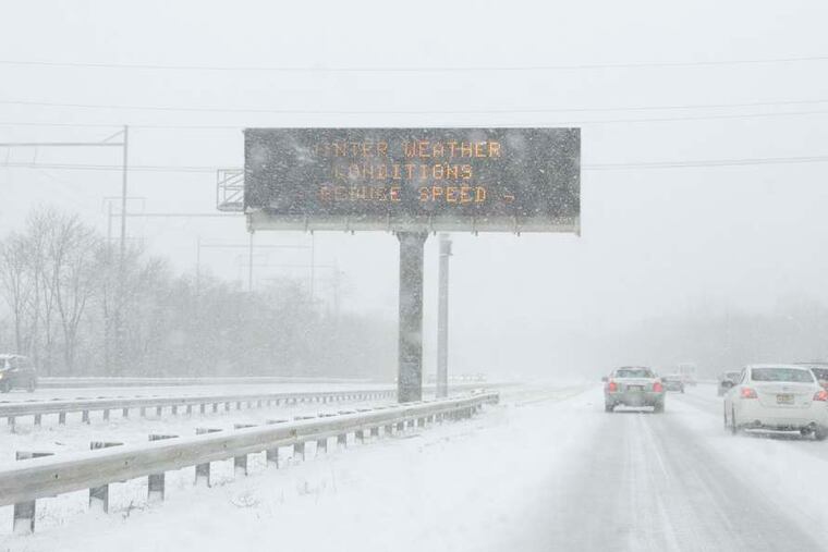
Meteorologists are warning that further proof could develop Tuesday - a winter-storm warning for three to four inches of snow has been posted for the immediate Philadelphia area. The snow is due to spread across the region sometime during the peak morning commute and could persist long enough to bedevil homebound commuters.
But we'll take this one storm at a time.
On Sunday, the forecasters acknowledge, they got it wrong, and they didn't need webcams or radars to figure that out. In this case the errors of their ways were nationally televised, as images of the Eagles game became snowier than the screens of 1950s televisions without rabbit ears.
So much for those predictions of perhaps a little nuisance snow or that holiday favorite, "wintry mix," changing to rain.
"I got the Groucho Marx glasses on," Gigi said Monday. "Every day is a learning experience."
"We're still trying to figure out just what went wrong," said Tom Kines, a meteorologist with AccuWeather Inc. in State College, Pa.
What is known is that a narrow - and very focused - band of snow set up across Southeastern Pennsylvania, South Jersey, and Delaware, and it just didn't move much. Gigi said it reminded him of a train of thunderstorms that keep hammering the same places and set off flash flooding.
It all happened quickly, with snowfall rates up to three inches an hour once the heavy snow moved in around noon.
Among the areas stuck under the heavy bands was the government's official measuring station in National Park, where 8.6 inches was reported - a record for the date and the fourth biggest snowfall before Dec. 10 on record.
And, of course, also caught under the band was Lincoln Financial Field, where snow rapidly accumulated on the playing surface.
The heavy snow ended up affecting the densest core of the region's population, and snow-challenged drivers were having as much trouble getting around as football players.
But Philadelphians didn't have to go too far to get away from it all, or at least most of it. Perkasie, Bucks County, reported under two inches.
Snow falls when warmer, moist air is forced to rise over cold air. The same cold, dry air mass that was interacting with the storm from the south protected areas to the north. The moist air from the storm nosed farther north than expected, and once it did, it didn't budge much.
Above Philadelphia in the snowflake-making regions, said AccuWeather meteorologist Henry Margusity, winds were light. So instead of getting ripped apart by winds, the flakes were able to grow.
Temperatures fell to several degrees below freezing during the snowfall, and then, with a dense snow cover in place refrigerating the overlying air, the temperature was slow to rebound.
What resulted was a significant icing event in parts of Chester and Montgomery Counties, with 0.1 to 0.2 of an inch of freezing rain reported.
Standing water and slush are likely to freeze overnight. Then, forecasters say, get ready for more snow Tuesday.
Tuesday morning, a frontal boundary is expected to be near the region and to interact with a strong upper-level system to set off a period of snow that could last several hours, Kine said. The National Weather Service says snow could affect both the morning and late-day peak commuting periods.
And it's possible, once again, that that narrow area will get creamed.
"We're concerned that somewhere, whether it's in Philly or close to Philly, that can have a repeat of what happened," Kine said.
610-313-8210