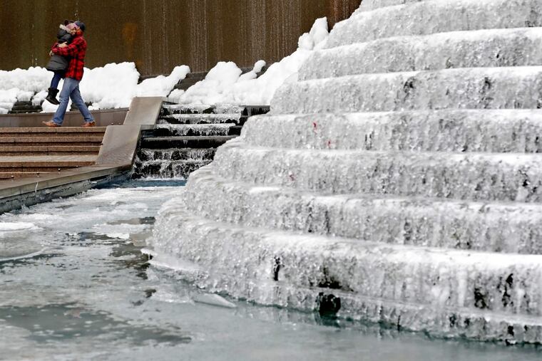
Blizzard, winter-storm warnings as 'bomb cyclone' heads up East Coast
An ultra-cold air mass and the warm Gulf Stream are conspiring to form a meteorological "bomb" that still could limit snowfall in Philadelphia.

Millions of East Coast residents will be learning anew Thursday that they live in a special place, at least from a meteorological standpoint.
The East's dangerous neighbor — the Gulf Stream — will conspire with frigid winds from the frozen parts of the planet to set off a wintry "bomb cyclone" off the Mid-Atlantic coast, meteorologists said Wednesday with high confidence.
Blizzard and winter-storm warnings were in effect from Caribou, Maine, to the South Carolina-Georgia border. Locally, the National Weather Service posted blizzard warnings for the Jersey Shore — where the snow would be heavier and the winds stronger than they will be inland — and the less-alarming winter-storm warnings for the immediate Philadelphia area.
With snow arriving in the early hours and continuing through most of the day, and wind gusts of up to 50 mph, the region could see whiteout conditions at the worst possible time for commuters, the morning rush.
Flakes unseen, the Archdiocese of Philadelphia declared a snow day for city schools on Thursday. Several hours later, the School District of Philadelphia announced it also was declaring a snow day. The city for its part announced a snow emergency, which means all parked vehicles had to be moved off "snow emergency routes" for plowing beginning at midnight.
Meteorologists warned that the character and intensity of the burgeoning nor'easter presented a forecasting nightmare, that the predicted accumulations were no sure things, and that amounts not too far west of the city could be negligible.
But highway departments and utilities said they were taking no chances.
"We're preparing for the worst," said Steve Schapiro, spokesman for the New Jersey Department of Transportation.
Meteorologists were more certain that the storm would be followed by a siege of cold that might make last week's temperatures seem like the good old days: Below-zero wind chills persisting from Thursday night into Sunday, and temperatures in the teens and single digits.
Meanwhile, the high at Philadelphia International Airport reached 33 degrees Wednesday, ending a string of seven days when temperatures failed to get above freezing. Before Wednesday, the last time the mercury had risen above 32 degrees was at 2:55 p.m. on Dec. 26, 2017. By the way, this stretch of consecutive days at or below freezing is tied for 30th place on records going back to the 1880s.
At least one weather-related death, in Montgomery County, has been reported, and there may be others, but officials said that medical examiners need to wait for test results before making rulings.
Counties throughout the region declared "code blue" emergencies and set up warming centers for the homeless.
Both SEPTA and PATCO were preparing their vehicles and infrastructure in anticipation of the arctic blast.
SEPTA will be berthing Frankford-Market and Broad Street Lines trains in subway tunnels overnight to shield them from the cold, and beefing up staff at headquarters and along the Regional Rail network, where they will be watching for the cold's effects on overhead power lines, signals and switches. Some of the Regional Rail infrastructure is a century old.
Regional Rail and trolleys will be running with speed restrictions on Thursday, as will PATCO trains, which will be on a snow schedule.
The cause of all this preparation and anxiety was a storm that late Wednesday was centered off the northern Florida coast. It was expected to intensify rapidly as it moved north and could reach major hurricane status by the time it reaches Nova Scotia late Thursday, the weather service said.
Fueling the storm would be Gulf Stream waters — sea-surface temperatures in some areas off Carolina coast were near 70, according to the Rutgers University Coastal Ocean Observation Laboratory — and frigid air migrating off the continent.
The result would be a meteorological "bomb cyclone," a process called "bombogenesis," a term that has become this winter's "Polar Vortex" for media celebrity.
The concept is not new.
Decades ago, researchers Frederick Sanders of the Massachusetts Institute of Technology and John Gyakum of McGill University in Montreal, examined rapidly developing storms.
What they found was that some cyclones literally blew up, intensifying so rapidly that they were in a class by themselves. They called them "bombs" in a paper published in 1980.
They identified two places on the planet that were the primary breeding grounds for bombs: One was near the Kuroshio Current, off Japan; the other, the Gulf Stream.
Technically, a bomb is defined as a storm in which the pressure — or weight of the air — drops about three-quarters of an inch. As pressure lowers, air rises more rapidly, and rising air results in condensation, thus snow in this case.
From a meteorological perspective, the storm is a fascinating one, said Gregg Gallina, senior meteorologist at the government's Weather Prediction Center.
But he advised that bombs also create forecasting headaches. Their internal dynamics give fits to computer models.
What's more, storms of such intensity tend to have sharp precipitation boundaries. Snow could fall profoundly along a narrow corridor, while areas to the west got deprived of moisture.
"There's going to be a very sharp cutoff," said Rob Miller, senior meteorologist with AccuWeather Inc.
For example, it's entirely possible that Atlantic City gets hammered while Washington and Philadelphia get an ordinary two or three inches, or even less, said Gallina.
While the storm is extraordinary, these things do happen. Gallina said a bomb of this strength occurs perhaps once every three or four years.
Added Gallina: "It's not so rare that everyone needs to panic about it."
The latest developments:
• New Jersey announced that all state courts and state court offices will have a two-hour delayed opening Thursday.
• The Cape May-Lewes Ferry announced it was suspending operation Thursday.
Staff writers Barbara Boyer, Joseph A. Gambardello, Jan Hefler, and Jason Laughlin contributed to this article.