Why winter has made a dramatic comeback in Philadelphia
Winter just last week appeared to be toast until something changed in the atmosphere.
Coming out of an astonishing warm spell, the forecasts as recently as last Thursday offered a reasonable case that Philadelphia was through with snow until the winter of 2018-19.
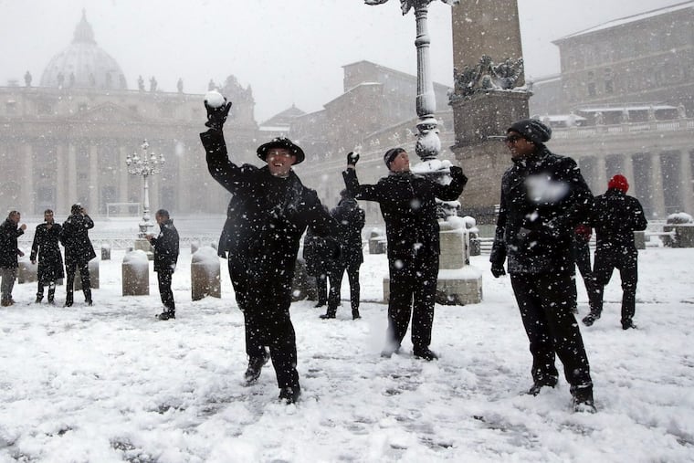
Yet one sign that the atmosphere wasn't quite ready to flip the seasonal switch occurred a few days prior, when snowball fights broke out on St. Peter's Square in Vatican City. Then snow invaded the Emerald Isle.
What happened in Western Europe was symptomatic of a sea-change in the atmosphere, setting off a chain of events that is giving the Philadelphia region one of the most-disruptive weeks of weather in the period of record.
The predicted heavy rain from a "bomb" cyclone mutated on Friday into the heaviest snowfall of the season for parts of the region, conspiring with winds gusting to 60 mph to generate more than 600,000 power failures. And officials are warning of a dangerous sequel Wednesday, with up to a foot of water-logged snow possible and gusts to 40 mph setting off fresh rounds of outages.
>> READ MORE: More snow to hit Philadelphia: Info on the forecast, travel, utilities and closings
The snows in Rome and the British Isles were evidence that for the first time in several weeks, a "blocking" pattern had developed in the North Atlantic that was driving cold into western Europe and eventually into the Northeast United States.
Air pressures near Greenland became higher than normal, and along with delivering the cold need for snowstorms, it served to get in the way of storms that otherwise would scoot out to sea. The pattern technically is known as the negative phase of the North Atlantic Oscillation, which is measured by an index.
That index went negative at the end of February, and reached a seasonal low on March 2, according to the Climate Prediction Center.
The changes were kick-started by a rapid warming of the upper atmosphere over the Arctic in early February, said Walt Drag, a lead forecaster at the National Weather Service Office in Mount Holly. Temperatures jumped by 50 degrees and more in just a few days, a so-called sudden stratospheric warming.
When its warmer in the Arctic, the cold has to go somewhere.
>> READ MORE: How to prepare for a power outage
>> READ MORE: Optician killed in Upper Merion during nor'easter identified
All the changes depress the jet stream, the boundary between warmer and colder air that is the breeding ground for storms, especially off the East Coast, where the warm Gulf Stream gives them an extra jolt.
While large-scale changes such as stratospheric warming and the North Atlantic Oscillation can be forecast days in advance, their effects cannot.
Last Thursday, the forecast for Philadelphia called for rain and "little or no accumulation" of snow, and the extended outlook saw rain for this Wednesday.
>> READ MORE: Looking back at Philly's two biggest March snowstorms: 1993 and 1958
Things have played out a bit differently.