Want to see if the British plundered your house during the Revolutionary War? Now you can.
Chester County historians revealed a 5-year project mapping out property lines to put together a more complete picture of the Battle of Brandywine during the Revolutionary War.
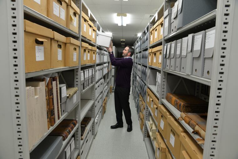
For the last five years, archivist Cliff Parker pored over centuries-old property records, deeds, and mortgages tucked away in Chester County’s files, deciphering clues on ochre papers in pursuit of what happened on Sept. 11, 1777.
Interspersed in the mass of papers was antiquated verbiage in elegant script — demesne, or domain. Messuage. Dwelling-place. Enfeoff, to “invest with an estate.” The words appeared in property records that spanned the 18th century, the Revolutionary War, and, within the war, the notoriously bloody Battle of Brandywine near Chadds Ford, now part of Delaware County.
Pieced together, the records made a road map of Chester County in September 1777, when formal names for roads had largely yet to exist, but British troops would soon travel those vague paths to defeat Gen. George Washington and his Continental Army.
An example of a Chester County geographical marker in 1771: “In the line of Samuel Hunt’s land in the Lancaster Road” and ending “in the road near Stephen Harlan’s corner.”
» READ MORE: 10 acres at Brandywine Battle site preserved in Chester County
In the absence of road names, property records are the way to trace where among 30 square miles in southern Chester County the British troops had stormed and fallen back; where the Continental Armies had responded in kind before retreating north to Germantown in defeat. In victory, the British, led by Gen. Sir William Howe and Gen. Charles Cornwallis, traveled farther east and captured Philadelphia for nine months, driving the Continental Congress to escape first to Lancaster and then to York.
In September, the organized collection and analysis of old property records and related papers became an organized digital project, the 1777 Chester County Property Atlas. A massive undertaking, Parker acknowledged — but “this," he said, "is my side project.”
“It’s important for people to kind of put history into context to understand the history of a property and where their ancestors were,” he said.
The project would reveal to current Chester County residents — those enterprising enough to start down a lengthy and complicated research path, anyway — whether the British had plundered their predecessors' homes of food, clothes, and livestock, and if they had even gone so far to set their houses ablaze.
“I’m at the southern end of the county, and I looked to see what was happening with my property," said Tacie Himelright, an employee at the Chester County Controller’s Office. "The British had come through and done some damage to it.”
She said the extent of the damage included ransacking and, likely, “some burning.”
“You can see where they were traveling, it was great," said Karen Marshall, Chester County’s heritage preservation coordinator. "There’s a line of poor farmers who had livestock stolen, clothing stolen, goods stolen, so you know the troops walked right by there.”
Troops stole from taverns, too, deed books showed.
A Dr. Samuel Kennedy owned a tavern, the Sign of the White Horse, in East Whiteland from 1758 to 1778. It was looted, as was The Sign of the Boot Tavern — later referenced as simply the Boot Tavern — in West Goshen in 1777.
Similar situations played out at the Sign of the Turk’s Head Tavern in West Goshen — shifting town boundaries eventually labeled the tavern to be in West Chester — and the Centre House Tavern in East Bradford.
The Atlas, which recorded titles for hundreds of properties through meticulous research, came to a halt at some properties when records of ownership abruptly cut off for a number of reasons that included sheriff’s sales and poor record-keeping.
In some cases, other records could help round out incomplete pictures.
» READ MORE: Two years in, Chester County residents maintain fight against Toll Bros. over Revolution-era farmland
A mechanic or tradesman could place a lien on a home and record how much they spent and what materials they used to build it. At times, now to the archivist’s benefit, the mechanics liens would include when the building was constructed.
“Lunatics & Habitual Drunkards Records” recorded that a committee was assigned to oversee maintenance and expenses on a property if a resident there was “declared incompetent due to ‘lunacy’ or habitual drunkenness,” according to a research guide from the county.
“It’s not cut-and-dry," said Parker, a longtime county archivist who partnered with coworker John E. Smith to develop the interactive atlas.
“Just because the law requires people to record deeds, to do something in a certain way — back in the time period where you’re researching, you have lots of people who just don’t record their deeds," he said.
Scots-Irish residents in southern Chester County distrusted the government and often neglected to keep proper records, Parker said.
“It’s tremendously difficult and frustrating," he said. “It’s trying to reconstruct a puzzle with more than half of the pieces missing," and "that’s what makes it fun for me. There’s enough circumstantial evidence left for those missing bits of information. It’s like detective work. You just connect all the dots.”
The Property Atlas, though novel in its own right, followed an animated battlefield mapping project Chester County produced 10 years ago that was called the 2010 Battlefield Historic Resources and Animated Map Study.
The American Battlefield Protection Program (ABPP), created in 1990 and run by the National Park Service, funded the effort. It paid for another county project in 2013, called the Battlefield Preservation Plan, which sought to protect 35,000 acres where the Battle of Brandywine was waged, said Jeannine Speirs, a planner at the Chester County Planning Commission.
From there, the roots of yet another project would emerge — the 1777 Chester County Property Atlas — after the 2013 Battlefield Preservation Plan had suggested that the county further study land where modern understanding of the Battle of Brandywine movement was hazy and historic land and structures still existed.
With more funding from the ABPP, the county worked with the Brandywine Battlefield Task Force, 15 towns where the battlefield stretched into, and local organizations. It began to again study the sprawling battlefield in detail, starting with the northern portion.
The ABPP required the county to bring in a Revolutionary War military historian and archaeologist, and for historians to survey the land through a soldier’s eyes. Among other points of evaluation — assessment of high ground good for observation and firing of weapons; concealment with forests, ravines, and sloping terrain; obstacles both natural and man-made.
“For local planning purposes, these projects were critical to provide information, using known 200-plus-year-old documents that were ground-truthed in today’s landscape, as to what happened and where it happened," Speirs said. She noted the information altogether would ideally help protect historic resources and battle land and explain the history of the Battle of the Brandywine to locals and tourists.
“There’s a greater understanding to make a greater connection to the past, and this project helps people get into it," Parker said. “The challenge is to change history, the way it’s told."
