Rutgers: New Jersey shore sea rise is more than double the global average
Sea level along the New Jersey coast has risen 1.5 feet, more than twice the rate than globally, the past 100 years, according to a new Rutgers University report released Thursday. And scientists say the rise is largely the fault of humans.
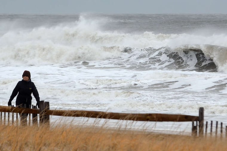
Sea level along the New Jersey coast has risen 1.5 feet, more than twice the global average of 0.6 feet over the last century, according to a Rutgers University report compiled for state officials and released Thursday.
The Rutgers scientists say the rise is largely the fault of humans, and our use of fossil fuels.
The report, commissioned by the state Department of Environmental Protection, presents few positive scenarios for the Garden State as sea levels continue to rise, even if fossil-fuel emissions decrease, as called for by the Paris accords.
As New Jersey is experiencing higher sea levels, it is also undergoing subsidence, meaning the land along the coast is sinking because of geological forces and groundwater withdrawal. In turn, New Jersey is seeing not only more flooding from more precipitation during storms but also an increase in what’s known as sunny day flooding — water that rises higher tidally, rather than because of storm surge.
Scientists who study climate almost universally agree the global climate is changing because of the combustion and processing of fossil fuels that release carbon dioxide or methane into the atmosphere. Both gasses have properties known to prevent solar radiation generated by the sun from escaping the atmosphere, essentially trapping heat.
“Human-caused climate change is accelerating sea-level rise in New Jersey and, together with shifts in coastal storms, driving increases in coastal flood hazards,” the authors state in a summary of the report, which includes historical sea-level rise information and projections.
“Due to a variety of factors, sea level is rising faster in New Jersey and the Mid-Atlantic region than globally,” they wrote.
Jeanne Herb, executive director of an environmental analysis group at Rutgers’ Bloustein School, said the report was written as a planning tool for communities. The group assembled to produce the report included scientists, local officials, engineers, and parks and recreation heads, all working under the direction of Robert Kopp, a climate scientist and director of the university’s Institute of Earth, Ocean & Atmospheric Sciences.
Matt Campo, a senior research specialist at the university, said projections for sea-level rise in the updated report are in line with previous projections for midcentury. However, Campo said there was increasing uncertainty about the end of the century.
“At the end of the day, we still look pretty similar for the next 30 years through 2050,” Campo said. “As you update the science, you worry if it’s going to change further out. ... The changes we make today will make the difference."
Much of the report is not new, but refines highly technical and scientific data. Still, it does have ominous warnings for parts of the New Jersey coast, particularly along the Delaware Bayshore and other areas less protected than the wealthy Shore communities along the Atlantic seaboard.
Coastal wetlands are among the hardest hit areas for sea rise, and, “this is expected to continue to increase under both low and high-emissions scenarios,” the report states.
The Delaware Estuary in particular — also referred to as the tidal, or lower half of the Delaware River — is currently losing about an acre of marsh per day, the authors wrote.
The report also singles out Barnegat Bay, a brackish lagoonal system of the Atlantic Ocean. “The marshes are not expected to keep pace at the current rate of SLR (sea level rise) and they have limited options in terms of retreat due to extensive land development.”
Among the report’s findings:
Sea levels rose an average of 1.5 feet along the New Jersey coast from 1911 to 2019, compared with the global average of 0.6 feet.
New Jersey coastal areas are likely to experience a sea-level rise of up to 2.1 feet by 2050.
Longer-term projections under a high-emissions scenario could rise up to 3.5 feet by 2070 and 6.3 feet by 2100.
Projections vary depending on whether fossil-fuel emissions are curbed. So, sea-level rise could be much lower than the higher-emissions scenario.
Though 1.5 feet might not sound like much, it can make a big difference to already vulnerable communities.
“As sea level rises, it increases the frequency of events already causing us issues today,” Campo said.
For example, between 2007 and 2016, Atlantic City averaged eight high-tide flood events per year. But in 2018 alone, the city saw 18 such events. In the 1950s, the frequency was an average of less than one high-tide flood event per year.
“We can see that sea-level rise is having and will continue to have significant impacts on New Jersey’s communities, its economy, and the health of our residents,” Herb said.
In a statement, the New Jersey Sierra Club said the Rutgers report reinforces the need for New Jersey to update its regulations for building along vulnerable coastal areas.
“Some of the worst areas for flood risk are in Ocean County where they are just growing and building,” the statement said. "Other areas in New Jersey like Cape May County, Monmouth County, Avalon, and more have built the most new houses in risk zones in the nation.”
