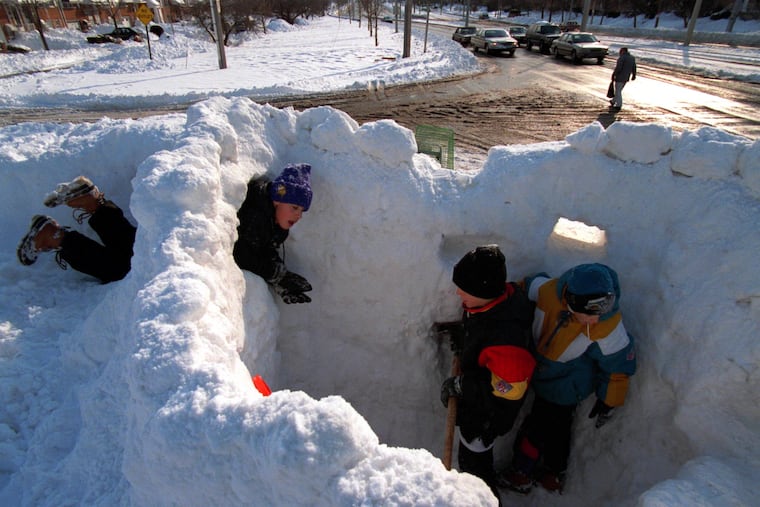
30.7 inches of snow fell in Philly on this week in 1996. Don’t bet against an encore some winter soon.
Philly’s biggest snows typically are generated by nor’easters that import moist air from the Atlantic, where sea-surface temperatures have been above normal.
The plows and shovels haven’t had a whole lot of action in the region in recent winters, and it looks like the rulers will be at rest at least for a while. It may even hit 60 degrees Friday.
Perhaps the atmosphere over the I-95 corridor is still catching its breath and awaiting a second wind after an unprecedented sequence of megastorms that began 30 years ago.
It was on Jan. 7-8, 1996, that an unreal 30.7 inches of snow fell officially* (we’ll come back to that asterisk) at Philadelphia International Airport, the biggest snowfall on record, and a total so astounding it precipitated a federal investigation. The region wasn’t shut down so much as entombed in road-closing heaps of snow.
Philly snow records date to the winter of 1884-85, and in the first 100 years, the city would experience a single snowfall of 20 inches or more only twice.
In the 20-winter period that began in 1996, it happened four times. Three of those winters rank in the top three snowiest.
This, during a time when planetary warming was picking up steam. Rather than paradox, some atmospheric scientists see symmetry.
How warming may be affecting snowstorms
Warming has resulted in more evaporation, filling the air with more moisture, “and the potential for more extreme precipitation,” said Kyle Imhoff, a Pennsylvania State University professor who is the state climatologist.
Said Louis Uccellini, former head of the National Weather Service and one of the nation’s most prominent storm experts, “if conditions are right … that would include the potential for more snowfall within an individual storm.”
Proximity to bodies of water, primary sources of moisture, may be making a difference, said Imhoff. In Erie, in recent decades warming appears to be prolonging the lake-effect snow season as waters have been less prone to freezing.
In recent decades, snowfall from coastal lows has “become more frequent,” he said. Philly’s biggest snows typically are generated by nor’easters that import moist air from the Atlantic, where sea-surface temperatures have been above normal consistently. That warmth may be giving a jolt to coastal storms, according to a paper published in July by a group of researchers, including the University of Pennsylvania’s Michael E. Mann.
It ain’t necessarily snow
That wouldn’t necessarily mean more snow. Ocean temperatures typically are several degrees above freezing in winter, and onshore winds often have turned snow to rain in Philly.
“The trick is getting enough cold air for snowfall,” said Imhoff.
Snowfalls of a foot or more require a highly unlikely alignment of circumstances, a meeting of opposites: Cold air that holds its ground near the surface, forcing warm moist air to rise and generate snowflakes.
Philly’s normal seasonal snowfall is 23.1 inches, but a “normal” season is hardly the norm. The totals have varied from nothing (1972-73) to 78.7 (2009-10). The region has experienced decades of robust snow totals, and snow scarcity.
Sarah Johnson, the warning coordination meteorologist in Mount Holly says she hasn’t yet seen the fingerprints of climate change on snowfall patterns.
“My hypothesis: It’s probably just the luck of the draw,” she said.
Tony Gigi, retired weather service meteorologist, said he wondered if some overarching pattern might explain the decadal variability of snowfall in the region.
About the 1996 storm
Gigi was working the overnight on the morning of Jan. 7, a Sunday, when the snow began. He somehow made it to his Mount Laurel home after work, only to be called back Monday to relieve stranded colleagues.
Overall, the storm was a forecasting triumph, but Gigi said the European model well outperformed its U.S. counterpart. But no one was predicting 30 inches for Philly.
It was an astounding total for a variety of reasons, including the fact that it predated the region’s peak snow season by about three weeks. Of the total, 27 inches fell on the 7th; the previous record for the date was 5 inches.
The 30.7 total became a source of controversy. The reason: “The snow wasn’t measured,” said Gigi.
The total was inferred from a formula using the melted liquid equivalent of the snow and the air temperatures, which were in the teens and 20s during the snowfall. “It was in the realm of possibility,” said Gigi.
But that’s not quite the standard method, said Johnson. Ideally, she said, snow should be measured once with a ruler (or yardstick) at the point that the snow stops.
In this case, the total was so suspect that it wasn’t entered into the climate record for four years. The weather service commissioned then-Franklin Institute meteorologist Jon Nese and New Jersey state climatologist Dave Robinson, an international snow expert, to conduct a forensic investigation. They concluded the total was legitimate, given similar nearby snow reports.
It remains unclear whether it was truly an all-time record, since no official measurements are available before 1884. The late weather historian David Ludlum quoted a visiting Swedish author as having witnessed snow “a yard deep” in Philadelphia in March 1705. However, Ludlum pointed out that it was unclear whether that was the result of a single snowfall.
The future of snow
As of Wednesday, at 4.8 inches, Philly’s official seasonal snowfall total is exactly “normal.”
Highs are expected to climb into the 50s through Saturday, perhaps reaching 60 on Friday before a cool-down early next week. Not a flake sighting is in the extended outlooks.
One factor in the lack of snow in recent years has been consistently cool waters in the tropical Pacific that tend to affect west-to-east upper-air patterns that are unfavorable to East Coast storms.
For the Philly region, “The pattern has not been kind to snow lovers,” he said.
Of note, the 1995-96 winter came at the end one of the most snowless 10-year periods in Philly on record.
