The arctic cold persists, and so does Philly’s snowpack. Both may even go away some day.
Some snow is possible next week
It looks like the Philly region will evade any snow generated by that coastal “bomb cyclone” during the weekend, but the disruptive snowpack on the ground continues to melt at a glacial pace. Maybe ever slower.
“For now, it’s not budging,” said David Robinson, the New Jersey state climatologist who is an international expert on snow cover.
And, ironically, that has a whole lot to do with what happened in the hours right after the snow stopped around 11:30 a.m. Sunday.
Add one of the more signifiant Arctic cold spells in Philadelphia’s period of record, and the entire region has endured a white and wintry week rarely experienced around here.
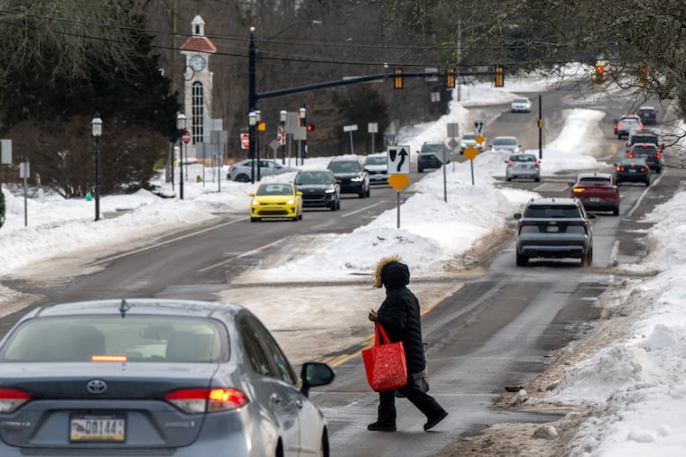
As of Friday morning, the official snow depth at the airport still was 6 inches, about two-thirds of what was measured when the storm ended five days before.
For perspective, the depth was 6 inches five days after a snowstorm in 2016 — after 22.4 inches had fallen.
The cold won’t be as harsh during the workweek, but a thaw isn’t imminent, and some snow is possible Wednesday.
Temperatures are forecast to drop deep into the single digits Saturday morning, flirting with records. It is not due to get into the 20s until Sunday, when backlash winds from the potent coastal storm are expected to drive wind chills below zero.
Those winds may contribute to significant flooding at the Shore, where they could gust to 50 mph.
About last Sunday in Philly
About 7.5 inches of snow had fallen officially by 11:30 a.m. Sunday at Philadelphia International Airport, more in some other places, when it yielded to several hours of sleet that accumulated 2 to 3 inches, coating the snow with a sparkling, icy veneer.
“You can’t help but recognize the beauty of it,” said Robinson, a Rutgers University geography professor and keeper of the Rutgers Snow Lab.
While it may be an aesthetic pleasure, especially at night under the full “snow moon” rising this weekend, it has had a profoundly chilling effect on cleanup efforts.
The sleet, liquid that freezes before it lands, literally put an ice cap on the snow. “Ice pellets are tougher to melt,” said PennDot’s Thomas Rogal, a maintenance supervisor for the Philadelphia district. In a melting race, a homely sleet ball wouldn’t have a chance against a six-sided snowflake.
On Sunday, said Rogal, the sleet was a game-changer for the road crews. Instead of just plowing, crews were “scraping the road surfaces,” he said. Sleet added a stubborn stickiness to the mass of frozen material.
It also contained about as much liquid as several inches of snow, said Robinson.
The surprisingly cold temperatures, in the lower 20s and teens, inhibited the effectiveness of salt on Sunday. “The material just didn’t function,” said Rogal.
In the city, the glacial mass has been especially disruptive, a royal, inconvenient pain for people living on side streets, for street crews, for anyone who has tried shoveling, and for the schools.
In addition to the snow and ice challenges, the cold has stressed aging heating systems in the public schools, once they reopened.
A thermometer in a Central High School classroom on Friday read 39 degrees. That’s colder than the normal high for the date in Philly — outdoors.
When will all this go away?
Philly hasn’t had a stretch of days like this in which the temperature has failed to reach 30 degrees since 1979, according to records tracked by the Pennsylvania state climatologist.
And it likely is going to finish in the top 10 for consecutive days in which readings didn’t get past freezing, said Mike Silva, a meteorologist with the National Weather Service in Mount Holly.
Low temperatures Thursday and Friday morning, 13 and 11, respectively, were several degrees above the forecasts. That probably was related to the winds at the airport, he said.
It also may be related to the sleet, said Robinson: Ice doesn’t have quite the same chilling effect as fresh snow.
Conditions Saturday morning — clear skies and lighter winds — should be more conducive for daytime heating (we use the term loosely) to radiate into space. Morning lows could approach the record of 3 degrees, set in 1948.
Some moderation is expected with the workweek, but not much. “We were hoping to get to the mid-30s,” said Sliva, but “it looks like we may barely get to freezing.”
Even at those temperatures, some melting should occur.
The total daily solar energy beaming toward Philly now is about 30% higher than it was on Jan. 1, according to NASA’s calculations, and the sunrise-to-sunset time is increasing by about two minutes a day.
Even the cold has a bright side, said PennDot’s Rogal. Potholes, it turns out, have something in common with a lot of humans: “They aren’t particularly fond of this weather.”
“The freeze-thaw is what always gets us,” he said. “We’re actually in better shape when the cold sets and stays.”
Even if it snows next week — “There’s a couple of systems that could affect us,” said Silva — based on 150 years of official record-keeping for Philly, it is going to warm up and the ground will reappear.
Eventually.
