Philly could set another high-temperature record Saturday, then see a chill
Saturday's high could reach 83 degrees, the National Weather Service says, which would break a record that was set in 1892.
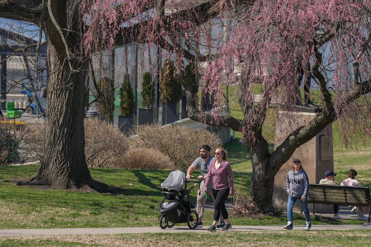
After setting a new heat record earlier this week, the Philadelphia region could surpass another one Saturday that has stood for more than a century. But don’t break out your summer duds just yet — after that, we’re due for a break.
Saturday’s high could hit 83 degrees, bringing yet another day of unseasonably high temperatures to the region, said Paul Fitzsimmons, lead meteorologist at the National Weather Service office in Mount Holly. And if the mercury climbs even one degree higher than 80, we’ll set a new temperature record for April 4, beating out the previous zenith for that date, which was set in 1892, according to data from the weather service.
For those keeping score at home, that would be the second temperature record shattered in the region this week. On Wednesday, the high climbed to 84 degrees, surpassing April 1’s previous record of 81, which was set in 1978. That temperature is a normal high for mid-June.
Wednesday also marked the third consecutive day that temperatures reached at least 80 at Philadelphia International Airport. Essentially, Fitzsimmons said, those temperatures are coming from a ridge of high pressure over the western Atlantic Ocean that is bringing in warmer air from the south, similar to systems we’d typically see later in the year.
“It’s a similar pattern you’d get in the middle of summer, when it gets really, really hot,” Fitzsimmons said. “If it was the summer, we’d be even hotter.”
And March was warmer than normal, with that month finishing with an average temperature about 5.2 degrees above normal.
Saturday, meanwhile, is due to see a warm front move through the region, bringing with it those record-challenging temperatures.
But fear not, Philadelphia. We’re due to start getting back to your more regularly scheduled weather programming starting Sunday, when a cold front is expected to move in.
“Sunday will be a transition day,” Fitzsimmons said.
Forecasters expect Sunday’s temperatures to climb into the low to mid-70s, with lows potentially at or near freezing. The cooldown, however, doesn’t come without a price — namely in the form of rain expected to arrive Sunday afternoon, as well as the possibility of scattered thunderstorms and winds in the 15 to 20 mile-per-hour range. Widespread severe weather, however, is not expected, according to the weather service.
After the rain, temperatures could return to seasonal norms, or perhaps slightly below. Highs through midweek are expected to remain largely in the 50s, and lows are forecast to be in the 30s and 40s.
Then, as Thursday and Friday arrive, we may be looking at another warmup, Fitzsimmons said, though likely not as drastic as what Saturday may bring.
“By Friday, we will see highs in the low 70s,” he said.
