Light snow may top the black ice in the Philly region Wednesday as storm recovery continues
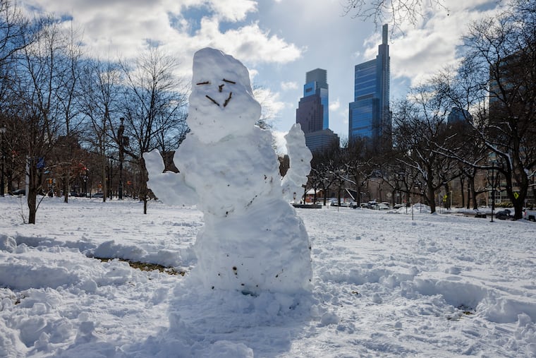
Philly's seasonal snow total, 30 inches, makes this one of the snowier winters in the 142-year period of record.
At this point, the prospect of a barely measurable snow Wednesday morning may seem like so much drizzle in the ocean.
However, given that a coating of snow could cover another harvest of stealth black ice in the morning as the snow melt refreezes overnight, motorists and pedestrians might want to exercise a measure of caution.
The forecasts are calling for a half-inch to maybe an inch in the Philly area.
While potentially hazardous, this won’t upstage what happened earlier in the week, when totals of 20 inches or more were common in South Jersey and southeastern Bucks County, and on Tuesday the aftermath recovery was proceeding.
For the record, the official total at Philadelphia International Airport was 14 inches. Of that, 7.5 inches fell on Monday, setting a record for the date. It was No. 16 on the all-time snowstorm list, and the first time in 33 years that a foot or more had fallen so late in the season.
The seasonal total now stands at 30 inches, one of the snowier years in the 142-year period of record.
The post-storm issues included contending with scores of downed trees throughout the region. A fallen tree in Radnor Township, Delaware County, still was affecting service on the Norristown High Speed Line.
Service still was still suspended on the Cynwyd Regional Rail line, SEPTA said, and other lines were operating with delays.
Airport operations were getting back to normal, said spokesperson Heather Redfern, flights having resumed Monday afternoon.
As for schools, they were opting for a variety of options from virtual learning (Philadelphia) to two-hour delays (Cherry Hill, Moorestown), to party’s over, get here on time (Upper Darby).
This may be the week of black ice in Philly
Invisible and insidious black ice, a dangerous slipping hazard, in all likelihood will be present through the workweek as the snow melt picks up speed during the day, with highs in the 40s, and temperatures falling below freezing at night.
More light snow, rain, or a snow-and-rain mix is possible Thursday into Thursday night, the weather service said. But odds are the immediate Philly area will see mostly rain, said Eric Hoeflich, a weather service meteorologist in Mount Holly.
After a modest warmup on a dry weekend, some computer models were hinting at more snow early next week as a storm moves east, but “not all the guidance is showing a significant system,” the weather service said in its afternoon discussion. “It’s definitely on our radar,” the agency said, but it doesn’t “appear to have potential for a ‘major’ event.”
In short, anything rivaling the Sunday-Monday storm would be, at the very least, unlikely.
Hoeflich said he spent 30 hours in the Mount Holly office, not leaving until 2 p.m. Monday. He said that the weather service provided air mattresses for him and other staffers and that his colleagues came armed with soft pretzels.
Sarah Johnson, the warning coordination meteorologist, brought pizza. Evidently carbs are a sine qua non of storm forecasting.
Said Hoeflich, “We certainly didn’t go hungry.”
