Expect warm weather, with above normal temperatures, this winter in Philly
Frost is possible during the weekend around Philly, but the consensus among long-range forecasters is that we're in for another mild winter.
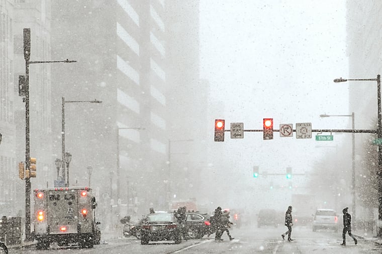
After Saturday’s November-like chill, frost could coat the cars around here Sunday morning. But forecasters say the cooldown won’t be any kind of harbinger.
The odds strongly favor a mild winter in Philadelphia, the East, and much of the country, at least based on the returns from the early voting among the major weather services.
Joining the bandwagon Thursday was the government’s Climate Prediction Center, which confined the likelihood of below-normal temperatures to the Pacific Northwest and the Northern Plains.
That might be heartening for a majority of the nation’s energy consumers stuck at home in an uncertain economy, but echoing winter-sports enthusiasts and other partisans of snow, the folks at ski.com called it “unfortunate news.”
What might be more disconcerting for winter-sports enthusiasts and other partisans of snow is that the government’s forecast has such strong support from the private sector. On Wednesday, the Weather Channel weighed in with a similar outlook, as did AccuWeather Inc. last month.
But it is worth keeping in mind that the atmosphere can be more chaotic than American politics, and all this is subject to change.
So why the bandwagon?
What’s going on in the tropical Pacific is driving about 75% of the government’s outlook, said Mike Halpert, the climate center’s chief seasonal forecaster.
Sea-surface temperatures over thousands of miles of the tropical Pacific have been below normal, or in the La Niña state, and that cooling trend has gained momentum. As of Monday they were about 2 degrees Fahrenheit below normal in the key La Niña measuring region.
» READ MORE: What ‘La Nina’ means for hurricane season and Philly’s winter snow prospects
That would put it in the “moderate” range, and although it’s impossible to say for certain where it goes from here, Halpert said a U.S. model wants to cool it all the way to the “strong” phase.
Said Todd Crawford, the seasonal forecaster for the Weather Channel, “I think a moderate La Niña is now the most likely outcome, with reasonable chances of even a strong La Niña at this point.”
During La Niña winters, the upper-air west-east jet-stream winds, which form at the boundaries of warm and cold air, tend to howl well to the north of the Mid-Atlantic region and repel Arctic air from spilling southward.
La Niña also can coincide with higher pressure, or storm-repelling heavier air, in the Southeast. That tends to make it warmer around here and chokes off potential snow-producing coastal storms.
Temperatures are due to tumble into the low 40s and the mid- and upper 30s early Saturday and Sunday, and the National Weather Service says it might have to post some frost alerts in the region for Sunday.
The Weather Channel has every winter month with above-normal temperatures in the East, including January. “What is typically the coldest month could be quite mild for a large part of the eastern two-thirds of the nation,” said Crawford.
» READ MORE: When winter doesn’t come: Here are the winners and losers of Philly’s nearly snowless season
AccuWeather’s Paul Pastelok agreed: “There could be a significant January thaw."
He said that Philly’s best shot at snow likely would come in December before the pattern takes hold. That said, he thinks the seasonal snow total would be about half or possibly less than the 22.6-inch average.
» READ MORE: Philadelphia issues guidelines for winterizing outdoor restaurants
Snowfall in Philadelphia has been wildly variable during the 12 winters coinciding with moderate to strong La Niñas during the 70 years in the climate center’s database. But in only one of those — 2010-11, 37.8 inches — was snowfall above the average. In the strong La Niña winter of 1949-50, the total was 1.9 inches; still 15 times more than the 0.3 measured officially in Philly last winter.
Should we believe any of this?
If La Niña were the only variable, this business would be a whole lot easier. However, Halpert points out that no feature in the atmosphere works in a vacuum.
The course of the winter around here is also governed by pressure patterns in the North Atlantic that aren’t predictable beyond a week or 10 days, and these days, who could call anything predictable?
» READ MORE: Snow has never been measured in Philly after April 28. Here’s what went wrong with this winter’s forecasts.
He also cautions that the government’s outlooks are “probabilistic," which means by definition sometimes they have to be wrong.
Said Halpert, “I’m afraid that’s true.”
