A record high, maybe 100, on tap for Philly on Sunday as the heat wave crests
Philadelphia could experience its hottest day in a decade on Sunday.
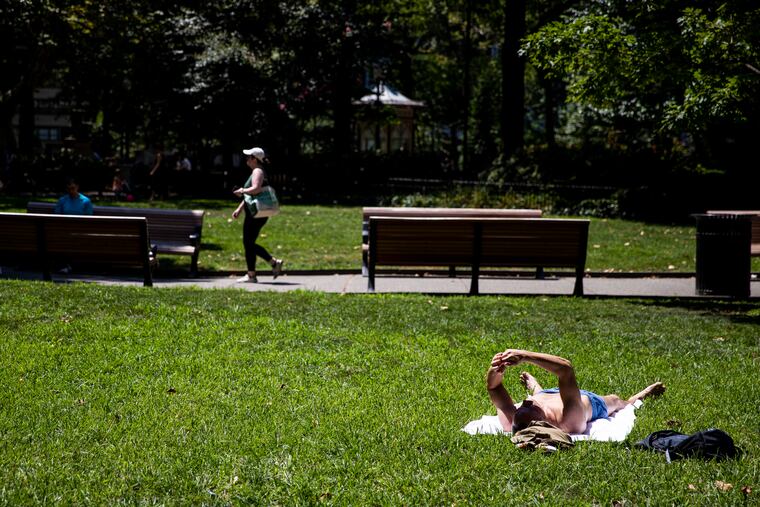
After the hottest day of the year, for an encore Philadelphia could experience its hottest day in a decade on Sunday as temperatures make a run at a record-breaking 100, or about 10 degrees higher than it is expected to be in Miami.
The official high at Philadelphia International Airport reached 98 Saturday, shy of a record, but with a heat index reaching 100 degrees, hot enough.
“You guys are roasting pretty good,” said Bob Smerbeck, senior meteorologist with AccuWeather Inc., in State College, where it wasn’t exactly in the “code blue” zone as temperatures there reached the low 90s.
In fact, heat advisories were in effect Sunday from the Chesapeake Bay to north-central Maine as high pressure in the western Atlantic continues to bake the Mid-Atlantic and Northeast with roasting winds from the south. Those same winds have been helping to churn the ocean, leading to an “upwelling” event that has been chilling waters at the Jersey Shore.
» READ MORE: Heat wave stirs cold waves at the Shore
The city’s “heat health emergency” remains in effect through Sunday, which means cooling centers and buses will be available, and the Philadelphia Corporation for the Aging will be operating the “Heatline.” In addition, the National Weather Service has issued an “excessive heat warning.”
Both are firsts for 2022, which until Monday had been a rather benign summer.
A respite is coming, meteorologists say. After a possibly stormy Monday, Tuesday might even qualify as splendid given recent conditions.
But don’t get used to it. And if you’ve absolutely had it with the heat, do feel free to skip the next few paragraphs.
On what would be its seventh day, the heat wave is due to peak Sunday in Philly with temperatures cresting past the record for the date — 98, set in 2011 — along with a heat index of 106, which would be the highest of the year. If it does reach 100, that would be the first time it has done so since July 2012.
The low temperature Monday morning might not get below 80, which would be a record-high minimum for a July 25.
Fortunately, having the heat wave cresting on the weekend limits stress on the region’s power supplies, said Rutgers-Camden University professor Richard Michelfelder. But expect a bump in July air-conditioning bills.
Sunday would mark the 16th day this month that temperatures have touched 90 or better. The long-term average for the entire month is 13.
» READ MORE: The dry spell has helped bump up temperatures
The recent dry spell — since July 7 Philly has measured 0.13 inches of rain — has been a great facilitator of the heat, meteorologists say. With limited moisture in the soil or the foliage the sun can focus its energy on heating rather than having to use it for evaporation.
The combination of the heat and dryness is a source of “physiological stress” for crops, said Beth Yount, a Penn State Extension natural resources educator, based in Philadelphia. If the region were to experience more 90-degree days, she said, that could affect this summer’s corn yields and tomato harvests.
Forecasters say that more almost certainly are coming, with another hot spell possible later in the week.
However, “it won’t last,” said Sarah Johnson, warning coordination meteorologist with the National Weather Service Office in Mount Holly.
And the dry spell might be on the run. A front due Monday is expected to touch off showers, possibly potent ones. The government’s Storm Prediction Center has the region under a “slight” risk for severe storms, those with winds approaching 60 mph.
The region’s gardeners have heard this before: Shower chances in daily forecasts have been far more plentiful than actual showers this month.
Summer rainfall is notoriously capricious, but this time, the Monday threat should be different, said Smerbeck.
“Our modeling all shows a bull’s-eye of precipitation for Southeastern Pennsylvania,” he said. Of more significance, he added, rainfall into the first week of August would be more or less “normal.”
Upper-air patterns are aligning in such a way that would allow moisture from the Gulf of Mexico to surge northward with some regularity, he said. When fronts come along, he said, “the moisture will be available.”
The region could use a run of precipitation normality as deficits have continued to grow. Rainfall in Bucks and Montgomery Counties and Philadelphia have been about a third of normal the last 30 days, according to the Middle Atlantic River Forecast Center, which analyzes samplings of stations countywide.
The government’s Climate Prediction Center outlook through Aug. 6 calls for near-normal rainfall in all of New Jersey and Delaware, and most of Pennsylvania.
But it also has the odds strongly favoring above-normal temperatures for that period throughout the Northeast. And so does its updated outlook for August.
In the era of climate change, summers in the Philly region have become significantly warmer in the last 50 years, with temperatures increasing an average of about three degrees, with overnights especially warm.
» READ MORE: Philly summers have become warmer
Conversely, however, recent summers have produced a harvest of short-lived heat waves, and meteorologists say that’s possibly related to higher humidities that have fueled heat wave-breaking thunderstorms.
In the meantime, if you can’t wait until Tuesday, you can seek asylum at the Shore, where those heat wave winds are helping to create some cold waves as the warm surface layer is being routed and replaced by the deeper, colder waters.
The surf Saturday morning off Atlantic City was a chilly 58.5 degrees on the official gauge, or a good 18 degrees lower than it was on Tuesday morning, and cool air has been fanning the barrier islands.
At 4 p.m. Saturday, when it was 97 in Philly, it was 79 in Harvey Cedars.
Philadelphia will offer cooling buses at four intersections Sunday from 11 a.m. to 7 p.m. Those locations are:
Germantown and Allegheny Avenues in North Philly
Wyoming and Rising Sun Avenues in Feltonville
Broad Street and Snyder Avenue in South Philly
52nd Street and Larchwood Avenue in West Philly
