More than 2 inches of snow fell outside Philly Saturday — and more may be coming
The National Weather Service said to expect more snow on Sunday than fell on Saturday.
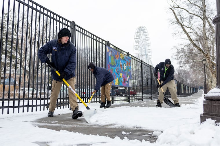
The wet, hefty snowflakes that fell across the Philadelphia region Saturday blanketed buildings and streets with slushy snow — and more is predicted Sunday.
While Saturday’s snowfall — recorded at about half an inch in the city, and topping two inches in the immediate suburbs — was melting by the afternoon, a new storm Sunday could bring another round.
Forecasts for the city and surrounding suburbs project 1 to 3 inches.
“Expect more snow tomorrow than what you saw today,” said Mike Lee, lead meteorologist at the National Weather Service in Mount Holly.
Here’s what to know about the snow, and the chances for more this weekend.
‘Wet and slushy’
With temperatures right around freezing, the snow that fell Saturday morning and early afternoon was “definitely wet and slushy,” Lee said.
By midafternoon, the snow had stopped. Half an inch was recorded in Center City, while in the nearby parts of the collar counties, totals hovered around 1 to 2 inches, reaching 3 and 4 inches closer to the Lehigh Valley.
While some of that snow was melting throughout the day Saturday, Lee noted that the melt could turn into black ice on roadways as temperatures fell at night.
And Sunday offers another chance for snow to accumulate around the region, Lee said.
Will Philly get more snow Sunday?
A coastal storm system that meteorologists have been tracking may bring more snow Sunday.
“There’s a little bit better chance for the Philadelphia area” to get snow from that system, Lee said.
Philadelphia and the Main Line could get 1 to 3 inches of snow Sunday, with snow predicted to start at daybreak and last through the evening, said Melissa Constanzer, senior meteorologist with AccuWeather.
South Jersey could see the greatest totals, Constanzer said, given the coastal nature of the storm.
“If you’re planning on going anywhere Sunday, expect travel to be impacted,” Constanzer said. Even if snow is not accumulating, she said, visibility could be a challenge.
Crews should have time to clear roads by Monday morning, Constanzer said.
That’s likely it for snow in the near future, with dry weather predicted to start next week, Lee said. Monday night is forecast to see the lowest temperatures of the season so far, reaching 13 degrees in Philadelphia, according to the weather service. The high Tuesday is forecast to top out at 23, with a low Tuesday night of 11.
“It is going to be pretty cold,” he said.
