A winter storm warning is in effect Friday for the Philly region for up to 6 inches of snow
The snow should start early Friday and continue into Friday night. Expect changes in forecast amounts.
The National Weather Service has posted a winter storm warning in and around Philadelphia for up to 6 inches of snow, starting before daybreak and continuing into Friday night.
Forecasters all were certain that measurable snow would fall, likely starting before dawn Friday and continuing episodically through the day. They had some differences about where the heaviest snow would fall.
But Philly was expected to be in the “high end,” Sarah Johnson, the warning coordination meteorologist in the National Weather Service’s Mount Holly Office, said Thursday.
Why the uncertainties in Friday’s snow forecast
On Wednesday, on what turned out to be the brightest January day in two years with an unimpeded sun glinting off the snow, and the trees showing off their icy glaze, meteorologists already were fielding blizzards of predictable how much questions regarding Friday.
They’re used to it, said Eric Hoeflich, a meteorologist with the Mount Holly office..
That’s understandable: Snow is the ultimate game of inches. When it comes to snow, that’s what people want to know, whether the forecast involves a tenth of an inch or a blizzard, said Dave Dombek, senior meteorologist with AccuWeather Inc., which was seeing 3 to 6 inches in the immediate Philly area, and 3 to 5 just to the west. With rain, he said, “Nobody really cares whether it’s a third of an inch or a half an inch.”
And not many could tell the difference. By contrast, snow is water in a frozen, visible form. And the difference between 0.3 and 0.5 inches of liquid might be 3 inches of snow.
Accumulations will be heavily dependent on “ratios,” how much snow the precipitation can make, and that would be dependent on temperatures through the atmosphere, said Dombek. On average around here, every inch of liquid translates to about a foot of snow.
The ratios are likely to be low in the morning, said Johnson, then pick up later in the day. Another factor would be the type of flakes. The weather service says that conditions may become ripe for “dendrites” — those six-sided crystals so often depicted in holiday decorations — which accumulate efficiently.
The forecast amounts are likely to shift, at least subtly. The meteorological setup will be complex, forecasters said, with an upper-air system approaching the region from the west, likely to be the primary snow-maker, while a storm pops off the southeast coast.
A wild-card would be bursts of heavier snow in the region, said Paul Dorian, a Valley Forge-based meteorologist with the Arcfield weather company. “I think heavier small-scale snow bands will develop during this storm, given this overall pattern.” His forecast Thursday also was calling for 3 to 6 inches across the region.
» READ MORE: Snow forecasts can shift constantly. Here's why
Banding is a perennial issue with snow forecasting, said Steve DiMartino, meteorologist who runs NY-NJ-PA Weather, in North Jersey. “The smallest detail like a wind shift or a medium scale process like a snow band can have major impacts on exactly who gets the heaviest snowfall and why.”
And while computer models are marvels, nothing happens in isolation in the chaotic universe of the three-dimensional atmosphere, and the worldwide observation network on which computers base their calculations is imperfect. “The number one obstacle for forecasting snowfall is getting enough observational data from around the country, said DiMartino.
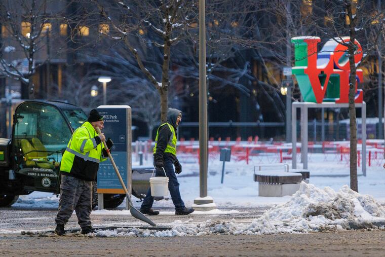
Whatever does or doesn’t happen Friday, it appears the roads should be in decent shape when the snow starts.
The cleanup
Road conditions improved markedly on Wednesday, even though highs never made it out of the 20s. They should get even better Thursday, with temperatures due to escape freezing for the first time since Sunday.
» READ MORE: How Philly’s Streets Department prepared to clear the roads after two years with little snow
Before Monday, it had been a record 716 days since Philly experienced an inch of snow — a record inch-less streak — but PennDot and Philly road crews blew off the cobwebs and plowed and salted roads, turning the snow and ice to a slushy slurry that turned out be a trauma-saver.
Had the freezing rain that followed the snow fallen on bare, untreated roads, the storm could have been far more disruptive, said Ray Martin, a lead meteorologist with the weather service office in Mount Holly.
Despite the long layoff, treating the roads was like riding a bicycle, said Philly Streets Department’s chief engineer, Steve Lorenz. “Even though we didn’t use [the plows and salt spreaders] last year, we had them ready to go,” he said.
» READ MORE: Wednesday was the region's first true "snow day" since January 2022
Numerous school districts delayed openings Wednesday as the remains of the the snow-and-ice pack was frozen rock solid by temperatures in the teens.
One of the notable participants was the Philadelphia School District, which took considerable heat for keepings schools on a regular schedule Tuesday, despite the icy rain falling atop better than 3 inches of snow.
» READ MORE: Philly's decision to open schools on time Wednesday stirred a storm
The district may get another shot at getting it right Friday.
After the snow
The snow will be set up by another approaching Arctic front, and temperatures may not get out of the 20s over the weekend.
But a warmup is due to start Monday, and it might even rain on Wednesday.
Staff writers Ximena Conde and Kristen A. Graham contributed to this article.
