How much rain from Isaias fell in the Philadelphia area?
An Inquirer analysis of National Weather Service data found Wynnewood, in Montgomery County, received the highest amount of rain, 8.59 inches, among 247 locations across the region.

What happens in Wynnewood during a tropical storm doesn’t stay in Wynnewood.
It ends up in Philadelphia.
Tropical Storm Isaias demonstrated in a big way how interconnected local waterways are, since they all eventually drain into the Delaware River, and the damaging effects of climate change. Because of that interconnection, the city got hit especially hard, even though it had half the amount of rain falling in some areas.
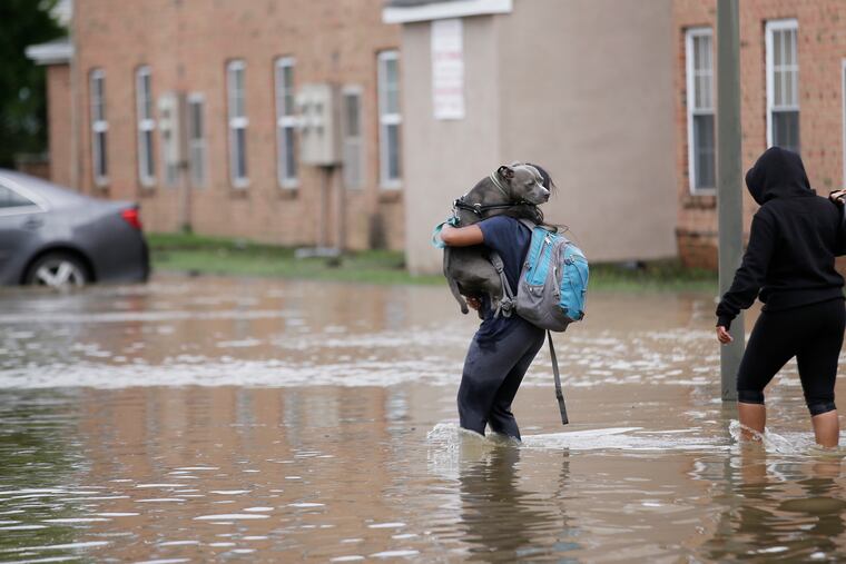
On Tuesday, Darby Creek and the Schuylkill saw enormous flows in a short amount of time, wreaking havoc as water gushed into homes in the city’s Eastwick section, caused flooding at Boathouse Row, and made a barge break loose and strike an I-676 bridge.
An Inquirer analysis of National Weather Service data found Wynnewood, in Montgomery County, received the highest amount of rain, 8.59 inches, among 247 locations in Pennsylvania, New Jersey, and Delaware. Storm water from Wynnewood ultimately finds its way into the Cobbs Creek watershed, which flows into Darby Creek in Philadelphia, right behind Lindbergh Boulevard in Eastwick, where so many homes flooded Tuesday.
Skippack and Collegeville, also in Montgomery County, had the second- and third-highest rainfall totals, each receiving 8 inches. Collegeville drains into the Perkiomen Creek. Skippack drains into the Skippack Creek, which flows into the Perkiomen. Both are tributaries of the Schuylkill.
That explains why so many of Philadelphia’s waterways roiled into whitewater, even though the city might have gotten less rain than elsewhere.
The top 25 communities for rainfall in the area from the storm all are in Pennsylvania. And the top seven are just upstream from Philadelphia.
Gail Farmer, executive director of Wissahickon Trails, a conservation organization whose headquarters were flooded during the storm, said the nonprofit is still cleaning up and making repairs days after the Wissahickon Creek rose into a torrent. The first floor of the group’s headquarters at Four Mills Nature Reserve in Ambler on Tuesday filled with 10 inches of water in just a few hours.
The creek received more than 7 inches of rain, which caused it to overflow, leading to multiple road closures in the area. According to a U.S. Geological Survey gauge at Fort Washington, the swell was a top-five flood event for the Wissahickon. The creek reached 15.25 feet, several feet over flood stage. The record at that location is 18 feet. The last time the organization’s building flooded was during Hurricane Sandy in 2012.
All that water had to flow somewhere, Farmer said.
“The Wissahickon watershed is 64 square miles. And all the 64 square miles flow into various tributaries, then into the Wissahickon, then into the Schuylkill,” Farmer said. “As with any storm, the magnitude increases as you go downstream. You have all the water upstream building momentum and volume and power as it makes its way down slopes and through the watershed into the Schuylkill, then the Delaware and eventually the ocean.”
Philadelphia got hit hardest, she said, “because it got all the rainwater from the drainage area above them.”
Farmer said the region should expect more such storms as the area gets warmer and wetter due to climate change. The impact is compounded, she said, by hard paved surfaces created by development. Woods, marshes, and open space all help absorb storm water, slowing it down and allowing it to percolate into the ground. However, in highly developed areas, the water hits hard surfaces and is shunted into storm drains, which empty into waterways.
About 24 inches of drywall have to be removed from the Wissahickon Trails building.
“Cleanup is going as well as can be expected,” Farmer said. “We’ve been going nonstop since 5 p.m. on Tuesday.”
Worse, she said, is that the water flow was so powerful, it destroyed much of the infrastructure on the 12.5-mile Green Ribbon Trail in Upper Gwynedd. The trail had to be closed.
“It’s underwater completely,” Farmer said. “We’ve lost all of our structures, such as boardwalks, signage, stepping-stone crossings. It’s going to take a good bit of time and dollars to repair.”
The table below is searchable by state, county, and municipality. Only areas with official National Weather Service gauges are included.