Take a tour through the Delaware Water Gap, the crown jewel that nearly disappeared
The Delaware Water Gap National Recreation Area, created in 1965, sees millions of visitors each year.
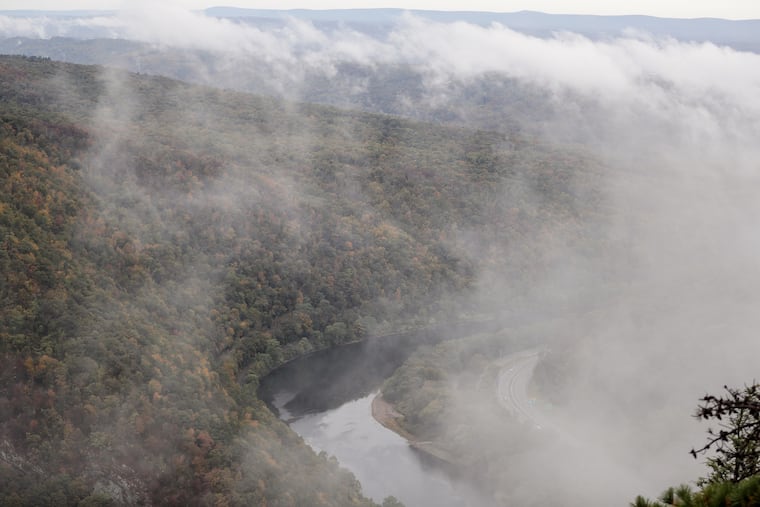
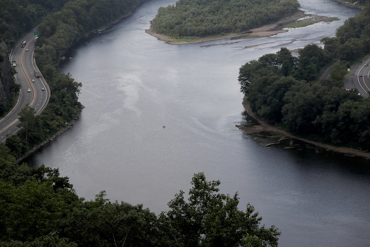
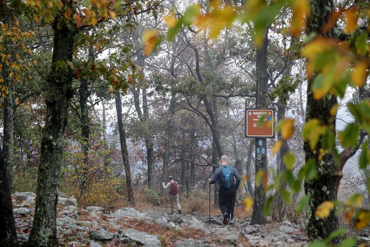
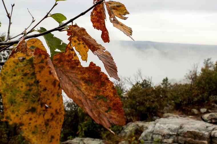
Fog snaked its way through the Delaware Water Gap on an early October morning, just like the river beneath it, clouding the view from the summit of Mount Tammany, the New Jersey peak that forms the gap’s eastern side.
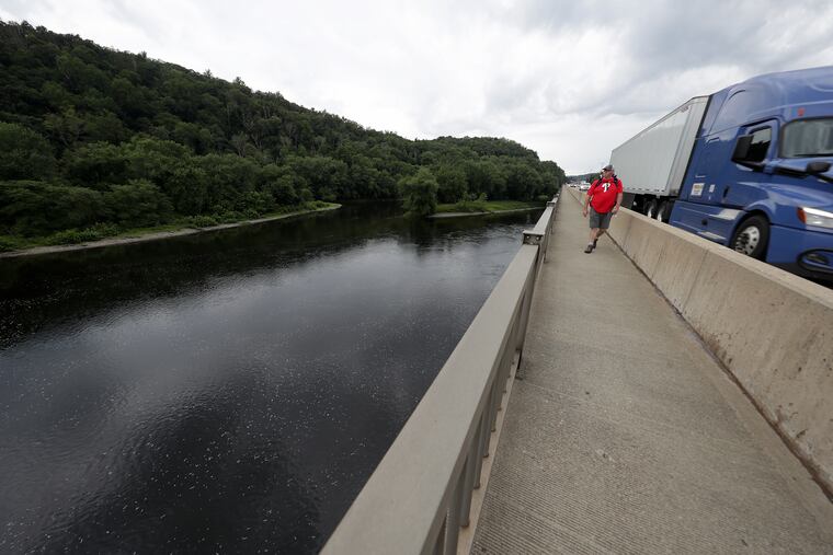
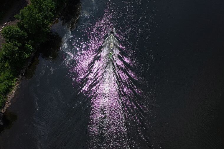
Blue jays shrieked and red-tailed hawks made runs along the ridge line, sticking close to the trees as a mist fell. From time to time, the fog unfurled upward and parted ways, revealing the early fall foliage, smokestacks, and the Pocono Mountains over in Pennsylvania. Down below, cars followed the river along Interstate 80, on the easternmost miles of the highway that stretches clear across America. As if to emphasize the Delaware River watershed’s central role in an industrial, densely populated region, the belch of tractor trailers traveled up the mountainside to greet the Water Gap’s wildlife and hikers.
But stick to the highway, and you see only a small portion of this 70,000 acre, national recreation area that was formed by geology, controversy, and conservation. To many, the Water Gap is the crown jewel of this enormous watershed. With borders along three states, the Water Gap is just over 100 miles north of Philadelphia and 75 miles west of New York City, yet worlds away from both.
“You’d be surprised how quiet it can get up here,” said Chuck Cooper, owner of Edge of the Woods Outfitters, a hiking store in the borough of Delaware Water Gap in Monroe County, Pa. “I’ve spent countless hours in the park, and I’m still finding new places I’ve never been.”
The Water Gap was formed over millions of years as surface water found its way through faults and fractures in the Appalachian mountain belt. Water eroded rock, working its way downward and forcing streams to grow larger. In the last 20,000 years, scientists believe, melting glaciers and sea level changes amplified the water flow, and the prominence of the gaps.
Yet all that geologic history nearly was changed in a comparative instant.
Much of the Delaware Water Gap we see today nearly disappeared in the early 1970s, when the U.S. Army Corps of Engineers began to move forward with a decades-old plan to dam the Delaware River at Tocks Island. The dam would have been the first on the Delaware River and would have created a 36-mile-long lake that was supposed to supply drinking water to both Philadelphia and New York City.
It didn’t seem like such a bad idea at the time. Flooding from Hurricane Diane in 1955 poured into the watershed, blowing out tributaries like Brodhead Creek, and killing 70 people in the area. The call for flood control in the wake of the disaster helped push the dam. The proposed lake and surrounding mountains and forest were to have been called Tocks Island National Recreation Area.
The proposed dam, just six miles north of the borough of Delaware Water Gap, became a national issue. Local residents who would lose their homes as a result of the lake pushed back. So did early environmental activists.
“When you’re living in a home your father or grandfather built with his own hands, and you’ve keyed your emotion into that place for 35 or even 65 years and then that land is expropriated for an absolutely monstrous project that will totally destroy and kill the area, there is just no way to accept it without rage and frustration taking over,” one local resident told the Philadelphia Inquirer in 1974.
The project was officially shelved by the Delaware River Basin Commission in 1975, and the land was turned over to the National Park Service. Maya van Rossum, head of the Delaware Riverkeeper Network, said the decision to keep the river undammed has proven to be “fundamentally important to the watershed as a whole.”
“And we have to give credit where credit is due,” she said, “because people cared and activists rose up and did what was necessary.”
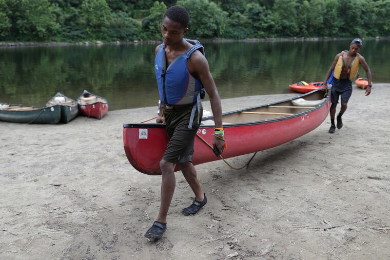


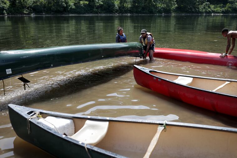
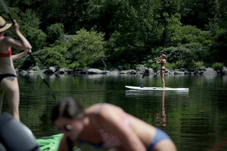

In early October, the borough of Delaware Water Gap seemed sleepy but in the summer, the town of about 750 in the Poconos is a frenzy of hikers, paddlers, fishermen, tubers, and cyclists that flock there.
Cooper’s mother, Susan Cooper, has operated Village Farmer and Bakery, just around the corner from his shop, for over 40 years, dishing out pot pies to locals and the famous “True Love Special,” a hot dog and slice of apple pie for $2.95, beloved by the thousands of Appalachian Trail thru-hikers that pass through the area each year. His brother, Jay Cooper, opened a Japanese restaurant next door.
“For us, the economy is heavily based on tourism obviously,” Chuck Cooper said. “We’ve got one of the most pristine sections of the Delaware River right at our door.”
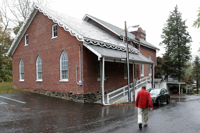
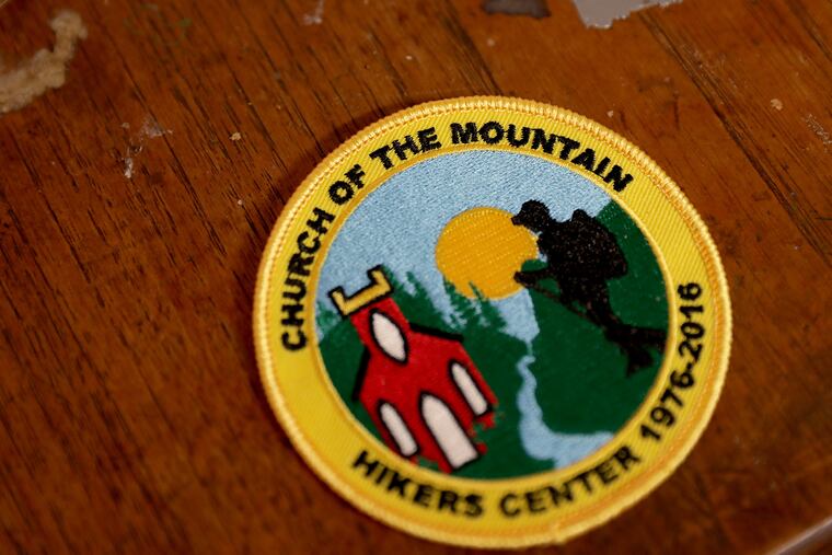
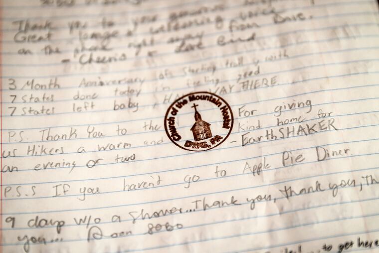
Up the street from the outfitters, just one Appalachian Trail hiker remained in the basement barracks of the Presbyterian Church of the Mountain. Just 28 of the AT’s 2,174 miles cut through the Delaware Water Gap, but the church opened a hostel for hikers in 1976 with showers, bunks, and room outside for tents. On this October weekday afternoon, the single occupant was a section hiker who was waiting for a ride back home to Boston. Many of the hikers coming through were southbound, from Maine to Georgia.
“This is the first hostel I’ve stayed at,” that hiker, Chris Jewell, said. “It’s great. I usually just stay in the woods."
David Childs has been the steward of the hiker mission at the church for more than 20 years. He said no one is out to sell hikers religion, but rather some hot meals, a place to sleep, and a collective love of nature.
“One of the things that drew me to the church is this setting,” Childs said. “The focus is outward. We want to hear the hikers’ stories, what they’ve seen out there."
Editor’s note: “From the Source: Stories of the Delaware River” is produced with support from the National Geographic Society, the Lenfest Institute for Journalism, and the William Penn Foundation. Editorial content is created independently of the project’s donors.
