A storm looms in what’s going to be another rough week for Jersey beaches
Hurricane Melissa is also likely to churn up waves at the Shore. Heavy rains are possible in Philly, with high winds on Halloween.
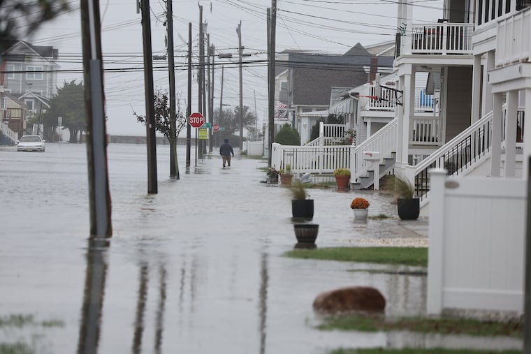
New Jersey’s beaches, still recovering from major sand losses from an offshore hurricane and a nor’easter, evidently are in for another assault this week as October is about to make a dramatic exit.
Gale-force gusts off the ocean could develop as early as Tuesday afternoon at the Shore, said Eric Hoeflich, a meteorologist at the National Weather Service office in Mount Holly, with brisk onshore winds persisting “maybe into Friday.”
A potent storm is forecast to affect the entire region Wednesday night and Thursday, with heavy rains in the immediate Philadelphia area, where drought conditions have been intensifying.
Also on Thursday, what is likely to become catastrophic Hurricane Melissa will be passing offshore, churning up the waves crashing on East Coast beaches.
“The coast once again is going to take a pretty good battering,” said Dave Dombek, senior meteorologist with AccuWeather Inc.
On the plus side, Hoeflich said, for the Shore, this week’s storm “doesn’t look as bad” as the beach-erasing nor’easter earlier this month. The path should be more inland, and the lunar influence on the tides would be less. Only minor flooding is expected, he said, subject to change.
However, not only would the track mean region-wide heavy rain, but it would also increase the potential for severe thunderstorms Thursday. A front is due to chase the rains Friday, but it may generate damaging gusts, the weather service says. Power outages are possible both days.
The timetable for the winds and the storm in the Philly region
The National Weather Service has posted a gale warning in effect until 6 p.m. Wednesday for the waters along the immediate coast for winds from the east that could gust past 40 mph.
That would be related to high pressure to the north of the region. Winds circulate clockwise around centers of highs; thus, areas to the south of the center experience winds from the east.
The breezes will be getting a second wind as a storm develops in the Southeast and tracks north. Meanwhile, a weakened Hurricane Melissa will be churning the ocean as it passes well off the U.S. coast on Thursday.
The Philly region could use the rain
The interagency U.S. drought monitor has the majority of the region in its “moderate drought” category.
Rain for the last 30 days has been about a third of normal in the city and the neighboring Pennsylvania counties.
South Jersey has fared only slightly better, but precipitation is well less than half of normal.
What is the forecast for the trick-or-treaters?
It is all but certain that Friday will be a dry day, with temperatures in the low and mid-50s. Wind gusts are forecast to die down sometime after 5 p.m., but hold onto those brooms, just in case.
