A dash of snow, an Arctic chill, and 55 mph wind gusts are possible this weekend in Philly
Light snow, up to an inch, is expected Friday evening.
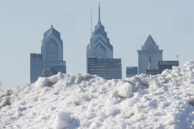
By now Arctic air may qualify for a frequent-visitor pass around here, but the version coming this weekend will be of a different quality and have a particular sting.
“It’s going to be a slap in the face,” said Cody Snell, a meteorologist with the National Oceanic and Atmospheric Administration’s Weather Prediction Center.
After a day in which highs will be around freezing on Friday — a solid 10 degrees below normal — some nuisance snow is possible late in the day or evening and early Saturday, and maybe even squalls. Then temperatures are going to tumble through the teens in the wake of another potent Arctic front.
They might not see 20 degrees in the Philly region until Monday.
Adding bite will be winds that could gust to 55 mph, and the National Weather Service says wind chills of 10 and 15 below are likely Saturday in the immediate Philly area. The agency has issued an “extreme-cold warning” — a relatively new addition to the advisory list — in effect Saturday afternoon through Sunday morning. Wind chills of 17 below zero are possible, and winds could gust to 55 mph, the weather service says.
Said Ray Martin, a lead meteorologist at the weather service office in Mount Holly, “It’s going to be awful.” Among the recent sequence of Arctic invasions, “it looks like the worst.”
In short, that unusually tenacious snowpack that was left over from the 9.3 inches of snow and white ice that fell on Jan. 25 and has since mutated into a form of frozen slurry will be spending at least another weekend in Philly.
What’s more, it’s likely to be a harvest weekend for the ice that is solidifying upon the region’s waterways, a growing concern.
A warm-up is due to begin Monday and pick up steam during the workweek, with highs maybe reaching 40 degrees on Thursday. But it may encounter some resistance, and another storm threat might be brewing for next weekend, forecasters say.
The snowpack already has achieved an elite status
Friday marked the 12h consecutive day in which the official snow cover at Philadelphia International Airport, measured daily at 7 a.m., was at least 5 inches.
In the 142-year period of record, that ties for seventh place for a snow-cover duration of that depth.
“To hold on to a snowpack like this is unusual,” said Johnathan Kirk, senior hydrologist at NOAA’s Middle Atlantic River Forecast Center, in State College, Pa., which is keeping a close eye on the waterway icing.
The Schuylkill in Philly is ice-covered, as is the Delaware River from Trenton to Washington Crossing.
In addition to an eight-day stretch when temperatures failed to reach 30, the durability is related to the 2 or so inches of sleet that capped the snow on Jan. 25. Sleet is white ice that melts more slowly than snow.
The dry and cold air has been a natural preservative; snow and ice melt more readily when the air is moist.
Another factor was the impressive liquid content of the snow and sleet, Snell said. The frozen mass contained 1.39 inches of liquid, the weather service said, comparable to what is contained in 15 to 18 inches of snow.
As temperatures finally nudged above freezing, some melting did occur this week, which would explain that unsightly slushy porridge at Philly intersections. However, the official snow depth lost only an inch between Jan. 27 and Wednesday.
The snowpack may receive a fresh frosting Friday night into early Saturday with up to an inch of snow, Martin said, but it’s not going to have the same staying power.
What’s different about this Arctic air mass
Any snow that falls is likely to get blown away in a hurry, Martin said, as winds will pick up before daybreak Saturday and gusts howl to 50 mph by late morning.
Typically, cold air pours into the region from the northwest and becomes modified as it passes over land, the Great Lakes, and the mountains.
This is going to be a straight-up Arctic shot. It will come more or less from the north, and the icy lakes are not going to do much to impede it, said Matt Benz, senior meteorologist at AccuWeather Inc.
The weather center’s Snell said a weak storm system moving off the Atlantic coast is forecast to blow up as it interacts with warm Gulf Stream waters. The differences between the cold high pressure with its heavier air over the East and the lighter air of the storm are going to place the Philadelphia region in a frigid sandwich.
Heavier air tends to rush toward lighter air, like air escaping from a punctured tire.
A thaw is coming to Philly, eventually
Just how warm it gets next week remains unclear, AccuWeather’s Benz said.
“Arctic air is hard to dislodge sometimes,” he said, adding that recent model trends suggest the warm-up will not be quite as robust as expected earlier.
A wild card would be a potential storm next weekend. The European forecast model was seeing rain and 60 degrees, Martin said, while the U.S. model was suggesting a blizzard.
His take: “I have no clue at this point.”
An anniversary of note
On Feb. 5, 2010, 6.6 inches of snow fell upon the airport, the beginning of an unprecedented siege in which 44.3 inches accumulated in a six-day period.
Twelve days after the snow stopped, the official snow depth was down to 4 inches.
