Marathon snow and sleet storm to continue into Tuesday, with lingering impact on roads, services, and schools
And with high temperatures only expected to reach the 30s for the next three days, “It’s going to be a slow melt,” said John Feerick, a senior meteorologist with AccuWeather Inc.
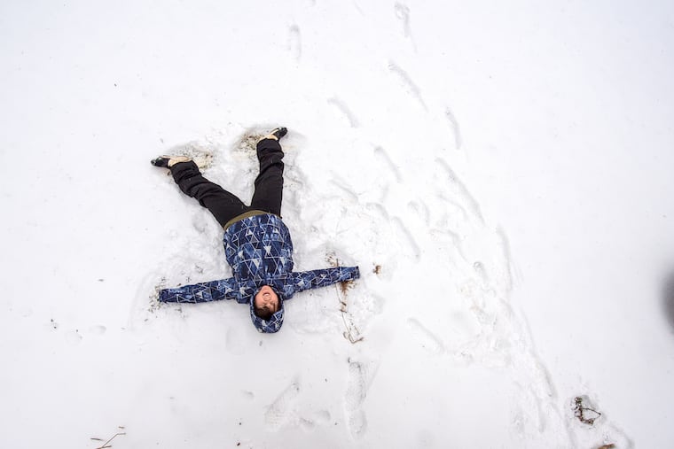
Bode Ouellette, age 10, lies in the snow and forms an angel with his arms and legs in Wallingford on Monday.Read moreJOSE F. MORENO / Staff Photographer
After fitful spurts of falling and blowing snow, wind gusts to near 50 mph, coastal flooding, and a marathon of sleet, forecasters promised Monday that one of the most-enduring storms the region has experienced really is going to exit sometime Tuesday.
But not the impacts.
“I would expect another day off for people,” said Brad Rudolph, a spokesperson for the PennDot Philadelphia region, which includes places that were reporting up to 20 inches of snow that was still falling late Monday, “and give us a chance to mop up.”
“It’s going to be a slow melt,” said John Feerick, a senior meteorologist with AccuWeather Inc., with highs in the 30s the next three days, and a whole lot of ice locked in that snow cover in and around Philadelphia.
Near-blizzard conditions shut down parts of the state, and Randy Padfield, director of the Pennsylvania Emergency Management Agency, urged Pennsylvanians to stay off the roads. Precipitation is likely into at least early Tuesday afternoon.
“We are particularly concerned with shipment and delivery of COVID-19 vaccines,” he said.
While snow amounts were less to the south of the Pennsylvania Turnpike, that was due in part to a siege of sleet that lasted 12 to 16 hours and cut down snow totals. Still, some areas in and around the city could end up with a foot total, including an additional one to two inches on Tuesday atop a cement-hard layer of ice as the storm sails ponderously out to sea. As of 7 p.m., 6.1 inches was measured officially at Philadelphia International Airport.
New Jersey Gov. Phil Murphy announced that state offices and all six vaccine mega-sites would remain closed on Tuesday because of the storm. The governor declared a state of emergency across all 21 counties, some of which experienced prodigious snow totals, with up to 30 inches in Morris County.
Most school buildings in the region will be shut Tuesday, and once again Philadelphia public school students will be getting a half day. Philadelphia is closing its offices and is operating one COVID-19 vaccine center; people can choose to reschedule appointments. Montgomery County’s mass vaccination site will be closed.
Those are some of the lingering aftereffects of a storm that on Monday resulted in some familiar interference with the business of life.
“This is a big one,” Murphy warned ominously, telling people to stay in.
A snow plow moves north on Rt.113 at Rt.401 in Chester Springs during the storm, Monday, February 1, 2021.Read moreSTEVEN M. FALK / Staff Photographer
Crews clear snow in the Towne Place at Garden State Park shopping center on Rt. 70 in Cherry Hill Feb. 1 2021 as the second wave of a norÕeaster bears down on the region.Read moreTOM GRALISH / Staff Photographer
A shopper pushes their grocery cart across busy Rt. 70 in Cherry Hill Feb. 1 2021 as the second wave of a norÕeaster bears down on the region.Read moreTOM GRALISH / Staff Photographer
A pedestrian walks in the street as sidewalks are snow covered along Haddon Avenue in downtown Collingswood Feb. 1 2021 as the second wave of a norÕeaster bears down on the region.Read moreTOM GRALISH / Staff Photographer
A bicyclist rides past snow covered cars along the 400 block of South 11th Street in the Washington Square West neighborhood on Monday, February 1, 2021.Read moreYONG KIM / Staff Photographer
Li'ryah Bailey, 9, and her grandma Jane Bailey walk down North Dover Street in Philadelphia, Pa. on Monday, February 1, 2021. The National Weather Service said that the heaviest snows this afternoon were expected between I-95 and I-78. However, it remained unclear precisely where the heaviest snow bands would set up. In its updated forecast map, it estimated a storm total of 11 inches for Philadelphia, a foot-plus to the north and west, and 2 feet-plus in the Poconos.Read moreMONICA HERNDON / Staff Photographer
Corey Holmes, 45, cleans snow off his car in Coatesville, during the storm, Monday, February 1, 2021Read moreSTEVEN M. FALK / Staff Photographer
A PATCO commenter clears the snow off their car in the parking lot of the Colllingswood station Feb. 1 2021 as the second wave of a norÕeaster bears down on the region.Read moreTOM GRALISH / Staff Photographer
Using a snowblower Nick Giampietro clears his sidewalk in Phoenixville during the storm, Monday, February 1, 2021.Read moreSTEVEN M. FALK / Staff Photographer
Christopher Tigro uses a snow blower to push away snow on the Thomas Jefferson University Bluemle Life Sciences Building at the Sidney Kimmel Cancer Center on Monday, February 1, 2021.Read moreYONG KIM / Staff Photographer
SEPTA maintenance worker Eric Winters Sr. shovels snow in front of the Northern Liberties trolley stop in Philadelphia, Pa. on February 1, 2021. Winters said he has been out since 10:00 P.M. Sunday night clearing snow and ice from SEPTA transpiration stops around the city.Read moreDAVID MAIALETTI / Staff Photographer
Students make their way through heavy snow and wind at Swarthmore College Swarthmore,. in Swarthmore, Pa. Monday, February, 1, 2021.Read moreJOSE F. MORENO / Staff Photographer
Eleni Kerbatsos, 6, and Konstantinos Papageorgiou, 6, play in the snow on North 28th Street in Philadelphia, Pa. on Monday, February 1, 2021. The National Weather Service said that the heaviest snows this afternoon were expected between I-95 and I-78. However, it remained unclear precisely where the heaviest snow bands would set up. In its updated forecast map, it estimated a storm total of 11 inches for Philadelphia, a foot-plus to the north and west, and 2 feet-plus in the Poconos.Read moreMONICA HERNDON / Staff Photographer
Jill Lee (right) and Vikram Balasubramaniam (left), both Penn students, have a snowball fight on the campus of the University of Pennsylvania in Philadelphia, Pa. on February 1, 2021. Lee said they are from California and don’t see snow like this.Read moreDAVID MAIALETTI / Staff Photographer
Bode Ouellette, age 10, lies in the snow and forms an angel with his arms and legs in Wallingford, Pa. Monday, February, 1, 2021Read moreJOSE F. MORENO / Staff Photographer
Icicles form on the roof of a strip mall in Westmont, N.J. Feb. 1 2021 during a warming lull between the two waves as a nor’easter bears down on the region.Read moreTOM GRALISH / Staff Photographer
Sandy Hughes, 66, clears out a parking spot in Downingtown during the storm, Monday, February 1, 2021.Read moreSTEVEN M. FALK / Staff Photographer
A train passes under Poplar Street in Philadelphia, Pa. on Monday, February 1, 2021.Read moreMONICA HERNDON / Staff Photographer
A person crosses Lemon Hill on skis in Fairmount Park in Philadelphia, Pa. on Monday, February 1, 2021.Read moreMONICA HERNDON / Staff Photographer
A pedestrian crosses Broad Street at Chestnut Street while snow falls in Center City on Monday, February 1, 2021.Read moreYONG KIM / Staff Photographer
A SEPTA bus turns onto Pennsylvania Avenue from North 29th Street in Philadelphia, Pa. on Monday, February 1, 2021. The National Weather Service said that the heaviest snows this afternoon were expected between I-95 and I-78. However, it remained unclear precisely where the heaviest snow bands would set up. In its updated forecast map, it estimated a storm total of 11 inches for Philadelphia, a foot-plus to the north and west, and 2 feet-plus in the Poconos.Read moreMONICA HERNDON / Staff Photographer
A pedestrian walks past private igloos for Hawthornes Cafe customers with snow on the ground on Monday, February 1, 2021.Read moreYONG KIM / Staff Photographer
Kate Ginty leads as her daughter Harriet Irrgang, 3, pulls her sledding snow tube near Segar Park along South 10th Street on Monday, February 1, 2021.Read moreYONG KIM / Staff Photographer
A snowman sits in the snow on the 700 block of South Sartain Street on Monday, February 1, 2021.Read moreYONG KIM / Staff Photographer
Lucas Lam, 3, smiles walking on snow as father Vu Lam shoves snow in front of their shop, Harry's World on the 1200 block of South Street on Monday, February 1, 2021.Read moreYONG KIM / Staff Photographer
Sarah Dolan shovels in front of her home on North 29th Street in Philadelphia, Pa. on Monday, February 1, 2021. The National Weather Service said that the heaviest snows this afternoon were expected between I-95 and I-78. However, it remained unclear precisely where the heaviest snow bands would set up. In its updated forecast map, it estimated a storm total of 11 inches for Philadelphia, a foot-plus to the north and west, and 2 feet-plus in the Poconos.Read moreMONICA HERNDON / Staff Photographer
A woman walks her dog along the Schuylkill Banks trail as sleet falls in Philadelphia, Pa. on February 1, 2021. The water storm is forecasted to affect the region into Tuesday.Read moreDAVID MAIALETTI / Staff Photographer
Kevin Shelton, Head Mechanic at the 1352 Lofts, clears the sidewalk of snow on Monday, February 1, 2021.Read moreYONG KIM / Staff Photographer
Cyclist in plastic poncho making way north on N. 13th Street at Market on a cold windy morning in Center City Philadelphia, Monday, February 1, 2021. The area saw snow overnight and now freezing rain.Read moreALEJANDRO A. ALVAREZ / Staff Photographer
A young kid bundled up for the cold walks past spring fashions on display at the Macy's Department Store at 13th and Market Street in Center City Philadelphia on a cold showy Monday morning February 1, 2021.Read moreALEJANDRO A. ALVAREZ / Staff Photographer
Blue slippers, shorts, furry hat and coat along Market Street at 13th on a cold windy morning in Center City Philadelphia and region, Monday, February 1, 2021. The Philadelphia Fire Dept and SEPTA Transit Police closed the 13th St. Station during a fatal incident underneath and so many people were sent outside into the cold.Read moreALEJANDRO A. ALVAREZ / Staff Photographer
Bus shelter on southwest corner of 13th and Market Street in Center City Philadelphia informs the public that its 32 degrees in the city. ( NOT SURE OF ACCURACY ) In background is a window display with spring fashion in the Macy's Department Store window on Monday, February 1, 2021.Read moreALEJANDRO A. ALVAREZ / Staff Photographer
Philadelphia canceled trash collection for both Monday and Tuesday, and told residents to hold on to their items until next week. More than 100 flights at Philadelphia International Airport were canceled; commercial traffic was banned on the Pennsylvania Turnpike and I-95, and that will remain in effect on Tuesday. SEPTA reported numerous delays and cancellations.
But SEPTA trains have been running about 85% empty even when it’s partly cloudy. And, yes, something was different about this storm besides the duration and the sleet fest.
Considering that the worst of it hit at rush hour on Monday, it likely would have been far more disruptive were it for not the lingering impacts of the coronavirus restrictions. They have imposed what at times has felt like an unwanted, unnatural perennial snow day.
But having so many people working and staying at home and keeping off the streets, said Rudolph, has been a plus for highway crews, “giving them a chance to navigate the roads.”
When the snow was falling heavily late Monday in the outer reaches of Bucks and Montgomery County, he said, three more inches were accumulating on some freshly plowed roads by the time the trucks got back to the garage.
As for the sleet, he said, “it’s a nightmare for us,” especially with the snow falling atop it.
Sleet was in the forecast on Sunday, but not 12 to 16 hours of it. Meteorologists did call for the precipitation to become heavy snow late Monday, but the totals from Philadelphia south and east likely will end up at least a few inches shy of some of the earlier projections.
A stubborn layer of warm air near the Delaware River kept the sleet onslaught going, said Jonathan O’Brien, a meteorologist at the National Weather Service Office in Mount Holly.
Those annoying pebbles of ice result from snow melting while on its way to earth then refreezing when it escapes the warm layer. It likely had some beneficial effects. It put a cap on the fallen snow, so it would cut down on drifting, said Feerick, and it does find favor with power companies because it bounces off tree branches, rather than glomming on to them and weighing them down.
Storms rarely obey the edicts of meteorologists or computers, and this was no exception. It was a classic “Miller-B” storm, named for the researcher who came up with the classification. It had its origins in a feature that traveled across the country, weakened as it came eastward, redeveloped on the Atlantic Coast, and became a potent nor’easter.
Miller-Bs are fairly common in winter, but usually they mature too far north to cause heavy snow around Philadelphia. This one did target areas north of the city ferociously, but also gave Philadelphia its second six-plus-inch storm of the season.
As it happens, the storm will be winding down on Groundhog Day. If Punxsutawney Phil sees his shadow, that would allegedly signal six more weeks of winter.
Be skeptical.
It’s supposed to be snowing Tuesday morning in Punxsutawney.
Inquirer staff writers Tom Fitzgerald, Kristen A. Graham, and Sean Collins-Walsh contributed to this article.
I am a staff writer and a weekend editor. I write about a variety of subjects, but most often about the neighborhood where we all live — the atmosphere.