A winter storm is set to hit Philly this weekend. But the city may get more rain than snow.
Wet, windy, and wintry weather is expected in the area beginning Saturday afternoon and lingering through Sunday, with a possibility of flakes and a likelihood of rain.
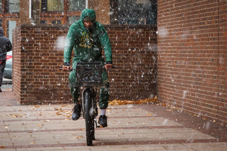
If your New Year’s resolutions include spending more time outside, this weekend in the Philadelphia region may not be the best time to start. Wet, windy, and wintry weather is expected beginning Saturday afternoon and lingering into Sunday, with a possibility of flakes and a likelihood of rain.
But snow lovers and sledding enthusiasts alike could once again be left yearning, as hopes for significant snowfall in the Philly area may flake out, said Joe DeSilva, a meteorologist with the National Weather Service Office in Mount Holly.
While the incoming system could blanket New England and Philly’s neighbors to the north, it’s more likely to yield a rain-snow mix in Philadelphia and its suburbs, starting with “a chance for some snow” Saturday before likely shifting into yet another rainy weekend in the region, DeSilva said. It was still too early to discuss any possible snowfall totals, he said Wednesday, as much of the developing low-pressure system’s calculus is still up in the air — specifically, over the Pacific Ocean.
Once the primary wave of that system hits the West Coast mainland in the next day or two, forecasters will have a better outlook on how it will affect the eastern side of the country. Last week, the incoming system looked to be “more intense,” DeSilva said, but recent models show that intensity trending downward.
“It’s still a ways away,” he said. Even subtle differences in the storm’s path, forecasters with the Weather Prediction Center noted, could have big implications for the amount and type of precipitation along the East Coast, and “plenty of uncertainty” remains.
Still, chances of snow this weekend are better in higher elevations north and west of the I-78 corridor, toward the Poconos and Lehigh Valley, where one to three inches could fall Saturday as high temperatures are only expected to hover in the 30s, DeSilva said. The anticipated winter storm led President Joe Biden to move his speech at Valley Forge from Saturday to Friday.
In snow-starved Philadelphia — which has seen traces of snow this winter but officially hasn’t recorded an inch since Jan. 29, 2022 — afternoon temperatures Saturday are expected to reach a high around 40 degrees, with evening lows around the freezing mark. Down the Shore, highs could reach the upper 40s.
The region could see wind gusts around 20 to 30 miles per hour, and up to 40 miles per hour along the coast, he said.
Ballpark rainfall estimates are around an inch or less for the region, which just experienced its third-rainiest December on record.
By Sunday night and into Monday, things are expected to clear off just in time for another, warmer, more intense rainy system entering the region Tuesday, DeSilva said.
And while that’s “unlikely to bring about wintry precipitation,” the National Weather Service says, “concerns for widespread heavy rainfall and flooding will return.”
