Winter and maybe even snowflakes are due back around Philly after this spring-like weekend
Snow is possible Tuesday, and forecasters are saying we may well get six more weeks of winter.
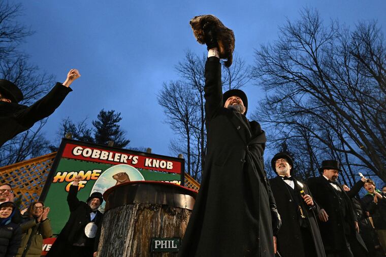
After a spring-like weekend, the most famous rodent in Gobblers Knob may be looking like a meteorological Nostradamus, but the humans who do this for a living insist he’s about to get knocked down a few notches.
After highs well into the mid-50s in Philly on Friday and Saturday, a “major pattern change” is about to unfold that would lead to a return of winter, or a reasonable facsimile, say the forecasters at the government’s Climate Prediction Center.
And the region could even see a touch of snow on Tuesday, as a coastal storm draws in colder air as it pulls away and generates colder winds from the north.
» READ MORE: Yes, the groundhog didn't see his shadow
The chances of this being a significant snowstorm for Philly appeared to be in a league with a half-court shot at the buzzer in a basketball game. The National Weather Service in Mount Holly was forecasting all of 0.3 inches for the city Tuesday morning.
“If anything, it’s probably going to underperform,” weather service meteorologist Alex Staarmann said late Saturday afternoon.
But as the storm intensifies over the ocean on Tuesday, “You’ve got to watch the back end of it” (the storm, not the groundhog), said Tom Kines, a senior meteorologist with AccuWeather Inc.
After the storm departs, the company’s long-range forecaster, Paul Pastelok, sees a Punxsutawney Phil-buster chilly spell lasting four to six weeks, with perhaps a few breaks here and there. Phil, you might remember, saw his shadow and promised an early spring.
How cold will it get?
The consensus among government and private-sector meteorologists is that what the Northeast is about to experience will be more on the order of the common cold, rather than the uncommon. Temperatures may be slightly below the normal highs for Philly in the low 40s. Normal highs climb into the mid-40s by the end of a month when the sun is feeling new powers day by day.
In terms of wattage, according to NASA, the sun over Philly on Sunday is similar to what it would be at the end of October.
The normal nighttime lows in Philly don’t rise above freezing until March 10, so storms could have modest supplies of cold air to work with in order to produce snow. “It doesn’t have to be real cold,” said Kines. In fact, some of Philly’s coldest winters have been snow-deprived, likely the result of storm-suppressing cold high pressure.
“There’s still hope,” said Patrick O’Hara, a meteorologist at the National Weather Service Office in Mount Holly.
And for those who don’t associate “hope” with shovels and rock salt and wouldn’t mind if this weekend’s weather lasted indefinitely, it is at least possible that the latest snow drought will continue for a while.
What happened to winter?
Philly is on track for one of its 10 warmest winters on record, and winter has been on the run recently in much of North America.
In Winnipeg, where normal highs this time of year are in the teens, it actually rained on Wednesday, when the temperature shot up to 37 degrees. The daily average temperature that day was almost 30 degrees above normal, according to Environment Canada.
» READ MORE: Philly winters can be full of surprises
The planet is getting warmer, but in this instance El Niño evidently has been a factor. The above-normal temperatures over vast regions of the tropical Pacific have had the effect of flooding much of the continent with warm air from the Pacific, said Kines.
While the southern track has been active, the storms riding along it haven’t been turning up the coast, snubbing the Mid-Atlantic and the Northeast.
The El Niño appears to be fading, but sea-surface temperatures out that way remain about 3 degrees Fahrenheit above normal, and its impacts are likely to persist for several weeks.
The upper-air patterns over the Arctic now favor colder air filtering into the United States, but the vanished snow cover over the Northern Plains and the warmth in much of Canada argue against bitter cold oozing eastward, said Kines.
The source region for cold in the Philly region likely would be due north in Quebec.
Snow prospects
A storm is due to cross the Mid-Atlantic region Monday, then intensify over the Atlantic. The north winds to the west of the storm center are forecast to draw in colder air that could lead to changeover from rain to snow Tuesday morning as far south as the I-95 corridor.
» READ MORE: El Niño is living up to is reputation of persistence as it continues to affect U.S. weather
It is possible that a few inches could accumulate to the north and west of the city, the weather service says.
Computer models are seeing more threats later in the month, but aren’t they always?
Said Kines: “There will be opportunities for snow along the I-95 corridor from Washington to Boston.”
