Records in sight Tuesday in one of the warmest Julys in the last 150 years
Warm Atlantic and Gulf waters are brewing humidity, and Philly might have its third-warmest July ever.
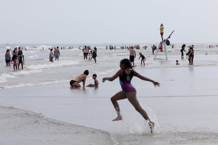
For the 19th day this month, the temperature reached 90 degrees in Philadelphia Tuesday, and among the 150 Julys in the period of record, this one could finish among the hottest three.
On average July hosts about 10 days of 90-or-better highs, and the National Weather Service says Tuesday afternoon will differ from Monday’s only in that it will be more uncomfortable. Heat indexes forecast to rise to 100 to 105 as the air again has swollen with water vapor. The weather service has issued a heat advisory. not only for Philly but from North Carolina to Maine.
While not a single daily high temperature record has been matched this month in Philadelphia, the run of overnight warmth has been impressive. The official reading hasn’t dropped below 70 at Philadelphia International Airport since July 7.
it didn’t get past 79 Tuesday morning, which would be a record-high minimum temperature for the date. And with the temperature on its way to the mid-90s, Philadelphia does have shot at reaching the highest daily average reading for a July 28.
The steamy mornings and the lack of high-temperature records both are related to the persistent sultriness. That moisture inhibits cooling by keeping daytime heat from escaping into space. Conversely, it can shave a few degrees off high temperatures during the day by diverting some of the sun’s heat energy at the same time that it drives up the heat index.
Meteorologists say the discomfort is tied to warm sea-surface temperatures in the Atlantic Ocean, the Gulf of Mexico, and elsewhere that continue to help brew the atmospheric soup.
“Water temps are very high, and that’s keeping the humidity up,” said Paul Walker, a senior meteorologist at AccuWeather Inc.
» READ MORE: Tropical-storm records and Philly’s stubborn, steamy heat have ties to warm Atlantic and Gulf
How warm are the waters?
Water temperatures off Cape May were near 77 Tuesday, according to the National Centers for Environmental Information, and in the 80s along the Chesapeake Bay.
They also were in the 80s in areas of the New Jersey coast, said Jim Eberwine, former marine forecaster at the weather service and now Absecon’s emergency management coordinator.
Temperatures over most of the Gulf and the North Atlantic have been quite warm. That evidently has been a factor in the record numbers of early forming named storms in the Atlantic Basin. Eight have developed already, and a ninth — Tropical Storm Isaias — might be about to pop.
» READ MORE: Arthur, the first named tropical storm of an expectedly busy hurricane season, forms off Fla.
On average, that eighth storm doesn’t occur until Sept. 24, and the average number of storms for the entire June 1-to-Nov. 30 season is 11.
Thanks in part to the water temperatures, the storms have been able to play dodgeball with the ultra-dry layers of Saharan dust and particulates in the upper atmosphere, said Jason Dunion, a Saharan Air Layer specialist with the National Oceanic and Atmospheric Administration.
The traffic has been so brisk that AccuWeather now thinks the numbers might run through the alphabet into the 20s, making this one of the most active hurricane seasons on record.
We have company
Back on terra firma, warm high pressure has dominated and roasted much of the East.
In Buffalo, N.Y., more known for its legendary snowfall, temperatures this month have averaged an astonishing 6.8 degrees above normal through Sunday.
Pittsburgh was running 4.6 degrees above; Binghamton, N.Y.; 4.3; Washington, 4.1; Atlantic City, 3.4; and New York City, 3.1.
Statewide, New Jersey is on track to finish in the top 5 and still has a shot at No. 1, said Dave Robinson, the state climatologist.
At 81.6 through Sunday, Philadelphia’s July average was 3.7 degrees above normal. The current forecast has it finishing the month at 81.9, No. 3 on the all-time July list that dates to 1871. That’s significant because that high-temperature bar is getting ever higher.
» READ MORE: Philly’s average temperatures are rising, along with the overall global trend
The current champ is 2011, at 82.4, followed by 1994, 82.1. Only 11 times has the July temperature averaged out at 80 or better, and seven of those have occurred since 1993.
Overall, summer temperatures in Philadelphia have tracked fairly neatly with the planet’s increases. The average June 1-to-Aug. 31 temperature in the 21st century through 2019 was close to 77 degrees, about two degrees higher than the 20th century’s summer temperatures.
Break coming?
AccuWeather’s Walker says that the jet stream winds, those upper-air boundaries between warm and cold air that have been summering in Canada, should sag south this week, and that temperatures might even fall below normal by the end of the workweek.
Leave the sweaters in storage, though; he’s talking about mid- and upper 80s. And don’t get used to even that level of cooling.
The government sees odds favoring warmer-than-normal temperatures in August, and AccuWeather says it might well be a repeat of July.
