Tropical Storm Fred remnants to affect the Philly region Wednesday, and showers are possible every day through Monday
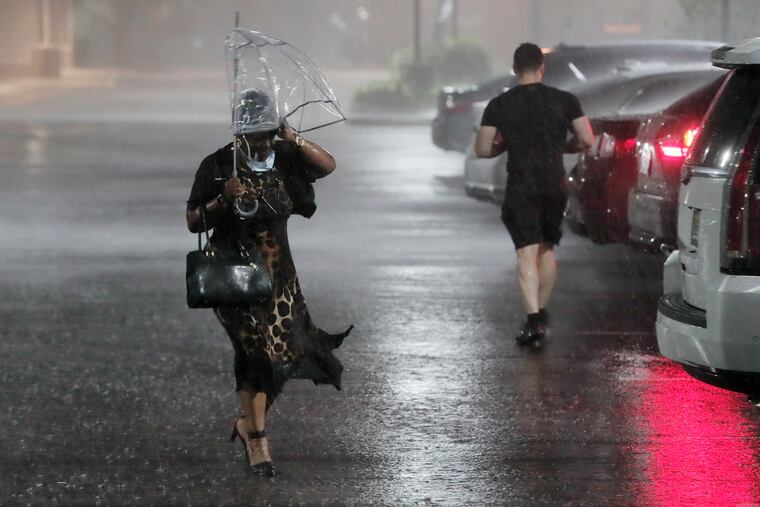
Flood warnings were up Tuesday for northern Delaware. Rain chances pop up through Monday with more rounds of thunderstorm lotto possible.
With Fred’s remnants forecast to arc toward Western Pennsylvania, and the atmosphere primed for a significant moistening, the Philly region evidently is in for more rounds of thunderstorm lotto.
Coinciding with the passage of Fred’s leftovers, the likeliest period for the heaviest rain would be late Wednesday and Wednesday night, the National Weather Service says, with areas west of the Delaware River the favored targets. However that is very much subject to change, and areas around Wilmington already were getting deluged on Tuesday, with flood warnings in effect for northern Delaware.
The U.S. forecast model would keep the heftiest amounts on Wednesday to the west, with the European arguing for widespread heavy rains that could merit flood advisories, the weather service’s Mount Holly office said in its morning discussion.
For now, the forecasts for the rest of the week are maddeningly ambiguous, but shower and thunderstorm chances pop up every day at least through Monday.
That refreshing air mass that surfaced Sunday was a drive-by, one-day wonder. That means the sweat- and shower-producing humidity so evident last week has returned.
“It didn’t go far away, unfortunately,” said Patrick O’Hara, a meteorologist at the National Weather Service Office in Mount Holly.
» READ MORE: ‘Micro’ thunderstorms are pounding the Philly region, with a nearly 100% chance for more
The supplier is an area of high pressure off the coast that is swamping parts of the Northeast with plenty of raw material for showers and forecast to be Fred’s conspirator.
The government’s Storm Prediction Center has the Philadelphia region under a “marginal risk” for severe storms Tuesday and Wednesday, and the Weather Prediction Center put areas west of the Delaware River in the “slight risk” zone for excessive rainfall for Tuesday and Wednesday.
On Monday afternoon, the center of the storm, with peak winds of 65 mph (9 mph shy of hurricane strength), made landfall along the Florida Panhandle.
It was forecast to weaken to a depression on Tuesday and then track along the Appalachians, perhaps reaching Western Pennsylvania sometime Wednesday afternoon.
The trend of the National Hurricane Center’s track has been shifting subtly westward, O’Hara said, and it’s possible that areas near the Jersey Shore would see little in the way of Fred-related rains.
» READ MORE: Despite a recent lull, the Atlantic hurricane season is about to experience a serious second wind
However, the mere proximity of a tropical storm can add atmospheric moisture and uncomfortable humidity to areas well away from the center, said Tom Kines, senior meteorologist with AccuWeather Inc.
With the moist flow from the south and Fred’s residue moisture,it appears that the atmosphere will remain juicy even after the core of Fred goes away.
The weather service in Mount Holly has most of Bucks, Chester, Delaware, and Montgomery Counties, along with Northwest Philadelphia, in the “enhanced risk” area for heavy rains through Tuesday night. Significant rains are possible Wednesday and Thursday.
But it is mid-August, the soil is showing its dust, the grass is browning, brittle leaves are littering the ground, and the stream flows are low. For now, O’Hara said, the agency is holding off on any flood advisories.
