Another weekend snow watch and ‘exceedingly rare’ cold are on tap for Philly
A “bomb cyclone” may have impacts at the Shore.
Another weekend snow chance and more cold are in the forecasts. But the big difference between last week and this one in the Philadelphia region is a matter of degrees — about 10 of them.
A coastal “bomb cyclone” could form during the weekend with significant impacts, at least at the Shore. Computers were still sorting out what effects, if any, it would have in Philly. On Thursday, however, they favored snow staying to the south and east, with only a 40% chance they got to I-95.
In the meantime the cold will be epical by Philly standards.
If the forecast holds, in addition to coming close to ending a 32-year zero-less streak, Philadelphia would have daily minimums of 5 degrees Fahrenheit or lower on the next two mornings.
And it appears the city will have its first nine-day stretch in which the temperature failed to reach 30 degrees since 1979, based on analysis of temperature data from the Pennsylvania state climatologist.
In issuing a cold weather advisory for wind chills as low as 10 below zero, the National Weather Service in Mount Holly noted that “it is exceedingly rare to get this combination of length and magnitude of an arctic airmass for this area.”
Philadelphia’s forecast high on Thursday, 19, would be more than 10 degrees lower than the forecast for Anchorage, Alaska.
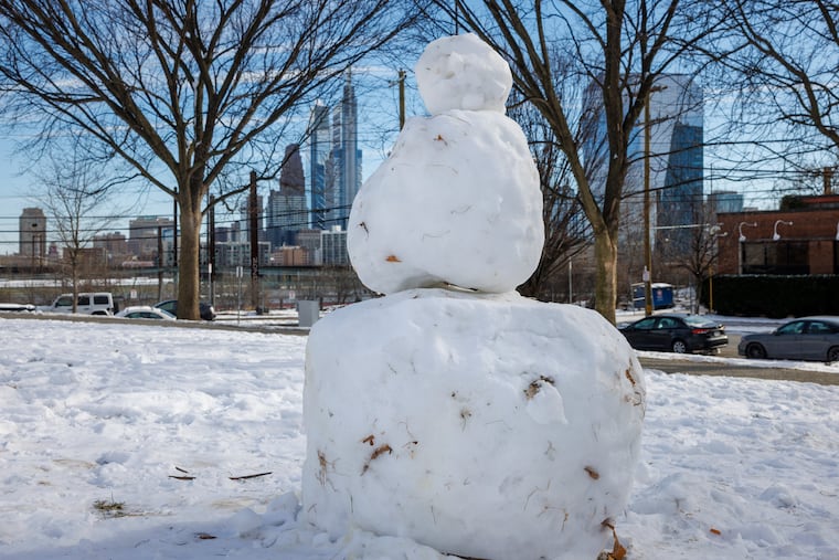
Heading into the weekend, that subtly laminated lunar landscape with the one-horse-open-sleigh look in the fields and parks is almost certain to persist while bedeviling road-clearing efforts.
Some snow is possible late Saturday or Sunday — and this is becoming a habit — in time for the rising of the full “Snow Moon,” which may be a problem for the Jersey Shore. The full moon will likely contribute to tidal flooding.
The snow outlook for the weekend
On Wednesday only two things were certain about the latest threat: A major coastal storm is going to blow up during the weekend, and it’s not going to rain.
“Everything looks like it’s going to come together,” said Paul Pastelok, the long-range forecaster for AccuWeather Inc.
AccuWeather said it may intensify enough to qualify as a “bomb cyclone.”
An early consensus among computer models was that the storm would stay too far offshore to generate a major snowfall in the immediate Philly area. Pastelok said it was looking for Philly to get “sideswiped” with a 1- to 3-inch event. However, that was very much subject to change.
The weather service would not be making a first guess at potential accumulations until Thursday afternoon, said Alex Staarmann, a National Weather Service meteorologist in Mount Holly. In its forecast discussion Wednesday, it said that based on a consensus of the models, the Shore had a 35% to 50% chance of 6 inches of snow or more, with a 20% chance along I-95.
More certain was the potential coastal flooding threat at the Shore with potent onshore winds coinciding with Sunday’s full moon.
And while it may seem the atmosphere enjoys ruining weekends, it’s not uncommon for weather systems to fall into 3½- and seven-day cycles. That has to do with the spacing between weather systems, meteorologists say.
Regardless of what happens during the weekend, the region is going to begin the workweek with snow on the ground.
The snow is going to have more staying power than the average computer-model snow forecast.
It’s not going to get a whole lot warmer anytime soon
Even though it’s ice cold, as if developing a slow leak, the depth of the snow pack is actually decreasing, but ever so ponderously.
That 9.3 inches of snow and sleet that accumulated Sunday was down to 6 inches at Philadelphia International Airport on Wednesday morning, Staarmann said.
Compaction and sublimation, which is similar to evaporation, are lowering the depth, despite the cold. But Wednesday’s depth report was the same as Tuesday’s.
» READ MORE: Philly snow cleanup: What to know about plowing, parking, schools, and more
And after what does or doesn’t happen Sunday, temperatures are forecast to remain below freezing at least until Feb. 4.
No significant warm-up is in sight, and the National Oceanic and Atmospheric Administration’s Climate Prediction Center has odds strongly favoring below-normal temperatures until Feb. 11.
The upper-air pattern continues to favor cold pouring into the Northeast.
And more cold air is possible later in the month with a visit from the polar vortex, Pastelok said.
Average temperatures in Philly finished 3.6 degrees below normal in December, and despite a 10-day warm spell earlier in the month, January is projected to finish at least 2 degrees below long-term averages.
For Pastelok and other seasonal forecasters, it has been a tough winter.
“We underestimated how cold the Northeast would be this year,” he said.
