Hurricane season is on pause, giving residents in Philly and elsewhere a break. But is it over?
After record numbers of landfalling tropical cyclones and flooding downpours from their remnants, forecasters are seeing no new threats on the horizon.
Philadelphia hasn’t experienced a drop of rain from tropical storm remnants since Ida disintegrated last month. No hurricane has reached U.S. soil since Sept. 14, and not one tropical storm has prowled the Atlantic Basin since Oct. 6, the longest such dry run in eight years, says the National Hurricane Center.
Much to the benefit of residents of the Gulf and Atlantic coastal regions and inland waterways — along with U.S. taxpayers — after record numbers of landfalling tropical cyclones and flooding downpours from their remnants, the torments of the 2021 hurricane season are on pause.
“I hope that’s it for the season,” said Dennis Feltgen, a meteorologist who is the hurricane center’s spokesman.
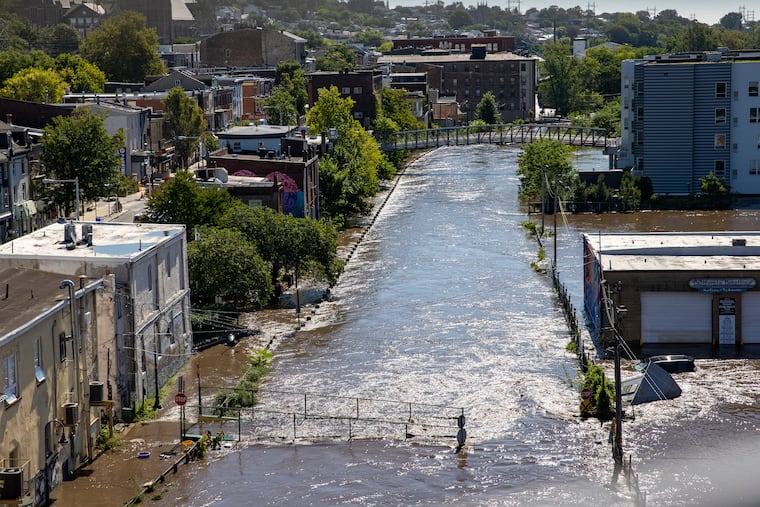
It’s not necessarily over: Recall that 850,000 Peco customers lost power after Sandy’s assault on Oct. 29, 2012.
But meteorologists are seeing no near-term threats, despite the warm waters in the hurricane-spawning regions of the Atlantic and below-normal sea-surface temperatures in the tropical Pacific, conditions that normally might produce another uptick.
What might explain the paradox, not to mention the good fortune? Shearing winds, which would rip apart incipient storms before they mature, are strong over the Atlantic Basin. The waves that can grow into cyclones aren’t bounding off the African coast these days, observes AccuWeather Inc. And developments in the Indian Ocean hold another clue.
» READ MORE: With tropics reawakening, what we can learn from Hurricanes Sandy, Hazel, and other destructive October storms
It’s not the polar vortex
One of the major forces behind the clusters of tropical storms, at least through Ida, was the so-called Madden-Julian Oscillation, or MJO, on the other side of the world, said Jon Gottschalck, chief of the operational prediction branch at NOAA’s Climate Prediction Center.
Named for the scientists who discovered it 50 years ago, it doesn’t have quite the celebrity of the polar vortex or El Niño. But under the public radar it has been a powerful driver of weather globally year round, and it has become a component of seasonal outlooks.
Gottschalck describes it as a massive “disturbance of clouds, rainfall, winds, and pressure.” On either side of the rising air that sets off the storminess, descending air has a drying effect.
It has atmospheric rippling effects across the tropics, alternately creating very ripe or very challenging conditions for harvests of storm activity for thousands of miles as it moves ponderously eastward.
Hurricane experts agree that once the disturbance took up residence in the Indian Ocean in August, it primed the Atlantic Basin for an August of havoc.
From Aug. 11 to 31, seven named storms — those with winds of at least 39 mph —developed, four of which became hurricanes, with winds 74 mph or better. Three of those grew into major ones, with peak winds of 111 mph or more, including Ida, of course, with top winds that reached 130 mph.
» READ MORE: Ida’s fatal power didn’t shock scientists who study how climate change primed the pump
Sometime last month, the oscillation’s state became less favorable for promoting Atlantic hurricanes, and as of Monday, the area of enhanced convection was displaced to areas bordering the Indian and Pacific Oceans, according to the climate center.
That position likely was producing shearing winds in the Atlantic Basin, said Philip Klotzbach, hurricane researcher at Colorado State University.
But the MJO’s short-term future remained very much up in the tropical air.
The outlook for the outlooks
In its most recent update the climate center said that the oscillation was expected to approach an area where it would favor a tropical storm revival in the Atlantic perhaps in late October.
But that might be off the table. Klotzbach observed that some of the computer models were ready to “effectively kill the MJO signal.”
Gottschalck said that the fact that the disturbance has been stationary raises an existential issue: Movement, he said, is “a critical component of its definition.”
» READ MORE: Despite a recent lull, the Atlantic hurricane season is about to experience a serious second wind
For a variety of reasons, the phenomenon has limited usefulness in long-range hurricane outlooks. No one is certain why it forms in the first place, forecasts of its movements are imprecise and, Gottshalck said, often the planet is MJO-less.
“There is considerable year-to-year variability,” he said, “with some years having almost continuous MJO activity with other years only having a few.” On average, three to four oscillations develop annually, he said.
And it’s hardly the only thing governing tropical storm seasons. The list of factors is long and complicated. It includes the behavior of the African monsoon season, Saharan dust in the atmosphere, sea surface temperatures, and levels of storm-killing wind shear.
Parting shot?
Both Klotzbach and Paul Walker, a senior meteorologist at AccuWeather, believe that something significant eventually could pop in the Caribbean, what Walker called a “homegrown” storm.
Klotzbach pointed to the developing La Niña cooling of surface waters in the tropical Pacific, which favor reduced shearing winds in the Atlantic Basin.
“I still think we’ll get something strong in the western Caribbean before the season ends,” Klotzbach said.
