Philly ties a high temperature record, with another one in sight for Sunday
Sunday's record may be more impressive than what happens Saturday.

The unofficial start of the summer season is still a weekend away, but the atmosphere once again is exhibiting its disdain for human conventions.
“It’s like the Fourth of July,” said Joe Mancini, mayor of Long Beach Township, and he could well have been talking about the crowds on Long Beach Island — where the traffic lights won’t go on until Monday — or the weather.
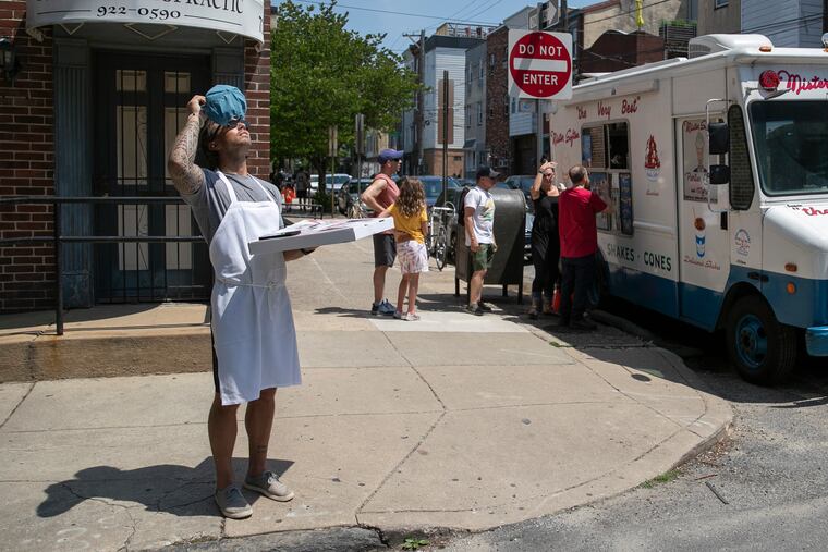
With the temperature reaching an ice cream-liquefying 95 degrees, Philadelphia tied a record for the date, first set in 1934, and has an excellent shot at setting a more-impressive one on Sunday.


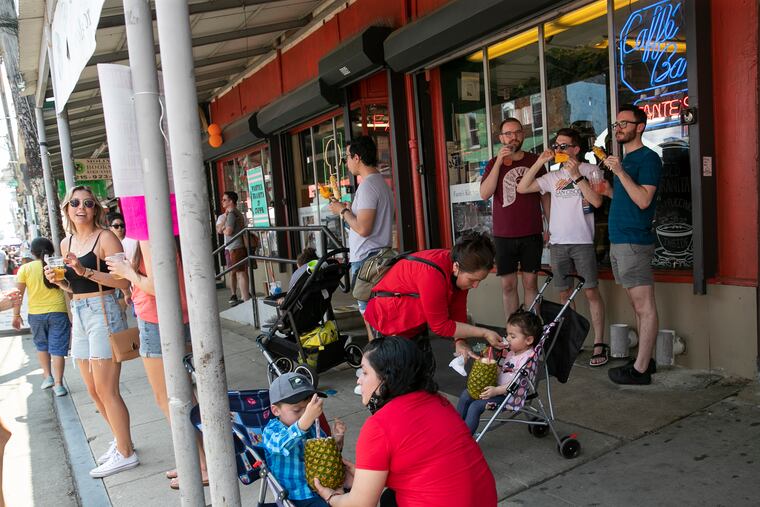


Away from the beaches, not even the Shore towns were providing much refuge from a vigorous pre-summer pulse of warmth that has triggered heat advisories from Wilmington to Burlington, Vt.
The temperature hit 93 at Atlantic City Airport, tying the record for May 21.
Clearly the inland heat was driving Shore traffic, but the ocean is still fighting the winter chills, with surf temperatures in the mid-50s.
And the beaches are still unguarded. Ocean City Beach Patrol personnel, on site to prepare for next weekend, were summoned to rescue three young swimmers, one of them a 12-year-old who has been hospitalized.
The barrier-island beaches are recovering from a nine-day assault of onshore winds that began May 5 and caused considerable erosion. “We lost some sand,” said Mancini, “but we didn’t close any beaches.”
Any sand deficit evidently didn’t discourage people seeking asylum from the heat.
While the high in Philly tied a record, the leftover moisture from Friday’s rains kept the temperature from going even higher, said Jason Franklin, meteorologist in charge of the National Weather Service Office in Mount Holly, since the sun has to divert more of its energy to evaporation. Not that it made much difference in comfort.
However, the water vapor and the “urban heat island” effect are expected to conspire to set a record Sunday, and execute a May rarity.
» READ MORE: Don't forget to drink your water
The forecast low for Sunday morning, 74, would be the highest minimum for a May 22 in records dating to the 1870s.
Highs of 90 or better aren’t all that unusual early in the warm seasons — it happened on three consecutive days in April 1990, and this marks the 60th anniversary of a significant pre-summer heat wave
But this degree of nighttime warming, a well-documented symptom of climate change, is notable. Increased water vapor generated by rising temperatures evidently is inhibiting overnight cooling by hindering the escape of daytime warming, particularly in urbanized areas.
“The urban environment keeps the heat and doesn’t let it go,” Franklin said. “All the concrete just radiates all the heat back.”
» READ MORE: Yes, the nights are getting warmer
If you’re looking to cool off, you might check out the Dakotas, where a freeze warning is in effect. It is not uncommon for the West to be frigid while the East bakes, and vice versa. That’s a byproduct of the extent of the upper-air systems that govern weather.
And, as the atmosphere is wont to do, change is coming. Thunderstorms are possible Sunday, and Monday’s forecast high will be quite close to Sunday morning’s low.
