After fine-tuning, SEPTA’s new transit map to debut
The new map, which emphasizes frequency, is a prelude to SEPTA’s promised bus network reinvention.
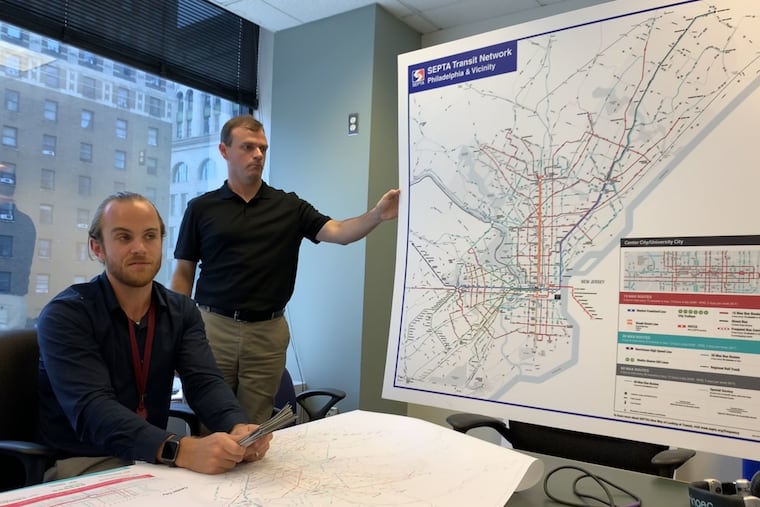
SEPTA’s long-gestating update to its route map is about to debut.
Within the next two weeks, four-by-four-foot prints of the new map, which uses color and lines of different thickness to help riders grasp at a glance how frequently a route runs, will start appearing at busy stops like the Frankford and 69th Street Transportation Centers. By the end of summer, they will be available in 100 locations, including all subway and trolley stops and many bus stops.
The redesign is a big change from a system map that has been largely the same since the 1940s, and is expected to make riding easier for regular travelers. And SEPTA also hopes it will make the bus system more attractive to new riders.
>>READ MORE: SEPTA gives its bus network map an upgrade
“I hope that people who aren’t bus customers find it a little bit easier to explore the bus network,” said Lex Powers, one of SEPTA’s long-range planners, who worked on the new map.
On new maps, thick lines with a reddish hue indicate routes that provide service at least every 15 minutes during much of the day, five days a week, called 15 max routes. Routes that provide service no less than every 30 minutes are colored teal, or 30 max, and those with hourly service are gray and called 60 max.
The same colors are being used on SEPTA’s printed schedules. SEPTA also is experimenting with a new type of schedule that provides information about a corridor served by multiple routes rather than those routes individually. The first of those schedules is being tested on the West Chester Pike corridor, which for much of its length is served by four bus lines.
The first iteration of this map came out in February, and SEPTA sought feedback from riders. More than 1,000 people responded to a questionnaire, Powers said, and the agency was encouraged because 64 percent said they liked the new map, and 42 percent replied they were likely to ride more frequently because of the new map.
Some respondents had concerns, though. They wanted the thickness and color of the lines to be more prominent so the differences would stand out. Others noted that the beta version of the map didn’t make clear that some lines run more frequently than every 15 minutes. The developers attempted to address the concerns in the latest version, thickening lines and deepening colors, adding context like landmarks, and simplifying an insert that shows routes in Center City.
One concern that won’t be addressed as quickly is a demand for an interactive digital version of the new map, because of formatting issues.
>>READ MORE: Here’s what went into creating Philly’s first new bus route in almost a decade
SEPTA officials described the new map as the first step of the bus network reinvention SEPTA will undertake over the next two to three years, said Liz Smith, SEPTA’s director of strategic planning and analysis.
Bus ridership in the Philadelphia region has dropped for four straight years, and city officials have pushed for SEPTA to take a new look at how to provide bus service that’s faster, more reliable, and more efficient. In some cases, that could mean new routes or fewer stops on existing routes. Other solutions deal with how service is provided or charged, with recent discussions focusing on the need to eliminate transfer fees. Before change comes, though, officials want a bus system that’s easy to interpret.
“It’s really the beginning of the overall bus network project,” Smith said.
