Tornado watches, flood advisories posted as Isaias approaches Philly region; N.J. declares state of emergency
The last time Philadelphia itself was in a tropical storm warning was Hurricane Irene in 2011.
» LIVE COVERAGE: Click here to read live updates of Isaias in the Philadelphia region for Aug. 4
Tornado watches are up for the entire region, and tornado warning was posted for upper Bucks County, on as Isaias approaches the region wringing out heavy rains that already have set off flood warnings.
And forecasters say conditions are about to deteriorate.
The strongest sustained winds were expected to arrive by mid- to late morning, along with gusts to 60 mph and perhaps 70 mph at the Shore.
No sightings have been confirmed, but the National Weather Service hoisted a tornado warning for the area around Dublin Borough, Bucks County, until 8:45 a.m. based on radar evidence.
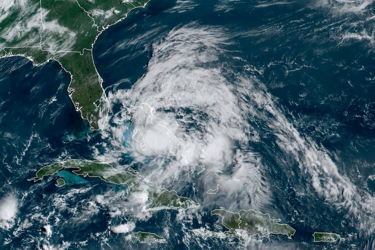
At 8 a.m. the center of Isaias was in southeastern Virginia and was expected to rip through the heart of New Jersey from late morning through the early afternoon.
Widespread power outages were expected as strong winds could work in tandem with saturated roots to bring down trees.
Projected rainfall amounts read more like winter-storm warnings — 3 to 6 inches were expected, or 4 to 8 weeks’ worth.
The storm was upgraded to a category 1 hurricane on Monday night, after it killed two people in the Caribbean, caused damage to the Bahamas, and brought heavy rain and flooding to Florida.
New Jersey Gov. Phil Murphy declared a state of emergency late Monday night in advance of the storm, effective since 5 a.m. Tuesday.
The heavy rains could coax streams out of their banks, but no flooding was expected along the main stem of the Delaware River could lead to potential flooding from rivers and streams. A flash-flood watch was in effect until midnight for the entire region.
The last time Philadelphia itself was in a tropical storm warning, said Nicholas Carr, meteorologist at the National Weather Service Office in Mount Holly.
Fay, which made landfall on July 10 in New Jersey, mostly just led to heavy rain in Philadelphia, while the winds were confined to the Jersey Shore and Delaware.
» READ MORE: Heavy rains cause flooding at Shore and in Philly as Tropical Storm Fay deluges the region
Pennsylvania Gov. Tom Wolf’s administration urged residents to know the difference between a flood watch, which means that flooding may occur, and a flood warning, which means there is actual flooding. Officials also suggested residents consider possible evacuation plans and identify a meet-up location for family members in the event they get separated.
“The best way to help emergency responders is for individual families to be prepared with an emergency plan and a communications plan, so everyone knows what they need to do to stay safe,” Pennsylvania Emergency Management Agency director Randy Padfield said in a statement.
