Winter storm warning for Philly area, with snow and hours of sleet expected
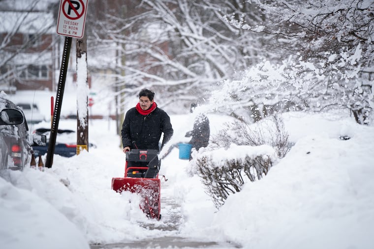
Up to 6 inches is possible in and around Philadelphia. The city has declared a snow emergency.
As per standard winter fare around here, the forecasts remain a mix of snow, ice, and ambiguity, but by day’s end Thursday, Philadelphia’s snow total for the winter of 2020-21 might exceed its average for an entire season.
» UPDATE: The latest on Thursday’s winter storm moving through the Philly area
The National Weather Service has issued a winter storm warning, albeit a rather tentative one, for 4 to 6 inches of snow for the immediate Philadelphia area, a decision that evidently did not come easily and is very much subject to change.
Snow, possibly heavy, is expected to develop around daybreak, then at some point during the day yield to sleet in and around Philadelphia; that some point being a sticking point.
The estimated changeover time will be a game-day decision as meteorologists Wednesday were sorting through a variety of possible outcomes for snow accumulations — a process likely to continue Thursday, even as it is snowing, or sleeting, or pausing.
And once again the suspense was centered along the I-95 corridor, which could be the dividing line between generic and more significant snow totals. This happens “over and over and over again,” said Joe Miketta, warning coordination meteorologist for the weather service office in Mount Holly.
“People think we use it as some kind of imaginary boundary,” said Miketta. It so happens that is an important topographical feature in that it marks a dividing line between the coastal plain and the upward sloping land of the so-called fall line.
Subtle changes in elevation can make differences in snow totals, since temperatures decrease with height, and in this instance, forecasters said, so will distance from the Atlantic Ocean.
“It’s a complicated forecast,” said Miketta. The initial snow would be generated by a storm originating in the Gulf of Mexico, where frigid air has been interacting with the warm waters, and forecast to move toward the Ohio Valley.
» READ MORE: Why Philly storm forecasts have been conflicting and constantly changing this winter
It is then expected to spawn a coastal nor’easter, and the snow here will depend on exactly where that forms and matures.
Temperatures are forecast to stay below freezing as an ultra-lite version of the air mass that flash-froze the central United States this week has moved eastward.
Since the cold air is fresh, said Paul Walker, a senior meteorologist with AccuWeather Inc., it will be stubborn even as the coastal low draws in warmer air from the Atlantic Ocean with its onshore winds.
The winds aloft will have better luck penetrating westward, he said, and once again nature will be serving the region an atmospheric parfait of air at different temperatures. A warm, thin layer, no more than a 1,000 feet thick, would be sufficient to melt snow that would refreeze as it passes through colder air on the way down and lands as sleet.
How far west that air intrudes will determine who continues to see the flakes Thursday afternoon and who hears those ice-pellet pings on the windows. The precipitation is forecast to continue well into the night, and perhaps into Friday.
Snow and sleet are measured officially as “snow,” although sleet accumulates at about a third the rate of snow, thus holding down accumulations.
Forecasters said it’s also possible that at some point Philadelphia could find itself under a “dry slot” in which nothing falls for a while.
“It seems there is never a simple winter-weather event in this part of the country,” the weather service said in its afternoon discussion. Yes, Miketta said, he is well aware that Philadelphians have seen this movie before, “and it’s not a very good one.”
The weather service forecast called for up to 6 inches in the city. Walker said AccuWeather had 4 as tops for the city, and 6 in the northern and western suburbs.
Either way, “that’s a decent storm,” said PennDot spokesperson Brad Rudolph. “That’s going to cause problems.”
Philadelphia declared a snow emergency, effective at 6 a.m. Thursday, and the Archdiocese of Philadelphia already announced that all classes for city schools will be virtual.
So far this season, officially 19.7 inches has been measured at Philadelphia International Airport. The average for an entire season is 22.3, or 22 inches more than fell all of last winter.
Highway departments have noticed the difference.
The PennDot Philadelphia region has spent $20 million of its $29 million snow- and ice-fighting budget, Rudolph said. It has spread 60,000 tons of salt, or more than triple what it used last year.
PennDot and the New Jersey Department of Transportation will be adding to their winter bills in the next few days.
Staff writer Kristen A. Graham contributed to this article.
