As the storm cleanup continues in the Philly region, a windy, soggy encore looms. Then, winter?
More flooding is possible Friday night into Saturday with another rainstorm, but it's about to turn cold. It might even snow.
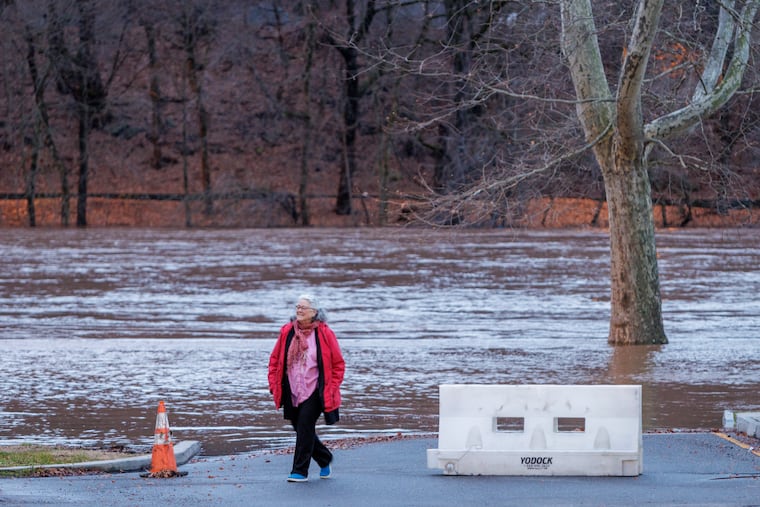
As cleanup continues from the gust-and-downpour fest that turned some trees to road-closing bowling pins and caused more than 300,000 power outages in the region, a “remarkably similar” storm could precipitate fresh rounds of flooding Friday into Saturday on waterways still recovering from the deluge.
The impending storm would be a veritable clone of its predecessor, which wrung out 2 to 4 inches of rain, closed roads, set a tidal record on the Delaware, and was blamed for at least one death. It also would resemble others in a sequence that began seven weeks ago.
But forecasters say that the era of the atmospheric echo chamber is about to end around here, and that the character of season is about to undergo a personality change. One or even two snow scares are possible next week.
“It’s definitely looking more wintry, for sure,” said Dave Dombek, senior meteorologist with AccuWeather.


It would be hard to look less wintry in Philly. Temperatures rocketed to 58 degrees Tuesday night, are likely heading back to the 50s Saturday, and are averaging better than 4.5 degrees above normal since the Dec. 1 start of the meteorological winter.
With a storm track that has favored keeping Philly on the warm sides of the centers, it has been both snow-less and mighty wet. Precipitation in Philly and the neighboring counties in the last 30 days has been two to three times the normal, according to the Middle Atlantic River Forecast Center, and an additional 1 to 1.5 inches of rain are expected Friday into Saturday.
» READ MORE: Philly is a hotspot for extreme rains, a study says
About Friday
“It looks like we do it all over again,” said Joe DeSilva, meteorologist with the National Weather Service forecast office in Mount Holly. A coastal flood watch is up along the Delaware for Saturday until 7 p.m.
But this time, the winds and rains won’t be quite as ferocious. If not for all the antecedent rains that have swamped the region and turned the Philly area into low-grade wetlands, “we wouldn’t be making much of a deal out of it,” said AccuWeather’s Bob Larsen.
He said at least 90% of the rain will come after nightfall Friday and be over by daybreak Saturday. Wind gusts to 45 mph are possible, and it is likely that the weather service will be posting a regionwide flood watch.
The forecasts suggest it won’t be as disruptive as the Tuesday night-Wednesday event.
The storm’s legacy
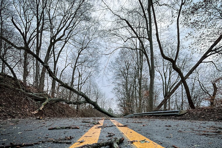
Rainfall amounts topped 4 inches in some areas, and winds gusted past 50 mph inland and 70 mph at the Shore, shaking houses. In Ventnor, horseshoe crab carcasses that had rested at the water’s edge were flung to the boardwalk.
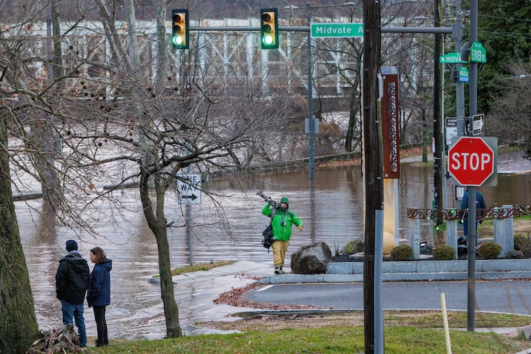
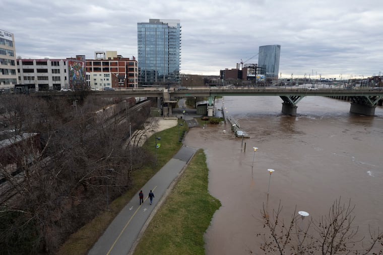
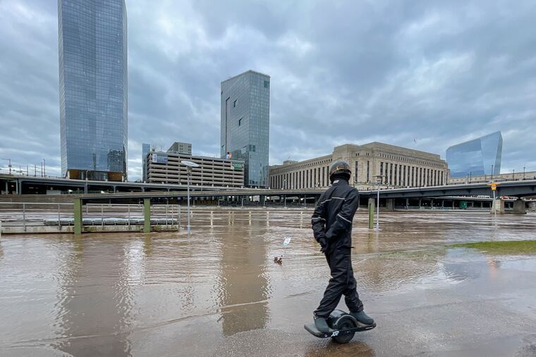
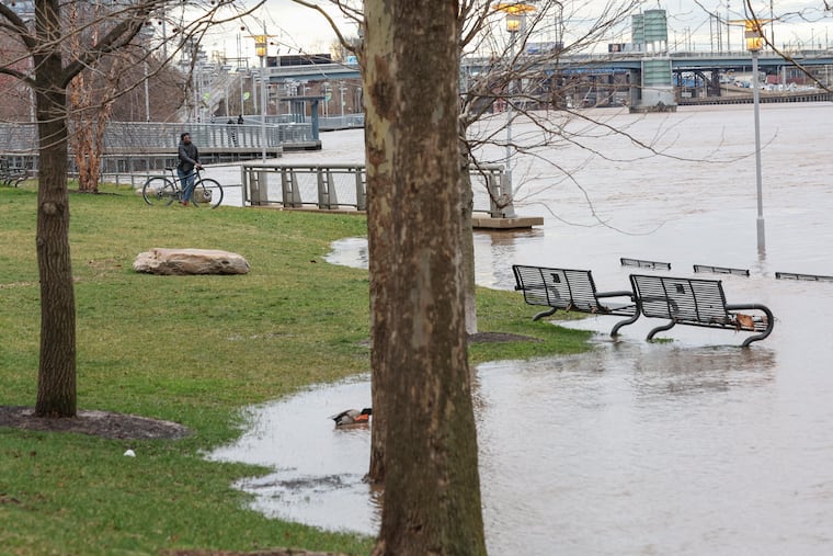
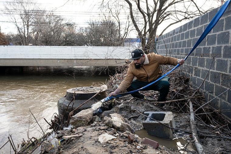
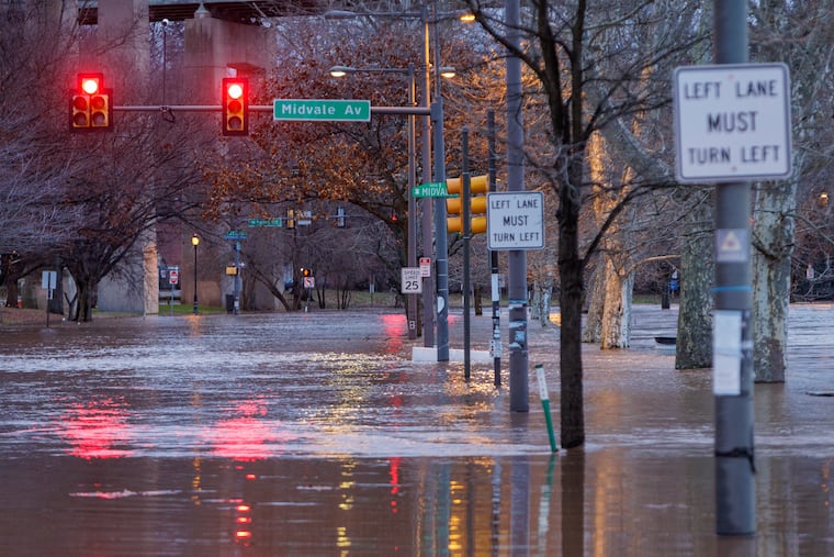
Floodwaters shut down major roads into Atlantic City, including the Black Horse Pike, and important thoroughfares elsewhere, including the Martin Luther King Drive, as flooding occurred all along the Schuylkill and two trees came to rest on the Strawberry Mansion Bridge. The storm also disrupted Amtrak and SEPTA service.
Multiple water rescues were reported in Delaware, Montgomery and Burlington Counties, where floodwaters impacted more than 50 homes in Delran, officials said.
» READ MORE: Flooding in Burlington County damages homes and leaves riverside residents wading in the mud
A 64-year-old Bucks County man died in a house fire that started after a power outage and the family resorted to candles for light, police said. The victim, whose name was not released, had mobility issues and was unable to leave his second-floor bedroom after the fire broke out in the early-morning hours. Other family members were able to leave safely, police said.
Bucks was one of several counties hard hit by outages. As of 6 p.m. Wednesday, Peco and Atlantic City Electric reported a total of about 35,000 remaining outages in Southeastern Pennsylvania and South Jersey. PSE&G was reporting only about 1,000 remaining outages.
High winds late Tuesday night into Wednesday inhibited restoration efforts, said Peco spokesperson Madison Davis, because as a matter of policy, utility crews can’t use bucket trucks when sustained winds are 30 mph or higher.
Meteorologists are confident that the Friday event will be the last of the “cutters” — so called because the centers cut toward the Great Lakes. Winds blow counterclockwise around the centers, so Philly and areas to the east of the center experience warm winds from the south and rain, while the Midwest might get smothered in a blizzard on the cold side.
» READ MORE: This has been a busy El Niño winter. Will it ever snow?
Storms travel along the boundaries of warm and cold air, and you might have noticed that cold air has been mostly absent along the I-95 corridor.
As for the moisture supply, “In a nutshell, it’s part and parcel of an El Niño winter,” said Larsen. Sea-surface temperatures over vast portions of the tropical Pacific remain about 3.5 degrees above normal, and that is energizing west-to-east winds bearing storms to the United States. The El Niño is expected to persist into spring.
The latest storm profoundly affected almost the entire East, exploiting copious supplies of moisture from the Gulf of Mexico.
However, profoundly cold Arctic air that could send temperatures to freezing all the way to the Rio Grande River is pressing eastward, said Larsen. That not only will mean actual winter temperatures, it also will change the cold-warm boundaries, and, thus, storm tracks.
The European forecast model had been suggesting that a coastal storm would form along the frontal boundary late Monday into Tuesday, with snow possible in Philly. The American model balked, but finally came into agreement. But in a later run, the European model saw the storm so far south that the snow might not get north of Baltimore.
“Wouldn’t it be ironic for snow-lovers,” said Larsen. “All these storms keep missing because they go north and west. You finally get one that’s farther south and east, but it’s too far south and east.”
That might please snow-loathers, but Larsen said another threat is possible at the end of next week, and the government’s Climate Prediction Center has odds favoring below-normal temperatures throughout the country for the 10-day period ending Jan. 20.
At least no flood threats are on tap after this weekend.
Staff writers Max Marin, Amy S. Rosenberg, Rob Tornoe, and Vinny Vella contributed to this article.
