This is a weather week to savor in Philly, but smoke is in your skies. Memorial Day weekend looks unsettled.
The wildfire smoke should back off later in the week. A coastal storm is an outside threat for the weekend.
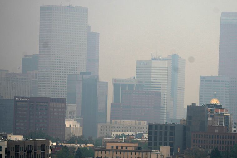
The workweek leading up to the unofficial start of summer should appeal to the appetites of May connoisseurs — assuming they don’t mind some milky veils of wildfire smoke in their skies and a haze more appropriate for a July heat wave.
High-altitude winds continue to transport smoke from the persistent and expansive early-season wildfires in Western Canada. The smoke has set off air-quality alarms in the Western United States, but is too high in the atmosphere to cause issues around here, said Eric Hoeflich, a meteorologist with the National Weather Service in Mount Holly.
However, it certainly has affected the aesthetics. “Looking outside, if I didn’t know any better I would think it was hazy, hot, and humid,” said Brett Anderson, senior meteorologist with AccuWeather.
» READ MORE: Smoke is no stranger in the skies over Philly
In reality, he said, the shading effect of the smoke may be shaving a degree or two off the temperature.
NOAA expects the smoke to linger at least into early Wednesday. Anderson said the smoke should back off later in the week, but after what could be a cool, unsettled Memorial Day weekend, conditions should be ripe for a robust return of the smoke next week, with more to follow during the summer.
“Get used to it,” he said.
The wildfires
Already more than 1,400 wildfires have scorched western Canada, charring 15 times more acreage than they would have normally at this time of year, according to data provided by Canadian officials.
Anderson said that fires in Alberta already have burned the second-most acreage on record — for an entire season — and that it almost certainly will set a new standard in June.
He said a developing El Niño, an area of unusually warm waters in the tropical Pacific, would correlate with continued summer dryness in the areas that have been affected most by the wildfires.
» READ MORE: Wildfire smoke was a significant problem two summers ago
The blazes resulted from a scorching May that followed a dry mild winter, part of a larger atmospheric pattern tied to the tremendous snows in the Sierras thousands of miles to the south, Anderson said.
The smoke plumes have ridden upper-level jet-stream winds, and he estimated that the smoke over Pennsylvania probably is above 25,000 feet up in the atmosphere.
NOAA computer models called for the smoke to persist well into Tuesday afternoon. However, a change in the jet-stream pattern should allow more blue to shine through over Philly on Thursday and Friday, Anderson said.
The forecast
Under normal circumstances, given the pattern this week, the Philly region could expect splendidly blue skies and comfortable temperatures. One out of two isn’t bad.
Save for Wednesday when readings might approach 80 degrees, temperatures were due to hold in the 70s during the workweek and into what is looking like an unsettled weekend for the unofficial start of summer.
A coastal storm could affect the region the second half of the weekend, perhaps as early as Saturday night, Anderson said.
However, it remains a virtual threat, and on Tuesday the outlook remained under a cloud of “a lot of uncertainty,” said the weather service’s Hoeflich.
For those heading to the Shore and looking to brave the surf, it will be a blue-toe situation with water temperatures likely around 60 degrees.
