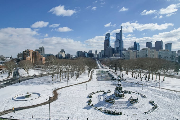
Heavy snow and gusty winds are expected for the morning commute Tuesday in the Philly region
With heavy snow, Tuesday morning's peak commute "could be the worst in quite a few years," says a weather service meteorologist.
» LIVE COVERAGE: Read more on Tuesday's snow
A possibly disruptive period of heavy snow, with wind gusts to 35 mph, was expected during the Tuesday morning commute, forecasters say, with several inches possible north and west of the city and up to 4 inches in Philly.
“It could be snowing very hard around rush hour,” Ray Martin, a lead meteorologist at the National Weather Service in Mount Holly said Monday night, after the agency had bumped up snow totals a couple of times.
“This could be a horrible rush hour. It could be the worst in quite a few years,” added Martin, who will be leaving work at 7 a.m. with a 20-plus mile drive to his home ahead of him.
Computer model runs on Monday were foreseeing a storm akin to a meteorological fireball exploding off the Mid-Atlantic coast during the morning, throwing back snow in defiance of the recent warm spell. Temperatures hit 50 degrees for the fifth consecutive day in Philly on Monday.
A winter storm warning was in effect for Chester and Montgomery Counties for 3 to 6 inches of snow, and for Bucks County for 4 to 7 inches. A winter weather advisory was in effect for Philly and Delaware County for 1 to 4 inches, for up to 2 inches in South Jersey and northern Delaware.
A coastal flood advisory was up until 10 a.m. Wednesday for areas along the Delaware River, and a warning for moderate flooding at the Jersey Shore around the time of Tuesday’s 10 a.m. high tide.
Regarding the snow accumulations, about the only certainty was that the totals were going to vary radically depending on temperatures and elevations.
“This has been a tremendously difficult storm to forecast due to rapidly changing conditions/temperatures expected,” the weather service said.
» READ MORE: Forecasters were saying that winter might return in mid-February
In its late-day forecast discussion Monday, the weather service said that the latest track guidance on the models suggested “a longer period of snow for areas closer to the I-95 corridor.” It also said that the weight of the snow could bring down some power lines.
A mere separation of 15 miles could make all the difference in who gets what, said Tom Kines, senior meteorologist with AccuWeather Inc.
“We’ve been hemming and hawing all day,” he said. “I guarantee you we’ll be wrong somewhere on this.”
The forecasts
Rain developed Monday night. It was expected to become mixed with and change to snow before or around daybreak, with heavy precipitation during the morning.
AccuWeather was calling for 1 to 3 inches of snow in the immediate Philly area, and 3 to 5 in the outer northern and western suburbs.
Paul Dorian, an Arcfield meteorologist based in Valley Forge, was predicting 3 to 6 across the entire region.
Temperatures during the snowfall are expected to be in the 33-to-35-degree range.
» READ MORE: Punxsutawney Phil, who promised an early spring, was unavailable for comment
Why all the uncertainty?
The temperature: It’s been warm and it is forecast to stay above freezing during the snowfall in the immediate Philly area. It will be cold enough for snow at the 5,000-foot level, said Kines, and snow can stick when it’s above 32 degrees at the surface. By coating the ground, it creates its own colder surface. But Kines said whether it’s 33 or 34 when it’s snowing could be crucial to how much accumulates in a given area.
Terrain: Elevated areas, such as Roxborough, Chestnut Hill, and the hilly areas of Philly’s neighboring Pennsylvania counties should see higher accumulations than areas to the south and east. Temperatures decrease subtly with height. Plus, where it’s hilly, the snow has a shorter distance to fall, thus less time to melt.
The storm itself: On Monday, it was in the Tennessee Valley and was forecast to migrate into the ocean somewhere off the Mid-Atlantic coast and intensify rapidly. As it blows up, the potent northerly winds to the west of the center were to drawn in colder air, leading to the changeover. It remained unclear precisely where the storm would mature and how much it would intensify, and meteorologists say all that makes this a challenging forecast.
“It sure is,” said Alex Staarman, a meteorologist at the weather service office in Mount Holly.
The precipitation was due to shut off in the early afternoon.
