After Philly’s warmest November start on record, tropical rains and hard freezes are expected
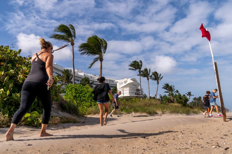
December cold is due Sunday after a stormy Friday, when winds could gust near 45 mph at the Shore, with an outside chance of an isolated tornado. Road ponding, and slippery rails also are possible.

From June warmth to tropical rains, to gusts up to 50 mph at the Shore, where a wind advisory is in effect, and 40 mph inland, to a regionwide hard freeze, by Sunday Philly’s weather may well have jumped six months in six days.
Forecasters are confident that rains will arrive Friday morning and continue Friday night as the remnants of Nicole interact with a frontal system, and the Storm Prediction Center has the region under a marginal risk for severe storms. It posts an outside chance of a tornado.
Widespread flooding is not expected, however, road-ponding is possible given that this is a ripe time for fallen leaves to clog drains. “We are getting to the drains today,” PennDOT spokesperson Brad Rudolph said Thursday, and “we’ll have crews out there” on Friday.
And SEPTA advised that slippery rails lubricated by wet leaves could cause Regional-Rail delays Friday.
» READ MORE: That first freeze has been coming later in Philly.
All the drama is to be followed by a vigorous front projected to chill even the Philadelphia heat island with December-like cold.
If you enjoy normality, Wednesday was your day. The daily high, 59 degrees, was right about where it should have been.
What was that?
Officially, the average temperature of 64.6 degrees in the first seven days of the month was better than 13 degrees above normal, making it the warmest first week in November in 150 years of official record-keeping in Philadelphia.
Three different daily records for a Nov. 7 were set on Monday, with a high of 79, normal for the first week in June; a low of 67, a record-high minimum; and a daily average temperature of 73.
Historically, 70-plus temperatures aren’t all that unusual during the first week in November — it’s happened more than 100 times — but this is the first time they’ve gone past 70 on all seven days.
The region was being warmed by winds from the south circulating counterclockwise around low pressure to the west, and clockwise around a high to the east.
» READ MORE: Forecasters have cast their votes for a mild winter
Helping to drive up the temperatures was the thinning leafage and the general dryness, said Dave Dombek, senior meteorologist with AccuWeather Inc. With little moisture to evaporate, the weakening sun could focus its energy on heating the surface.
So much for that
After cresting near the seasonal normals on Wednesday, temperatures are due to shoot to the mid- and upper 60s Thursday afternoon and might well make it back to 70 or better Friday.
Dombek said the temperatures and the ferocity of the winds and rains will depend on Nicole’s track and what happens after it gets absorbed by that frontal system.
The National Hurricane Center late Thursday said that Nicole’s short-lived career as a hurricane had ended, and that it was swirling as a tropical storm off the western Florida coast with peak winds at 45 mph.
Its leftovers were forecast to arc toward the Mid-Atlantic.
The center of the storm is forecast to pass well west of Philadelphia, with the heaviest rains falling from Harrisburg westward. But the region would be in the path of strong winds from the south, part of the counterclockwise circulation around the storm’s center.
It should all be over by Saturday morning.
» READ MORE: In Philly winters, expect anything.
“You get that through and the whole pattern changes,” he said. Temperatures will be falling into the 50s during the afternoon. The forecast calls for temperatures mostly in the December-like 40s Sunday, Monday, and Tuesday, with overnight lows falling to — or near — freezing even in the city Monday and Tuesday, along with wind chills in the 20s.
The Climate Prediction Center sees the odds strongly favoring below-normal temperatures for the period through Thanksgiving eve in Philly and much of the nation.
The weather service says it’s even possible that parts of the Poconos and the mountains of northwestern New Jersey could see some snowflakes during the middle of next week.
It’s getting to be that time of year.

