If you’re seeing snow around the Philly region, ‘you’re not hallucinating,’ and freeze warnings are in effect
You won't need the shovels, but it really was snowing in some places on Friday. Meanwhile, a wind advisory remains in effect.
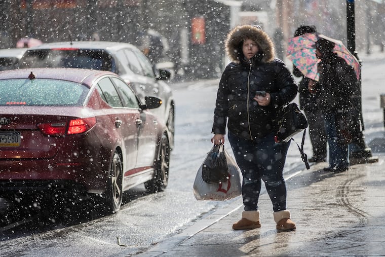
These are indisputably strange times, but if you thought you spotted snow in the air on Friday, please don’t question your sanity; it’s not like you’ve been inside too long.
“If you see flakes you’re not hallucinating,” said Mike Silva, a meteorologist at the National Weather Service in Mount Holly.
Surface temperatures have been in the 40s, with wind-chills in the 30s — and they don’t take into account the fact that we’re not used to it — but temperatures aloft where nature makes this stuff are considerably colder.
It is easy to confuse a snowflake with a flying blossom, but one cosmic difference between the two is that a blossom won’t melt when they land.
And any flake that survives its long trip through the atmosphere is going to melt in a hurry. The Philadelphia record for snow on an April 10 is 0.7 inches, set in 1894, and Silva says that one is safe, so bestill Penndot.
The latest measurable snowfall ever in Philadelphia occurred on April 27 back in 1967, 0.1 inches.
Flakes or blossoms, it will continue to be quite windy, forecasters said, with gusts past 50 mph possible at times. The region will be caught in a wind tunnel between strong low pressure near the Canadian Maritimes interacts with higher pressure, or heavier over over the central United States.
Blossoms and blooms that survive the winds could be in for a tough night, especially north and west of the city.
A freeze warning is in effect for Bucks, Chester, Delaware, and Montgomery Counties, where temperatures are expected to drop toward 30 during the overnight hours, assuming the winds die down. Winds can inhibit the escape of daytime heat into space.
The roars are going to continue for awhile, and the weather service has a wind advisory in effect until 7 p.m.
The agency also warns that with the air becoming drier and the winds brisk, the forest-fire danger will be enhanced.
The winds likely won’t quite rival Thursday’s, when a potent front set off gusts up to 71 mph; an official 59 mph at Philadelphia International Airport. But they’ll do a decent imitation.
» READ MORE: Winds gusting to 70 mph roar through Philly region; power outages widspread
Thursday’s winds knocked out power to more than 37,000 PECO and Atlantic Electric customers.
The winds should back off Friday evening, but temperatures will remain chilly Saturday with temperatures not getting out of the 50s. They should get close to 70 Sunday, but significant rain is likely Sunday night.
» READ MORE: When winter doesn’t come: Here are the winners and losers of Philly’s nearly snowless season
Looking ahead, the government’s Climate Prediction Center’s two-week outlook has odds favoring below-normal temperatures for about 60% of the contiguous United States, with chilly, upper-air low pressure in control.
Much of the nation could be locked in a winter-like pattern — which was noticeably missing all winter.
Staff writer Richard Barron contributed to this article.