Philly rarely gets a white Christmas, but we’re about due for one
In any given year Philadelphians have about a 10 percent shot of waking up to a snow cover on Dec. 25, according to government statistics.
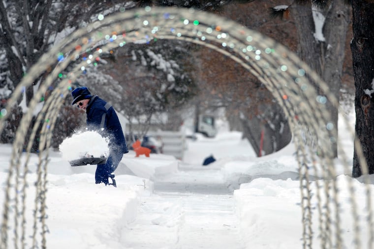
It has been 10 years since the sun rose over a generous frosting of snow on Christmas in the Philadelphia region.
Prospects aren’t looking so good right now, but should a reprise occur next week, it would be statistically fitting, at least based on the government’s analysis.
In any given year, the chances are only about 1 in 10 that an inch or more of snow will be on the ground in Philadelphia at 7 a.m. on Dec. 25, researchers with the National Centers for Environmental Information have calculated.
That is the somewhat arbitrary criterion they use for a “White Christmas,” and officially Philadelphia has qualified only six times in the last 60 years.
Bing Crosby, Irving Berlin, holiday card-makers, movie-makers, and assorted retail giants notwithstanding, Christmas snow is very much the exception for Philadelphians — and for an overwhelming majority of Americans.
Only one major city in Pennsylvania, Erie — buried by a 50-plus-inch Christmas snowstorm two years ago — has a 50% shot of a white Christmas, according to the analysis. And that would be one more than in New Jersey. Chicago, Boston, Detroit — all come up way short.
» READ MORE: Record-setting storm buries Pennsylvania's fourth largest city under more than 4 feet of snow
Officially, eight inches was on the ground at Philadelphia International Airport on Dec. 25, 2009, the fallout from the nearly two feet that piled up on Dec. 19-20 in what became the snowiest winter on record.
That was the first time since 1998 that snow cover (two inches) was observed officially at the airport on Christmas morning. Before that? You have to go back to 1966, when just more than foot fell on Dec. 24 into early the next day.
About that analysis
The government researchers studied available weather data for thousands of U.S. locations for the 1981-to-2010 period, which was used to calculate climate “normals” for temperature and precipitation. The 30-year normals are reconfigured every 10 years on the assumption that climate is always changing, which, indeed, it is.
To generate adequate sample sizes, they looked at snow-cover data from Dec. 11 through Jan. 8, or two weeks on either side of Christmas, with the results centered on Dec. 25.
Oddly, they concluded that the chances of a White Christmas were just 8% at the official station at Philadelphia International Airport, but 10% down the river in Wilmington, and 12% at the Franklin Institute in Center City.
Imke Durre, the study’s lead author, said microclimate effects (the airport is a regional banana belt, being next to a swamp and the Delaware River) and some discontinuities in the data might account for small percentage differences within short distances. So we’ll stay with 10% citywide.
The odds get better the farther one gets north and west of the airport. About the best place to be around here, at least according to the analysis, would be Coatesville, where the likelihood of that Christmas-morning snow would be 24%, triple that of the airport, and equal to Allentown’s.
» READ MORE: Where is temperature measured in Philly, and why?
Christmas aside, Philly isn’t exactly a winter wonderland
In the city itself, the odds are stacked against having snow cover on any given day.
It might seem like way more, but on average, the city has had only five days each winter in which an inch or more of snow is measured officially.
The average for December is just 0.6 days. The sun reaches its lowest point at the winter solstice, but typically it takes the Earth’s surface a few weeks to respond to changes in solar radiation. In summer, for example, the hottest days tend to occur in July and August.
What’s more, most major snowfalls around here result from coastal storms that can lure air from the Atlantic Ocean, where sea-surface temperatures are in the 40s, and that can change snow to rain.
The improbable dream: A brief cultural history
He is a prime suspect, but don’t blame songwriter Berlin for all these evocations.
By the time he wrote “White Christmas,” which crooner Crosby debuted in the 1942 movie Holiday Inn, the image had long been frozen into the American consciousness.
The writer Washington Irving mentioned Christmas snow prominently in his 1809 satirical work, A History of New-York From the Beginning of the World to the End of the Dutch Dynasty, by Diedrich Knickerbocker.
» READ MORE: Dreaming of a White Christmas? What are the chances?
Further solidifying the association was the 1823 poem “A Visit from St. Nicholas,” more popularly known as “The Night Before Christmas,” attributed to Clement Clark Moore. It famously described a sleigh-riding Santa Claus and “the moon on the breast of the new-fallen snow.”
The immense popularity of Dickens’ A Christmas Carol added more layers to snow’s mystical ties to Christmas. Even James Joyce invoked snow imagery in his masterful The Dead, which is set at Christmastime in Dublin, safely quarantined from any definition of “Snow Belt.”
The outlook for next week isn’t promising for snow. The government’s Climate Prediction Center has the odds favoring above-normal temperatures and below-normal precipitation.
Then again, climate records are unavailable, but it would be an excellent guess to say that snow wasn’t a common occurrence in Bethlehem 2,000 years ago.
