Short-lived Bertha the second named storm of a hurricane season that hasn’t even started yet
Flash flood watches and advisories were up from the Carolinas' Atlantic Coast to the West Virginia-Ohio border.
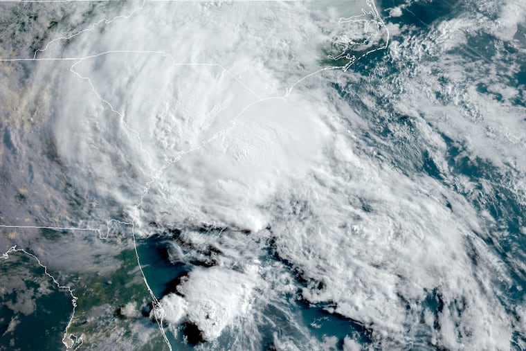
Stripped of it tropical-storm status, Bertha continued to generate heavy rains in parts of the Carolinas and the Blue Ridge Mountains in Virginia.
The National Weather Service posted flash flood watches from the coastal border of the Carolinas all the way to the Ohio River Valley.
The National Hurricane Center announced at 2 p.m. that Bertha no longer was a tropical storm; its peak winds Wednesday night were down to 30 mph; the minimum for a tropical storm is 39 mph.
» READ MORE: Arthur, the first named tropical storm of an expectedly busy hurricane season, forms off Fla.
Bertha’s winds maxed at 50 mph around the time it made landfall Wednesday near Mount Pleasant, S.C.
It evidently won’t have any impact on the Philadelphia region, as the clockwise winds around the high pressure area centered off the Atlantic Coast — responsible for this humid air mass — steers Bertha’s remnants well away from here.
Bertha became the second named tropical storm of the Atlantic season, which doesn’t begin officially until Monday.
The consensus of the publicly released forecasts is that this will be quite an active season. On average, 11 named storms form in the basin during the season, which ends Nov. 30, with six of those becoming hurricanes, with winds of at least 74 mph, and two major hurricanes, with winds of 111 mph or better.
The preseason estimates in the outlooks ranged from 14 to 20 named storms, with six to 11 of those becoming hurricanes.
» READ MORE: Philly’s gloomy weather has been matching the national mood. And it might be about to get worse.
Warmer-than-average sea-surface temperatures in the tropical Atlantic, and normal to possibly below-normal temperatures in the tropical Pacific are two of the factors cited in the robust outlooks.
Warm waters in the Pacific can incite the overlying air to stir up west-to-east shearing winds that in the upper atmosphere can suppress Atlantic storm development; cooler waters would suppress the shearing.
The next name on the list would be Cristobal.
