Tornadoes reported in Montco and near Dover; flood warning for Philly and neighboring towns
The tornado watch is up until 7 p.m.; flood and wind advisories are also in effect.
Severe thunderstorms, temperatures in the 60s, even tornado watches aren’t all that unusual around here. It’s just that they usually don’t occur on the eve of winter on a day when the weakening sun sets at 4:36 p.m.
But in these strange times on the earth and in the air, a tornado touched down Monday afternoon near Dover, Del., the National Weather Service confirmed, and possibly at least one twister in Montgomery County.
The temperature soared to 67 on strong south winds, about where it should be on April 25, when the sun is gaining power, the days are lengthening, and severe thunderstorms would be part of the cost of allowing spring to do its business.
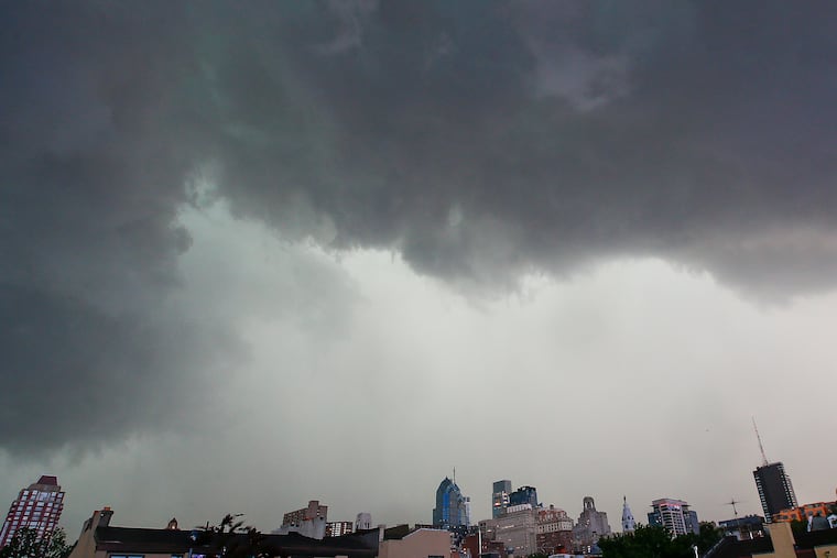
Yet, on the day before the start of the meteorological winter, potent thunderstorms flashed and roared through the region with a ferocity more associated with the spring severe storm season.
“The intensity of the thunderstorms was very impressive,” said John Feerick, senior meteorologist at AccuWeather Inc.
In addition to the Delaware twister, a “radar indicated” tornado might have touched down near Lansdale, and a “possible tornado” ripped up multiple trees in Trappe, about 14 miles away.
The Delaware tornado was sighted 14 miles west of Dover, and hours before the strong thunderstorms developed, several wind gusts of 50 mph were reported near the Jersey Shore and in Montgomery County.
Monday’s fitful downpours set off flood advisories and warnings on both sides of the river and in Delaware. Flooding reportedly closed a portion of Route 29, and in Pottstown, water swamped a car up to its roof at Myrtle and Buttonwood Streets, according to reports.
A strong storm that was moving southwest to northeast across the Tennessee Valley and well to the west of the Philadelphia region “pulled up a lot of mild air really quickly,” said Dean Iovino, lead meteorologist with the National Weather Service Office in Mount Holly.
Since Philadelphia was to the east of the storm’s center, the region experienced warming winds from the south as part of the storm’s counterclockwise circulation.
Feerick said that this time of year, when the sun is too faint to warm the ground, most any warmth has to commute on a south wind.
Cold air aloft and the milder air below generated volatility to the atmosphere, Feerick said, and the Storm Prediction Center said that conditions were ripe for spinning up “damaging wind gusts and a few tornadoes.” That prompted a tornado watch for the whole region from about 1 to 7 p.m.
» READ MORE: Storms disrupt SEPTA rail service; EF-2 tornado damages dozens of homes in Delco
For all the bluster and mayhem, only widely scattered power outages with reported, with fewer than 5,500 Peco customers affected as of late afternoon, most of those in Chester and Montgomery Counties.
Behind the storm, Tuesday should feel more like the first day of the meteorological winter: The weather community divides the seasons into tidy three-month increments, something that nature often finds amusing.
The temperature around daybreak Tuesday is expected to be in the mid-40s, and “whatever it is at sunrise, that’s the high for the day,” Feerick said.
Highs the rest of the week are forecast to range from 45 to 50, close to long-term normals, with rain possible Friday and Saturday.
But Feerick says no need yet for those snow-throwers that probably have a heavy accumulation of dust by now, although the weather service says “snow showers” are possible early next week.
» READ MORE: Expect warm weather, with above normal temperatures, this winter in Philly
