Scene Through the Lens | August 23, 2021
Inquirer staff photographer Tom Gralish’s weekly visual exploration of our region

I have been taking road trips for as long as I can remember. But over these past two COVID summers there has not been a lot of seeing-the-USA-in-my-Chevrolet-ing, or getting-my-kicks-on-Route-66.
Instead, I rambled closer to home.
I did make a few pre-election drives through a lot of Pennsylvania’s swing districts last fall. And recently, I was on country roads for a story on rural broadband service as congress considers the $1 trillion infrastructure bill.
But I wasn’t quite ready this summer to dive right into the deep end with an epic cross country road trip. Instead, I dipped a toe into the (tea-colored) cedar waters of South Jersey’s Pinelands.
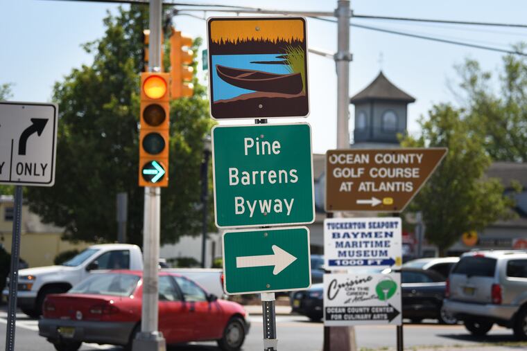
Over the winter, while we were all paying less than $2.50 for a gallon of gasoline, the U.S. Department of Transportation named a 130-mile route the third New Jersey National Scenic Byway. As my colleague, environmental writer Frank Kummer, wrote, the new designation recognizes certain U.S. roads for their scenic, archaeological, cultural, historic, natural, or recreational aspects (it’s also a way to raise awareness for certain areas — and lure tourists).
The Pinelands were already designated as the country’s first National Reserve. That happened in 1978 when Congress passed legislation to designate 1.1 million acres (1,700 sq mi) as the Pinelands National Reserve to preserve its ecology. In 1988, it was designated by the United Nations as an International Biosphere Reserve.
That’s the back story. Between assignments to and from the Jersey Shore this summer, I would detour through the quintessential Pine Barrens waterways.
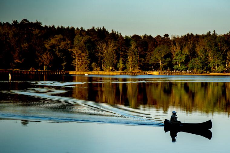


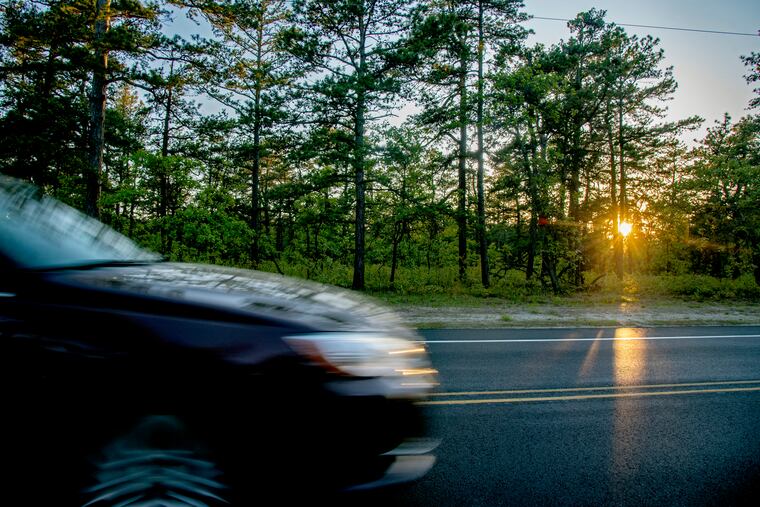
The Byway snakes through only the lower half of the Pinelands Reserve, all definitely South Jersey, as it falls well below the Rt.70/Rt.72 two-lane route between Philly and Long Beach Island.
This is as good a place as any to say that the Byway is NOT like the Grand Loop Road in Yellowstone National Park or the one-way Park Loop Road through Acadia National Park.
Instead it meanders through the southern half of the one million-acre Pinelands National Reserve, a pristine forest area in the middle of one of the world’s most densely developed regions.
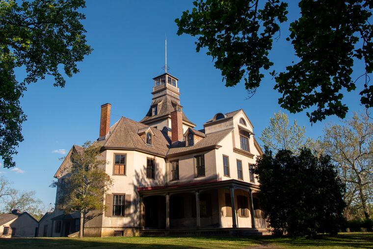
I once lived near the village of Batsto, on the Mullica River in the Reserve. Archeological evidence shows the area was in use by native people for thousands of years. And remains of prehistoric life have been discovered. The American history of the village dates before the Revolution, when bog iron ore was extracted from river banks, trees became the charcoal for fuel, and streams powered an iron works that produced stove plates, kettles, pots, and pans for the colonists. During the war, Batsto manufactured supplies for the Continental Army.
Philadelphia industrialist Joseph Wharton, who founded Penn’s Wharton School and was one of the founders of Swarthmore College, started buying up hundreds of acres around the area.
It wasn’t the land Wharton was after though, but access to the 17-trillion-gallon Kirkwood-Cohansey Aquifer, even today one of the East Coast’s largest reserves of fresh water. Eyeing the liquid treasure, he hoped to pipe the pristine waters into Philadelphia.
In the industrial late 1800s, the city was getting 95 percent of its drinking water from the Schuylkill which had become an open, polluted sewer. But New Jersey shut down his plans with legislation prohibiting the sale of New Jersey water outside of its borders. That law is still in effect today.
After that, Batsto was a gentleman-farm estate for Wharton’s descendants, until they sold it to the state in 1954. You can tour the Wharton-Batsto Mansion and there are weekend events through the fall (but check their Facebook page for the most up to date Covid information).
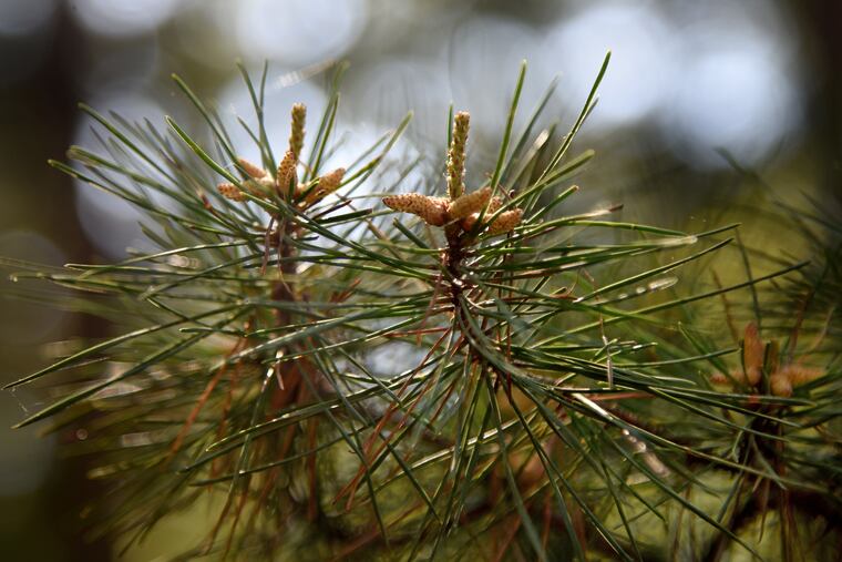
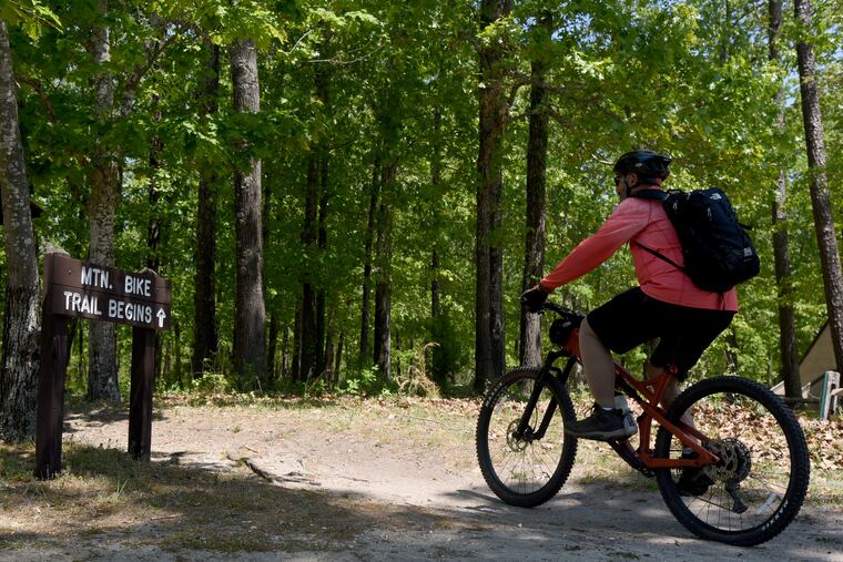
The village is a starting point for exploring the Wharton State Forest, which contains miles of unpaved roads for hiking (check out the excellent South Jersey Trails website of Mike McCormick), mountain biking and horseback riding along with numerous lakes, ponds and fields ideal for wildlife observation. The protected areas of the state forests are the largest surviving open space between Maine’s northern forests and the Florida Everglades. And it’s not part of the Byway.
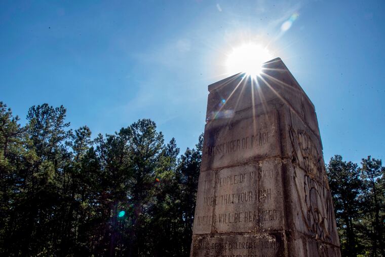
But I decided to extend my drive a little deeper into the woods anyway, to see a monument to Mexican aviator Emilio Carranza. From Batsto it’s a 11.5 mile hike on the Batona Trail. I didn’t do that, and if you drive it, take this piece of advice: do not listen if your GPS says to approach it from the east, off New Gretna Chatsworth Road. If you do, you’ll find a 5.3 miles of washboard surface driving on a dirt road. So approach it from the west instead.
Captain Emilio Carranza of the Air Corps of Mexico flew to the U.S. to reciprocate a goodwill flight Charles Lindbergh’s had made earlier to Mexico City. After arriving in Washington, DC and stopping in New York City, Carranza left Roosevelt Field on July 12th, 1928 for the non-stop flight back home. But a lightning storm forced his plane to crash in the remote woods.
The American Legion post in Mount Holly hosts a memorial service every year for the flyer, keeping a promise made by its forefathers almost 100 years ago to never forget.
Captain Emilio Carranza of the Air Corps of Mexico flew to the U.S. to reciprocate a goodwill flight Charles Lindbergh’s had made earlier to Mexico City. After arriving in Washington, DC and stopping in New York City, Carranza left Roosevelt Field on July 12th, 1928 for the non-stop flight back home. But a lightning storm forced his plane to crash in the remote woods one of the eateries I photographed a few years ago after celebrity chef, author, and television personality Anthony Bourdain died. The globe-trotting adventurer known for seeking exotic cuisine in far-flung places celebrated the food and culture of his home state of New Jersey in a 2015 episode of his Emmy award-winning CNN show Parts Unknown. “Oh enchanted land of my childhood,” he said as the episode opened.
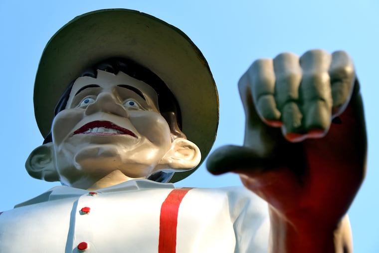
Speaking of eateries, Exit 33 off the AC Expressway for Winslow Blue Anchor will get you face-to-knees with Mr. Bill, a 25-foot-tall fiberglass giant in front of Mr. Bill’s Richman’s Ice Cream & Burger Co. He is one of the hundreds of figures created in the 1960s and ‘70s, as roadside attractions and attention-getters along the highways and byways of America (think Route 66, as mentioned at the very beginning of this column). On a previous road trip I photographed a dozen of what are now called “Muffler Men” still standing tall around South Jersey and Pennsylvania.
Rather than the the AC Expressway, I often take the older White and Black Horse Pikes. And not just for ice cream. They were once the only way to the Shore. Both roads remind me of what travel was like in the days before Interstates (the AC Expressway opened in 1964). The White Horse Pike - US 30 - follows an old Lenape trail running from what’s now Camden, to the areas once inhabited by the Absegami in present day Absecon. It became a toll road in 1854. The Black Horse Pike - Rt. 168, US 40 and US 322 - was laid out in a straight line by surveyors in 1795.
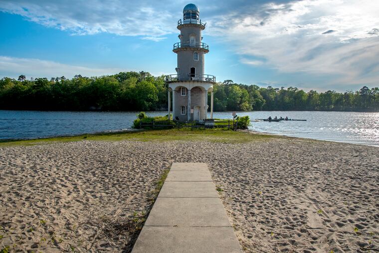
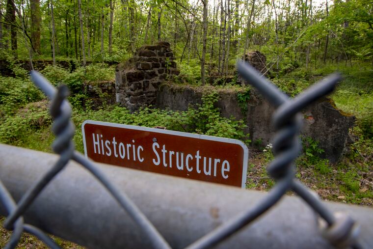
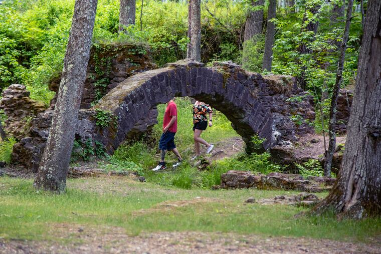
There is more to the Byway, and more photos in the gallery at the beginning, of the village of Smithville, and the seaport of Tuckerton, the “ghost towns” of the Weymouth Furnace as well as other monuments. The New Jersey Pinelands Commission, which oversees administration of the Pine Barrens Byway, has created a guide and an excellent quick-read map and brochure that even includes places to find restrooms.
As more of this summer is now in the rear view mirror, I’m looking ahead to next year, inspired by the words of New Jersey poet Walt Whitman, “Afoot and light-hearted I take to the open road...” (Song of the Open Road, 1856)
Since 1998, a black-and-white photo has appeared every Monday in staff photographer Tom Gralish’s “Scene Through the Lens” photo column in The Inquirer’s local news section. Here are the most recent, in color:


» SEE MORE: Archived columns and Twenty years of a photo column
