The heat from Center City’s buildings and streets might be giving the rains a little extra juice
Philly and other cities might be exporting some of their rain. “You can readily see progressively higher rainfall totals downwind,” says one expert.
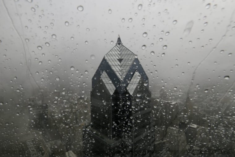
Fred’s residue was the unquestioned instigator of that overnight rain blitz last week, with a powerful assist from a stubborn moisture-engorged air mass that obviously has no regard for where it’s not wanted.
It was yet another episode in the summer of the downpours. But those rains late Wednesday night and early Thursday and predecessors in June and July might have received at least a subtle lift from an unnatural source — Philadelphia.
The city is a significant “urban heat island” in what researchers call an archipelago of such islands along the I-95 corridor that are populated with sun-soaking skyscrapers, streets, and pavement.
» READ MORE: Fred remnants set off floods in the Philly region, two tornadoes, and whole lot of phone alarms
The prevailing winds in Philadelphia are from the southwest, and radar estimates show that in the 90 days that ended Thursday, precipitation totals were an inch or more higher to the north and east of Center City, said Jordan McLeod, who has studied the heat island effects in the Atlanta area extensively.
“You can readily see progressively higher rainfall totals downwind,” said McLeod, climatologist with the Southeast Regional Climate Center.
What’s more, Trenton, about 40 miles northeast of Philly, receives about 3% more annual rainfall, according National Weather Service data.
And extensive research in the last 50 years has established what McLeod’s mentor at the University of Georgia, J. Marshall Shepherd, has called “the Urban Rainfall Effect.”
Details, details
Cities’ effects on climate and weather have been studied for at least 100 years. That urbanization generates heat and alters wind patterns is beyond dispute.
While it clearly has impacts on local precipitation — beyond the earth’s warming contributions — quantifying those is quite complicated.
» READ MORE: Why Philly trees cast more shade on the wealthier
Nothing personal, but to the atmosphere, Philadelphia is barely a pinprick’s afterthought. The development and movement of weather systems occur in a three-dimensional gas, 10 miles deep, covering about 200 million square miles.
Did we mention that scientists call this a nonlinear chaotic system, and nothing happens in isolation?
At the local level, micro-scale effects can be important players, particularly in the case of thunderstorms in summer, when the upper-air currents that govern storms seem to lose interest at times and forget what it’s like to blow.
Thunderstorms result from convection: Warm air rises over cooler air, the droplets condense on nuclei, such as dust or other aerosol particles. Cities happen to be tremendous factories of heat and particulates.
While research suggests strongly that cities are adding more than dollops of moisture to some thunderstorms, it is unclear just how much of that would be falling back on the core of the city and how much would be displaced, and how far away.
» READ MORE: ‘Micro’ thunderstorms are pounding the Philly region, with a nearly 100% chance for more
A NASA study some years back using satellite data concluded that summer rainfall in Memphis and Atlanta was 50% of what it was 20 to 40 miles away.
However, teasing out the urban heating from other factors in rainfall is somewhere between maddening and impossible, the experts say.
Take Fred, please
At the peak of Fred’s rainfalls, the winds were from the south. While the official precipitation total at Philadelphia International Airport on Thursday was 0.00, rains were generous to the north, with towns across the Montgomery County line getting clocked with 2 and 3 inches of rain.
Philadelphia might have made a contribution, but it very likely would have been swamped by the larger features — the remnants of Fred, and that aforementioned annoyingly moist air mass.
Further, the “fall line” — the subtle elevations to the north and west of Center City that can give an extra kick to the rising air in storms — likely was in play. In fact, rain totals were higher to the west, with better than 5 inches in West Chester.
That fall line, marking the edge of the coastal plain, is a factor all along the I-95 corridor.
Distilling the heat island component “is going to be difficult” in the likes of Washington and Philadelphia, said Brian Haines, science and operations officer at the National Weather Service Office in Mount Holly.
“How do you pull that signal out of the overall precipitation signal?” he asked.
Agreed the Southeast climate center’s McLeod, “It’s difficult to say how much of this rainfall signature is due to urban effects.”
Marshall Shepherd and his colleagues have raised the question as to whether the I-95 heat-island archipelago is having some overall regional impacts on precipitation and temperature.
Pending further research, “it appears that only larger cities can have significant impacts on rainfall,” said McLeod, suggesting that the effects would be highly localized.
But Sandip Pal, an atmospheric scientist at Texas Tech University, has just undertaken a project looking at how less densely populated cities might affect local climates, focusing on Lubbock, where Texas Tech is located.
For now, adding an urban-heating component to thunderstorm forecasting would be out of the question.
The problem, said Bill Bunting, chief of the Forecast Operations Branch at the government’s Storm Prediction Center, is basically everything.
“Terrain, differential heating in urban areas; it’s really hard to model,” he said.
