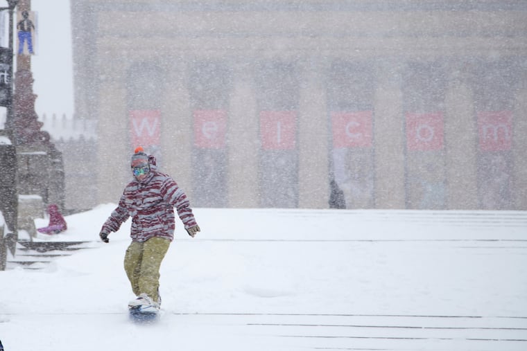
Heavy snow arrives, with ice to follow, and it all may stick around for a week, or more
Up to 10 inches of snow is possible, followed by ice station Philly.
It may not approach their magnitudes, but Sunday’s snow-and-ice cold brew is expected to bear eerie similarities to some of Philly’s historic winter storms and perhaps rival them for disruption.
By 7 a.m., up to 3 inches had been reported around the region, with heaviest amounts to the south where the snow started earlier.
Officially, at Philadelphia International Airport, 1.6 inches had been measured, already making this the city’s biggest official total of the month. But Center City trumped it at 1.8.
From 8 to 10 inches was expected around the city before the snow mixes with sleet and possibly freezing rain during the afternoon, said Nick Guzzo, a meteorologist at the National Weather Service Office in Mount Holly. All that is subject to change, of course.
As for the potential mixing, “pick your poison,” said Guzzo’s colleague Mike Lee.
The office has posted winter storm warnings for the entire region, joining offices from New Mexico to Maine.
The precipitation is due to shut off early Monday, but by then it may be a case of welcome to ice station Philly.
Nothing that falls is going to melt, as temperatures will get no higher than the 20s Sunday and may not see 30 for the rest of the week
Affirming their faith in the forecasts, Philadelphia, New Jersey, and Pennsylvania have declared emergencies. If you have plans the next few days, don’t count on them happening, and some kids might be able to put off homework for a few days.
Perhaps of more interest to some parties, Pennsylvania announced that all its liquor stores will be closed Sunday, and the Girl Scouts have pushed back their cookie-sale dates all the way to the spring equinox. (At least some of the bars and churches may be open.)
How much for Philly?
On Saturday, the National Weather Service was sticking with 8 to 10 inches for the immediate Philly area, said meteorologist Amanda Lee, with less to the southeast. AccuWeather Inc. was calling for 6 to 10 inches.
A lot of that would fall during a “front-end thump,” said AccuWeather meteorologist Elizabeth Glenny. Once the mixing begins, accumulation rates would back off.
While people understandably want to know how many inches of snow are going to land, that is almost always difficult to answer, meteorologists say, especially in a storm of this nature.
In this case, snow amounts are dependent on a coastal storm that had not yet formed Saturday and on what might happen in parts of the atmosphere that are not well-observed.
Temperatures in the bottom 5,500 feet of the atmosphere over Philly are expected to remain below freezing, said AccuWeather senior meteorologist Tom Kines, but computer models insist that a warm layer in the higher atmosphere would result in the changeover.
That warmth would be imported from the Atlantic Ocean by the strong onshore winds from the northeast generated by the storm — it’s not for nothing that these things are called nor’easters.
Another wild card would be if the snow is heavy enough that it could survive the warm layer and delay the changeover.
But the mixing of sleet, which is liquid that remains frozen in its trip through the atmosphere, and freezing rain, liquid that freezes on contact, is inevitable, forecasters said.
Freezing rain atop a snowpack is especially dangerous because it adds weight to vulnerable and snow-burdened power lines and tree branches. Sleet is polite enough to bounce off hard surfaces, but since it is pure ice, it is slower to melt.
Said the weather service’s Mike Lee, the mixing “just means we’re getting a different blend of horrors.”
Remembrance of Philly storms past
Mike Lee said that about 1.5 inches of liquid precipitation — the amount of melted snow and ice — was expected to fall during the storm, and whatever landed was certain to participate in becoming a massive block of ice.
Liquid-to-snow ratios can vary widely, but 1.5 inches of precipitation would be equivalent to the total precipitation contained in the record 30.7-inch snowfall of Jan. 7-8, 1996.
“It’s a little bit scary, but true,” Glenny said.
And it is close to what fell during Philly’s last double-digit snow, the 22.4 inches of Jan. 22-23, 2016.
In mid-March 1993, a foot of snow accumulated rapidly during a blizzard, followed by several hours of sleet and a flash freeze during the early morning. It created what a weather service meteorologist famously called an “Arctic landscape.”
The landscape Monday may be similar, but with one important difference.
That March storm occurred near the equinox, when the sun was about 50% stronger than it is this time of year, according to NASA data, and days were close to two hours longer. (Yes, those days are coming.)
The temperature bottomed out at 11 degrees Saturday morning, the lowest reading of the season at Philadelphia International Airport, and into the single digits outside the city.
Most airlines have canceled flights departing Sunday from Philadelphia International Airport. By late Saturday afternoon, there were 502 canceled flights into or out of the airport, according to the city.
Temperatures are expected to get no higher than the mid-20s Sunday and Monday. And then it’s going to get colder, with daytime highs no better than the low 20s, and nights in the single digits.
Shovel early and often.
