Another weekend snow threat is in the outlook for the Philly region
An air quality alert is in effect for South Jersey
You may have read this somewhere before: Computer models are seeing the potential for a significant winter storm to affect the Philly region on yet another weekend.
Those ingenious machines continue to predict that a storm will intensify off the Southeast coast Sunday into Monday. But “a large amount of uncertainty” remains about whether it will generate accumulating snow in the Philadelphia region, the National Weather Service said in its morning discussion Thursday. In the early going, areas south and east of Philly were the likeliest targets.
Based on past experience, not to mention the nonlinear chaos of the atmosphere, about the only thing certain was that they would be changing their stories multiple times in the next few days, as would their virtual peers.
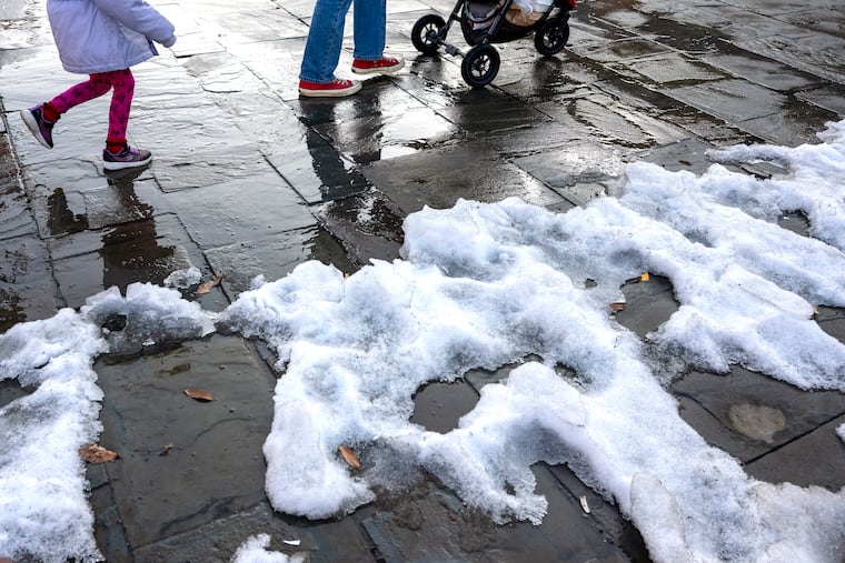
In the short term, it is highly likely that, along with a certain dreariness, the region will be getting something that has been mighty scarce lately — rain. Philly’s rain total this month is under 15% of normal. Over the last 60 days throughout the region, it has been 40% to 50% below normal.
The forecast for the rest of the workweek in Philly
The freshness date on the snowpack has about expired and about now looks like it could use a good scrubbing, along with the air.
Atop the remnants, generally light winds have been aiding and abetting a rather stagnant air mass. A “code orange” air quality alert was in effect for South Jersey Thursday, and health officials advised those with respiratory conditions to limit outdoor exposure.
The primary irritants were tiny particulates, about 30 times smaller in diameter than a human hair.
Rain is likely to be in the air Thursday night into Friday, and it could be a substantial amount, on the order of a half-inch or more. So far this month, officially 0.25 inches have been measured at Philadelphia International Airport.
The moist air and the rain should erase more of the snowpack, “but we don’t want the snow and ice to melt too quickly,” said Ray Martin, a lead meteorologist at the National Weather Service Office in Mount Holly. No significant flooding is expected, just some potential damage to footwear.
Temperatures are expected to top out in the 40s Thursday and Friday.
About the weekend storm potential
It may hit 50 degrees on Saturday with an appearance of the sun. So much for the easy part.
Come Sunday, “there could be some rain or snow,” said Matt Benz, senior meteorologist with AccuWeather Inc.
A storm is due to slide across the South and eventually regroup off the Atlantic coast on Sunday.
But Benz pointed out that a key feature of the potential storm still was over the Pacific and not due to make landfall until sometime later Thursday, when it would be captured by land-based observation and give the machines a clearer idea of its intentions.
And it is not at all clear how much cold air would be available for snow, Benz said, but if the storm intensifies sufficiently, “it can manufacture its own cold.” Another factor is just where off the coast the storm would be when it matured.
In case you’re wondering why the atmosphere seems to pick on Sundays, having storms show up in seven-day cycles is a common phenomenon.
They often migrate in 3½-day cycles, which has to do with the rhythms of storm movements as they travel across the country, and it so happens that the more significant one has been arriving on the seventh day.
It keeps happening until it doesn’t, and it’s still very possible that it doesn’t this time around.
Said Benz: “We have a long way to go to Sunday.”
