One of Philly’s longest snow-cover streaks is over, at least officially
Dense fog is expected late Tuesday night into Wednesday morning
Officially* one of Philadelphia’s region’s most impressive and enduring snow-cover streaks in the period of record ended peacefully at 7 a.m. Tuesday.
After 23 consecutive days of at least an inch on the ground at Philadelphia International Airport, the National Weather Service observer reported a mere “trace” at 7 a.m. Tuesday, meaning that whatever was left was hardly worth a ruler’s time.
“I can’t imagine too many people are sad about this,” said Mike Silva, meteorologist at the weather service office in Mount Holly.
The news might have evoked vast choruses of “good riddance” were it not for the fact that mass quantities of the snow and ice remain throughout the region, enough to contribute to the formation of dense fog late Tuesday night into Wednesday morning, the weather service warned.
And regarding that asterisk, observations at PHL have been known to differ from actual conditions elsewhere, if not common sense.
Plus, computer models are seeing yet another weekend winter-storm threat.
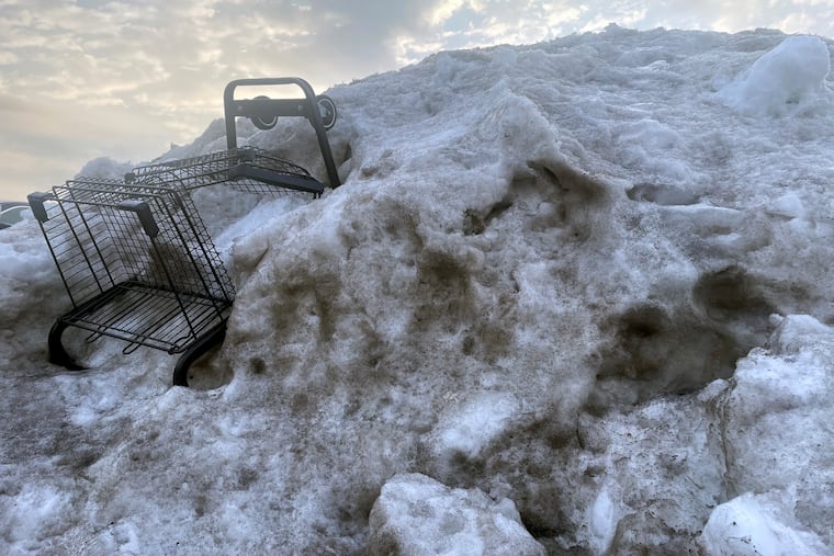
In the meantime, heaps of aging, graying plowed snow are ubiquitous around the great Philadelphia city-state. As for melting “those big mountains, that’s going to take forever,” Silva said.
For 18 days after 9.3 inches of snow and sleet was measured at the airport, the official snowpack had been 3 inches or more, the longest such streak in 65 years.
The 23-day run of an inch or more, which began on Jan. 25 when the snow started, was the longest since 2003.
The endurance had to do with the melt-resistant icy sleet that fell atop several inches of snow and the Arctic freeze that followed. Temperatures remained significantly below normal for 17 consecutive days.
The great melt is picking up steam in the Philly region
However, the melting process is at long last accelerating. Bare ground is appearing around tree roots, and evidence of vegetative life has been poking through the snow cover.
Temperatures above freezing and the February sun have been making hay, but so has the return of invisible atmospheric moisture, even as precipitation remains far below normal.
When warm, moist air comes in contact with snow, it condenses and yields latent heat that accelerates melting. That is evident in the swelling ranks of rivulets on driveways and in the streets.
The combination of the moisture, the cold snow and ice pack, and generally calm winds will result in fog that could reduce visibilities to a quarter mile at times. The weather service issued a dense fog advisory, in effect from 10 p.m. Tuesday until 10 a.m. Wednesday.
Melting conditions should be excellent the rest of the workweek, with highs in the 40s and light rain possible Wednesday night, and likely on Friday.
Temperatures are due to remain above freezing into the weekend, but “then we’ll have to see what happens Sunday,” Silva said.
Another storm is due to develop in the Southeast, and expect another week of computer-model vacillation on whether it will produce rain, snow, or partly cloudy skies.
“We have some models that say snowstorm, and others that say nothing,” Silva said.
It’s been a while since computer model forecasts have been this conflicted about a weekend storm — about a week.
